by Glade and Andrea Brosi

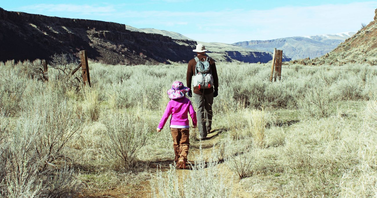
Last Sunday we decided to explore the Palisades and were rewarded with the first wildflowers of the spring season. They were Sagebrush Buttercup and little clusters of them could be found frequently along the trailside. Our trail of choice was a short and easy desert hike on Bureau of Land Management land, following a bench that is walled in on either side by impressive Basalt cliffs. There was a seasonal frozen waterfall as well.
The bench ends at a series of cliffs that overlook the valley below.
Distance: 5 miles round trip. Elevation gain and loss 30 feet.
Location: Here are the GPS coordinates to the parking area. 47°26’4.79″N 119°47’52.05″W
Activities: Hiking, trail running and snowshoeing. It is a fun place to hike in the winter with or without snow – if the snow is deep enough it would be a fun snowshoe.

Directions: Start off on HWY 28 (heading from Wenatchee towards Quincy) and take a left at Palisades Road. It may be difficult to see the road sign if coming from Wenatchee because many roads intersect here, but if you hit the bridge at the bottom of the hill (surrounded by orchards) you have gone too far. The Palisades road is on the left side of the giant coulee and is paved.
The hike begins 18.8 miles from the turn onto Palisades Road from HWY28. Three miles before the trailhead, the paved road turns to a well maintained gravel road. 1/3 mile before the trailhead the road goes directly through the BIllingsley Ranch and then immediately turns uphill. You will feel like you are trespassing on the ranch, but indeed the road continues onward, keep going.

The parking area is the first well marked pullout on the right hand side of the road. The parking area is easy to find and has a “entering public land” sign that has been shot (haven’t they all?) There is enough space for several cars but I have been there several times and only once has there been another person there. You don’t need an SUV or even a Subaru to get there – the road and parking area are in good shape. There is a brown metal gate (with the sign) that you walk through to get to the hiking trail which winds through grass and sagebrush – at times the trail feels like a cow path.
This hike is dog and kid friendly.
Land Managers: Bureau of Land Management. They ask that you please pay attention to private property as this is intermixed with BLM lands (see the attached map). Also, there is no fee for using this trail. Please practice leave no trace. To the BLM staff this area is known as “Blind Canyon.”
Reporter: Glade and Andrea Brosi on 3/4/18. Updated on 3/11/18 by Sarah Shaffer.
Leave It Better Than You Found It. This should be every outdoor user’s goal. Pick up trash left by others, pull some noxious weeds along your route, throw branches over unwanted spur trails, don’t ride or walk wet trails when you’re leaving ruts/footprints deeper than ¼ inch…

A note from Sarah Shaffer. This hike very much reminded me of a western movie. Large cliffs tower above you with the sound of Canyon Wrens calling from the basalt columns. Dried up watering holes and large erratics scatter the countryside. A frozen waterfall cascades down the basalt plateau. Sagebrush abounds after roughly mile 2 of the hike. I would recommend bringing trekking poles on this one, not to assist with the hike but rather to use during a potential rattlesnake encounter. After about the first 1.5 miles the trail turns into a series of cow paths. The Sagebrush is taller than a small child. We would recommend that someone use loppers to trim back the sagebrush, to form a more noticeable path for the second half of this hike down to the overlook.

If you have small children and don’t feel like literally “bush whacking” for the second half of the hike, go the first 1.5 miles to the fence line and then turn around. This is a great hike for meandering, checking out wildflowers and listening to the birds.
Treat this information as recommendations, not gospel. Conditions change, and those contributing these reports are volunteers–they may make mistakes or may not know all the issues affecting a route. You are still completely responsible for your decisions, your actions, and your safety. If you can’t live with that, you are prohibited from using our information.
This post was originally published on 3/12/18.
