by Andy Dappen
Forty for Forty: Recognizing the 40th Anniversary of the Chelan-Douglas Land Trust with 40 stories about lands the Land Trust has protected and kept open for public access.
Late April through mid-May is peak wildflower season in the foothills of Central Washington and, in honor of the Chelan-Douglas Land Trust’s 40th anniversary, an outing to identify 40 different foothills flowers strikes me as a fun reason to take a romp in the hills.
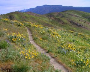
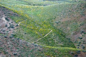
For a powerfully flowerful experience, a good route needs elevation gain to catch late-spring bloomers at low elevations and early-spring bloomers up high. A route should also span slopes with southern and northern aspects, as well as areas varying from loamy to rocky soils. Many options exist, but I settle on a route in the Sage Hills starting at the Kenzie’s Landing Trailhead and eventually climbing the zig-zagging thunderbolt of the Lightning Trail.
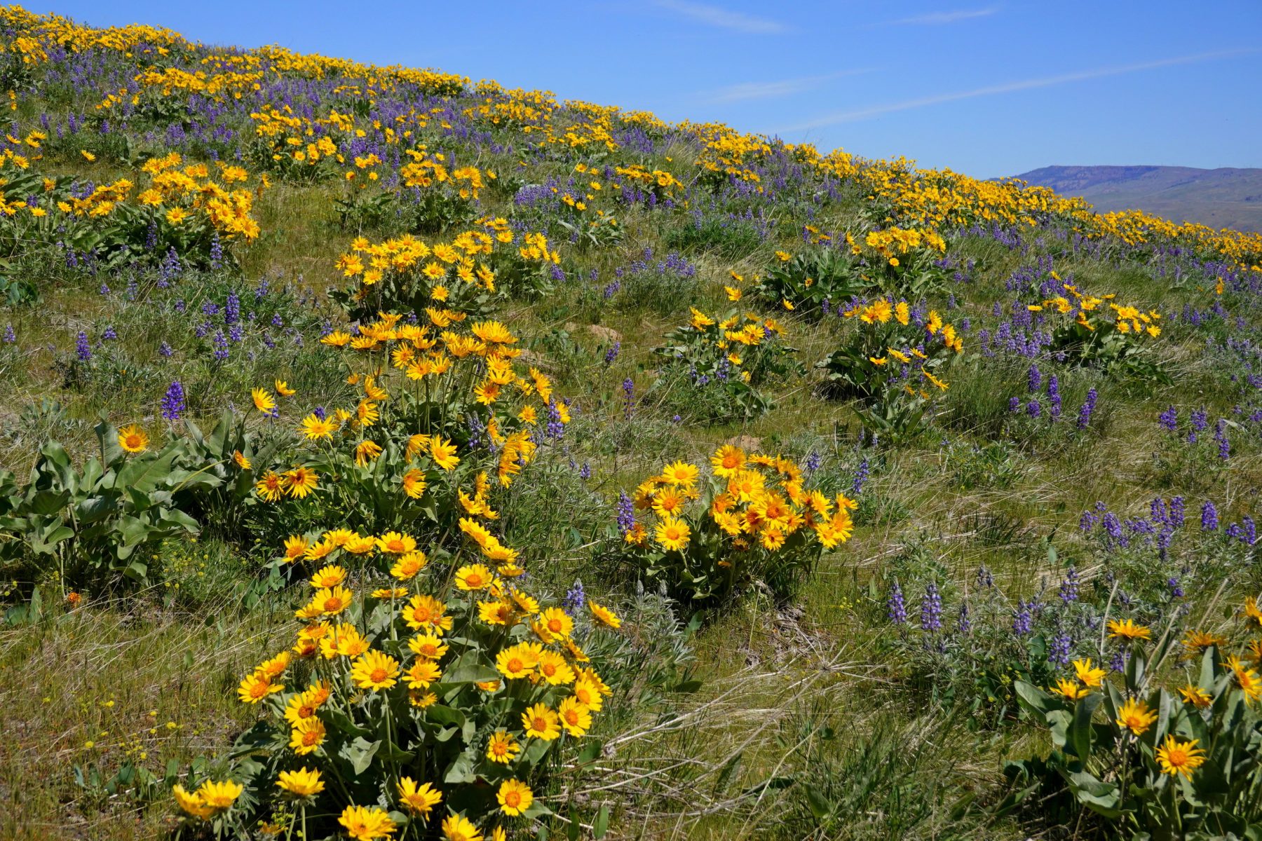
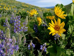
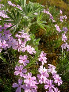
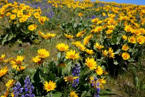
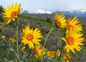
It’s a bright, blue-sky morning when I arrive at the trailhead, which has a varied mixture of exposures and soil types. The arrowleaf balsamroots, our most prominent flower, are everywhere producing optic splashes of yellow. Meanwhile our second most plentiful flower, the foothills lupine, has more recently come into its own and is throwing its bluish-purple hue into the mix. It’s easy to be distracted by these two heavy hitters but, by hunting carefully amongst them, I find smaller pillows of pink long-leaf phlox and white showy phlox, a few emerging long-leaf hawksbeard, stork’s-bill, stickseed, bare-stem desert parsley, nine-leaf desert parsley, and brodiaea – a lily sporting a ridiculous profusion of vowels.
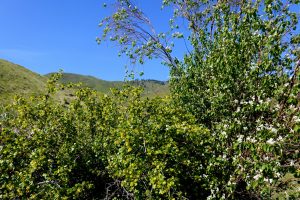
I wander into a ravine by the trailhead to find a completely different mixture of flowers including: serviceberry, golden currant, wild rose, wax currant, and common fiddlehead. Unfortunately there is also a carpet of whitetop – a shin-height noxious weed from Eurasia with a cream-colored flower that is spreading in our hills.
Beyond the trailhead, 1.5 miles of gentle uphill travels up the Maiden Lane Trail and along the Sage Hills Trail through a wide drainage locals call ‘The Gut.’ I’m mostly seeing the same display of flowers, and in a valiant effort to keep my count rising, I count the tiny flowers along the route like the white Pacific popcorn flower, small-flowered blue-eyed Mary, and purple crossflower. There are also a few small patches of a milk vetch, probably crouching locoweed, whose name asserts why you, or your stock, should not sample its poisonous alkaloids.

My count rises encouragingly along the zig-zagging course of the Lightning Trail. Initially the soils are rockier and less fertile (lithic) and an entirely new cast of characters show themselves. There are linear-leaf daisies, upland larkspurs, large-fruited biscuitroots, false dandelions, narrow-leaf goldenweeds, and stiff sagebrushes – a shrub whose leaves give me pleasure to squish and smell (try it).
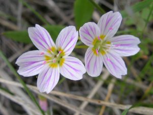
The Lightning Trail climbs steadily for 1300 vertical feet and, with the increased elevation, the flowers scroll back in time to those that could be found at lower elevations several weeks ago. I pass by blooms of prairie star flowers, spring beauties, bluebells, yellow bells, sagebrush buttercups, shooting stars, and ballhead waterleafs. Up high, the trail wanders into lithic soils once again and I find the dried husks of a flower that dates back to last September. I’ve already found and added the dried flowers of yarrow and rabbit brush to my list; now snow buckwheat becomes my 39th sighting. From past walks through this same area, I know another species might be found here, though I fear it may not have emerged yet. I search anyway and am in luck — a few blooms are showing and, appropriately, death camas becomes the deathblow killing-off my list.
Job completed, I find a perch and sit. The green hills, blue sky, and warm sunshine all flip my mood. On the walk up I’ve been wearing the botanist’s hat to identify and categorize. On the way down I stop thinking that a particular splash of color is something like the Western groundsel and simply appreciate it as a beautiful yellow flower.
Details: A Forty-Flower Walk
Access. In Wenatchee, drive Maiden Lane through the Broadview housing development and park at the very end of the road at the Kenzie’s Landing Trailhead (elevation 1,130 feet).
Trip Instructions. Head up the Maiden Lane Trail for 0.5 mile to Three Trails Saddle. Turn right onto the Sage Hills Trail and in 0.1 mile take the right spur at a fork in the trail. For the next 0.75 mile, the trail undulates up and down a few times but gradually works uphill through a wide draw known as ‘The Gut.’ About 100 yards before a gap called Gut Saddle, take the left spur of a trail forking off the Main Sage Hills Trail and start zig-zagging uphill on the Lower Lightning Trail. In about 0.35 mile, the Lower Lightning Trail intersects the Coyote Canyon Trail. Turn left onto the Coyote Canyon Trail and only follow it about 40 yards to another fork. At this fork, take the right spur heading more steeply uphill. This is the Upper Lightning Trail. The Upper Lightning Trail leads to the Horse Lake Reserve in 2.7 miles, but there is an excellent viewpoint (elevation 2,900 feet) over the Columbia River Valley and the Enchantments after 2.25 miles that makes a logical turn-around point. Retrace your route back.
Special Notes. There is no signage marking the intersections and turns described above, so carry a map of the area or an App like CalTopo showing the trails.
Maps. Click here to see a WenatcheeOutdoors map of the Sage Hills Trails. Or see a CalTopo map of the Sage Hills here.
Trip Length: 8 miles (roundtrip).
Elevation Gain: 1,800 vertical feet.
Resources. Sagebrush Country – A Wildlife Sanctuary by Ronald Taylor is a valuable book to help identify our local wildflowers. The ‘Seek’ app from iNaturalist is also an excellent tool for budding field botanists.
Allowed: Hiking, trail running, mountain biking, dogs on leash (scoop their poop).
Not Allowed: No motorized use, no hunting, no shooting, no plant collecting, no camping, no campfires, and no littering.
Land Ownership. This route uses a combination of Land Trust and Chelan PUD lands.
Andy Dappen is a retired outdoor journalist, the founder of the WenatcheeOutdoors.org website, and a former board member of the Chelan-Douglas Land Trust.
