by Andy Dappen
For over a month, our regional air has been clouded with smoke from surrounding wildfires. With fire now in the regional mindset, it’s an opportune time to emphasize that a major benefit of the undeveloped foothills properties that the Land Trust and its partners have protected along the southern and western flanks of Wenatchee give the entire community a beneficial, though not invincible, wildfire buffer.
Regionally in Okanogan County (2014), and farther afield in Colorado (2021) and California (2025), wind-driven wildfires burning on hot, dry days have created conflagrations that have claimed lives and inflicted massive property damage. Especially when burning through landscapes where people have moved, piecemeal, into the wildlands-urban interface and property is fragmented into large wooded lots with scattered structures, the right fire in the wrong conditions quickly grows into an inferno that must be fought on so many fronts that it overwhelms the fire-fighting resources of a city, county, or even region. Far more defendable for a community is what the Land Trust and the city have created along our southern and western foothills. Here, the open lands are undeveloped and the community’s fire-fighting resources can be concentrated along a single flank where development is prepared and aligned to create a fire-resistant wall against an advancing blaze.
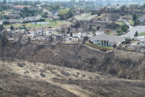
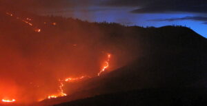
Even with a well-planned, fire-resistant interface, however, a wildfire driven by severe winds and aided by high temperatures and low humidity can breach a community’s defenses. We saw this scenario unfold in Wenatchee with the 2015 Sleepy Hollow Fire. Initially propelled by a gale, the fire overwhelmed the Broadview development and ignited homes. These burning homes ignited neighboring homes, which ignited even more homes. About the same time, windblown embers from the wildfire travelled downwind a mile to create a spot fire within the city’s perimeter at a cardboard recycling warehouse. That ignited other nearby warehouses, all of which were belching dangerous and flammable embers skyward. The city was aflame not only along its perimeter but from within, fire resources were losing the battle to contain all these blazes, and Wenatchee was quite literally approaching the type of destruction that the Marshall Fire inflicted on Boulder County, Colorado in 2021, where a thousand homes burned. Without the extremely good luck of the winds abating during the evening of June 28, 2015, the destruction to Wenatchee could have easily been ten times worse.

I count myself among the particularly lucky ones. Sitting on the border of the city limits, my property is flanked by open sagebrush country. That day with the chaos wrought by the Broadview and the warehouse fires, there were no firefighting teams available to defend our neighborhood as a wall of fire swept through the sage country and rushed toward us. Partly because my wife and I had prepared our property for wildfire, partly because friends and neighbors brought expertise and resources to help defend our property, and partly because the wind had moderated by the time the blaze reached us, our home and our neighborhood were spared.
Ten years have passed since Wenatchee was so seriously threatened by fire, making it easy to grow complacent about the dragons living with us on this landscape. Nonetheless, it’s a certainty that we will be assailed by equally dangerous or even more dangerous fires in the future. The amount of development and the type of development allowed along all of the city’s interfaces will play vital roles in mitigating the damage when the next monster pays a visit.
Details – A Foothills Wildfire Walk
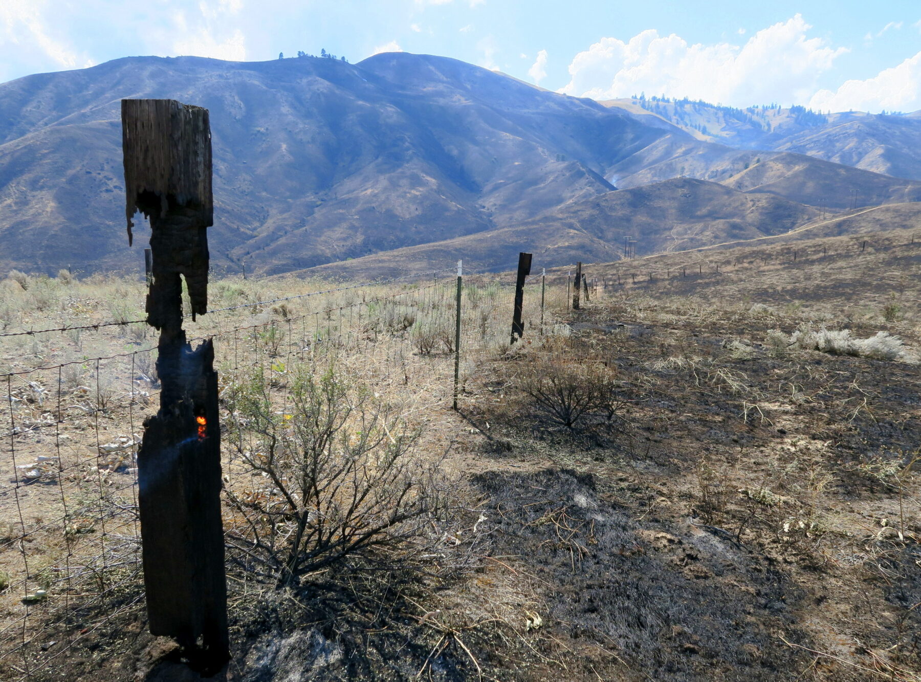
In autumn, when the air holds the scent of smoke and the landscape is parched, walk along the western border of the city where the open hills meet the urban interface to appreciate how the Land Trust, city of Wenatchee, Chelan PUD, and private land owners, have all used the tools of smart development to constrain the potential destruction of future wildfires.
Access. From the intersection at Fifth and Western in Wenatchee, follow Fifth Street west (uphill). In 0.7 miles the road bends sharply left to become Number One Canyon Road. Remain on the arterial as it twists for 0.5 miles to reach the Sage Hills Parking Area – a pullout on the right that can handle about 10 vehicles. There are no bathroom facilities so tend to those needs before arriving.
Instructions. Start by following Austin Court (a paved road) 150 yards uphill before turning right on Sage Hills Drive (another paved road) and following it a few hundred yards to its end where the Sage Hills Trail begins. Pay attention to the homes at road’s end and the measures landowners have taken to harden their properties to wildfire.
–Follow the Sage Hills Trail north 1.5 miles to Three Trail Saddle. At the saddle, take the rightmost trail leading downhill to the Kenzie’s Landing Trailhead in another 0.65 mile.
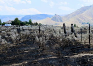
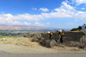
–From the trailhead, walk downhill on the gravel road into the Broadview neighborhood (0.25 miles) and then downhill along a paved segment of Maiden Lane to a sharp turn to the right where this walk ends (0.3 miles). The return trip retraces the route. As you walk Maiden Lane, consider that the many of homes on the north side of the road that are adjacent to the open lands were completely destroyed during the Sleepy Hollow Fire. Some of these homes had shake roofs (once a requirement for homes in the neighborhood) and quite a number of those homes caught fire and ignited adjacent homes or homes across the street. The new and surviving homes along the wildlands interface are now much more fire-resistant in the materials used for roofing, siding, and eaves; far better screened to prevent embers from entering eaves, attics, and vents; and landscaped to prevent vegetation from adding to a property’s peril. Other home owners in the neighborhood are also now acutely aware that, even if they’re not located on the front line, their home and landscaping must be hardened to the embers thrown by approaching wildfires or from nearby homes that catch fire. For the observant, this portion of the walk is particularly illuminating about measures making homes and neighborhoods more fire-resistant. And for the empathetic, this portion of the walk may connect you to the tremendous pain and heartache this neighborhood endured when 28 families lost their homes.
Trip Stats. Roundtrip distance: 6 miles. Total elevation gain: 800 vertical feet.
Land Ownership. The route spans a mixture of lands and roads owned by the Chelan-Douglas Land Trust, Chelan County PUD, and City of Wenatchee.
Allowed. The outing is suited to hikers, trail runners, and mountain bikers. Leashed dogs are allowed (carry out your dog’s waste). Horses are legal but the number of other users makes the route less desirable for equestrian use.
Not allowed. No motorized use, camping, campfires, hunting, shooting, picking of plants, off-trail travel, or littering.
Upcoming Events. Join Wenatchee Outdoors and the Chelan-Douglas Land Trust for a free, family-friendly Halloween hike at Castle Rock on Tuesday, October 27, from 4:30–5:30 pm. Meet at the Castle Rock Trailhead and be prepared to hike a short loop (less than a mile) and collect treats along the trail (bring a Trick-or-Treat bag). No registration required.
Andy Dappen founded the WenatcheeOutdoors.org website and is a former board member of the Land Trust. He hopes people who frequent Land Trust properties will join the organization and support its work.
