by Andy Dappen
Historically, driving up the gravel portion of the Burch Mountain Road near Wenatchee was a journey entirely through undeveloped lands. Over the past decade, the lower two miles of the road has witnessed the signs of growth common throughout the West – large homes sprouting on multi-acre parcels of land. It’s a process of fragmentation disrupting the movement of wildlife and complicating how municipalities provide services (like fire protection) to such homeowners.
Two miles up the gravel road, the fragmentation ends. First, the road enters public lands owned by the Washington Department of Fish and Wildlife (WDFW), next it crosses private land where the Chelan-Douglas Land Trust (CDLT) owns the development rights to prevent further parceling of these wild lands, and finally the road re-enters tracts of public land (a combination of WDFW and Forest Service holdings). With development contained here, the surrounding lands remain places where wildlife and recreationalists can roam.
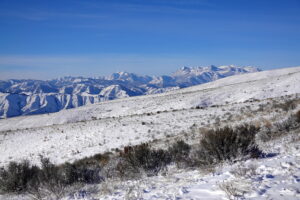
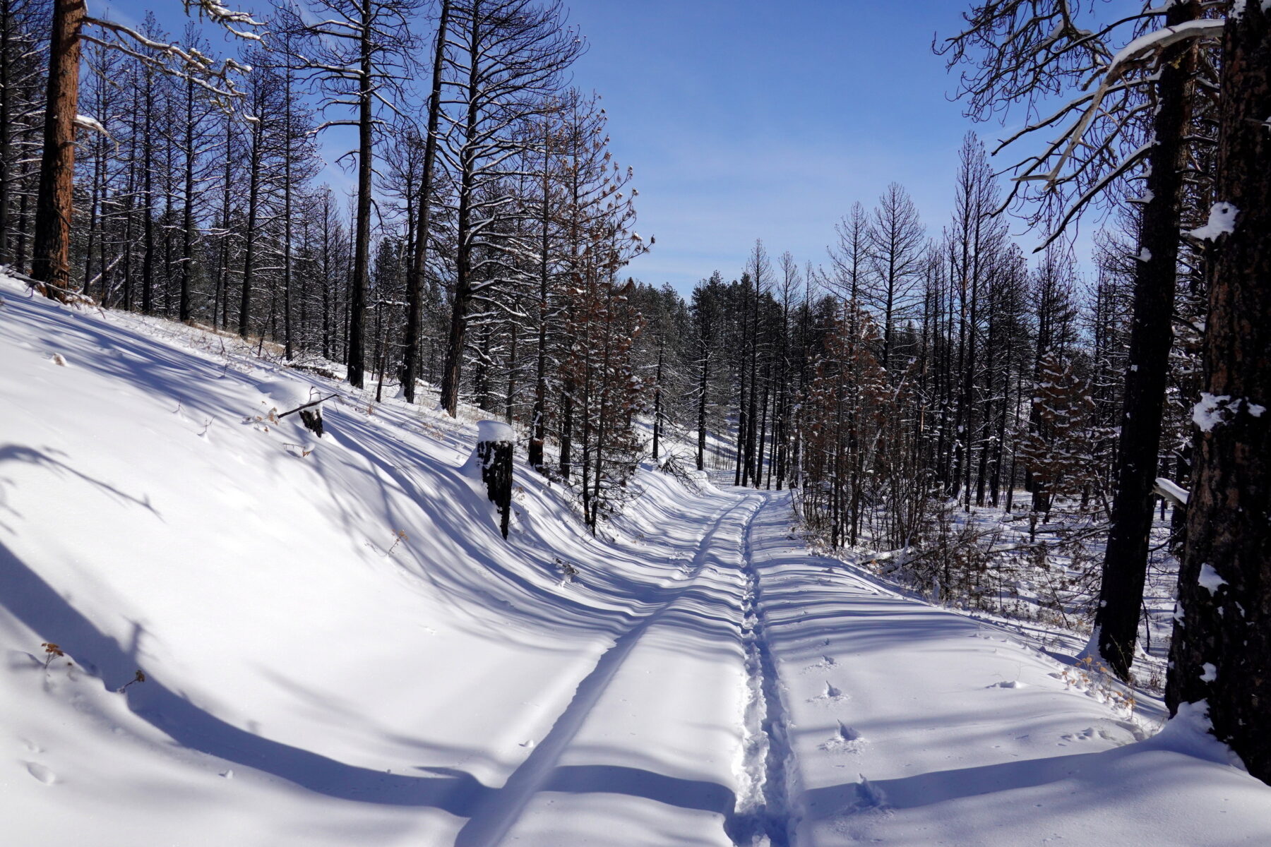
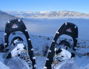
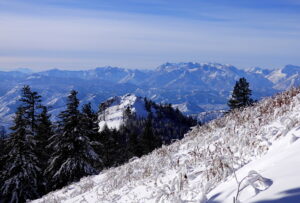
In winter, when many of Wenatchee’s trails in the surrounding foothills close to human traffic, I enjoy taking the occasional foray up the unpaved portion of Burch Mountain Road for some winter walking or, if snow blankets the upper slopes, to snowshoe or cross-country ski. These outings primarily follow the upper stretches of the road. Admittedly, walking a road lacks the aesthetics of walking a trail, yet the views from this walk compensate for the tread. Looking down on the city of Wenatchee and blue waters of the Columbia as it snakes through the surrounding hills is dramatic. And as you climb, the folded landscape surrounding the Wenatchee River Valley and the snow-covered peaks beyond Leavenworth all scroll into view. This punches the Aesthetic-Meter from ‘Dramatic’ to ‘Celestial’, making the area well worthy of a winter visit.
Details: Burch Mountain in Winter
Access. Accessing this area is best suited for SUVs, pickups, and other vehicles with decent clearance, winter tires and, ideally, all-wheel drive. A good time to visit if you hope to ski or snowshoe is when the lower mountain is bare and the snowline sits near or slightly above the highest homes. Drive Burch Mountain Road to the end of pavement and zero out the odometer before driving on. After two miles you’ll pass the driveways to the highest homes. At 2.1 miles, pass a sign on your right reading ‘Chelan Wildlife Area- Swakane Unit’. At 2.2 miles, look for a small pullout on the left and park. Bring a snow shovel in case you need to clear snow to create a parking slot.
- A mile from the car, the road traverses private land that is protected from future development by a conservation easement held by the Chelan-Douglas Land Trust (CDLT).
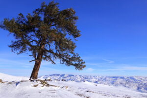
- At 1.5 miles, the road is once again flanked by public land as you reach One Tree Lookout. Enjoy the views from the pullout on the right side of the road.
- At 2.4 miles, the road enters thicker forests and the character of the surroundings change noticeably but pleasantly. Carry on through the forest for another 0.4 miles to reach a fork in the road. Take the left spur and, in another 0.1 miles, reach a gate blocking vehicular traffic from motoring up the road leading to the radio towers atop the South Peak of Burch Mountain.
- Go around the gate. In another 0.3 miles (a total of 3.3 miles from the car), the road switchbacks to the right. Leave the road here by making a hard left turn and traveling 100 yards to a spectacular viewpoint on a ridge overlooking the Wenatchee River Valley.
- If you’re feeling spunky, travel west along the ridge for another 0.3 miles to reach the short, but steep, slope leading to the summit of Eagle Rock.
Difficulty and Fitness. The route to Eagle Rock is, technically, easy for walkers and snowshoers. The final steep slope up Eagle Rock is more difficult and slippery when snow covered. Use good judgment as to whether climbing this final slope is within your comfort level and skill set. To complete the entire route is a roundtrip distance of 7.5 miles and requires moderate to good fitness, but anyone can enjoy traveling the described route a few miles and turning around when they’ve had enough.
Conservation Easements. This term (used above) refers to a tool used by organizations like the Land Trust to help willing landowners keep property in a wild state. By selling or donating the development rights to a conservation organization, the landowner significantly reduces the overall value of a property. Often this allows landowners to keep undeveloped property they love in a wild state. Public access is not a requirement of conservation easements and, in the case of this easement, public access is only allowed along the road.
Andy Dappen was the founder of Wenatchee Outdoors in 2005 and is a former board member of the Chelan-Douglas Land Trust.
