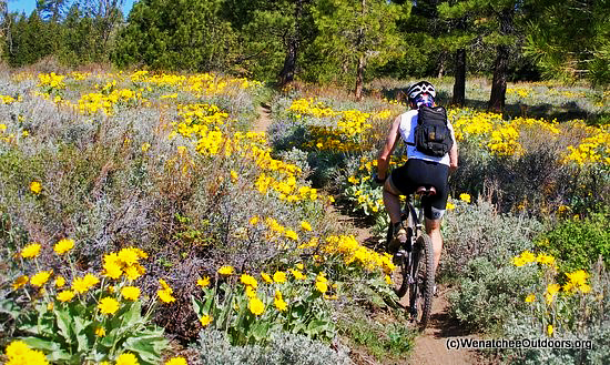
Attractions. Stairway to Heaven is a trail accessed from Number Two Canyon that heads up the lower slopes of Twin Peaks east of the main road usually used to access the summit. Like Suspended in Paradise, Stairway to Heaven eliminates part of the road but eventually reconnects with it. This trail is more intimate than the road, cuts through beautiful glades of ponderosas and fields of flowers. If you’re objective is to get up to the top of Twin Peaks quickly for its long views in all directions, the road is the fastest route. If, however, you’re into the quality of the experience, this trail adds bonus points to your day out.
Difficulty: 2 (Intermediate). The trail climbs steadily but never too steeply. Relatively easy walking and intermediate mountain biking.
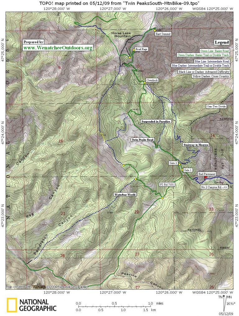
Access. From Wenatchee drive up Canyon Number 2 Road and park at the small lot at the end of pavement or drive another 0.5 miles past the end of pavement to a small parking pullout right before a locked gate on a spur road to FS Road 7101. Passenger cars with low clearance are advised to park at the end of pavement and ride the dirt road for 0.5 miles to where the trail description below starts.
Trip Instructions:
- Go past the locked gate and follow the spur road 100 yards to a trail on the right. Look for small bridge across ditch.
- First switchback at 0.32 miles in an area marked by extensive 4×4 damage and garbage dumping.
- First crossing of jeep road at 0.69 miles, trail continues straight across road.
- Trail switchbacks in a gully of serviceberry brush.
- Last crossing of jeep road at 1.33 miles.
- At 1.8 miles the trail enters a series of switchbacks known as the “Bermuda Triangle”.
- At 2.3 miles the single track ends at an old logging spur. Follow the spur uphill.
- At 2.76 miles, the logging spur ends and the trail forks. The left trail leads downhill to the “Suspended In Paradise” trail. The right trail is the continuation of “Stairway to Heaven.”
- Follow the single track to another logging spur at 3.28 miles, follow this spur to the main road to Twin Peaks.
- Upon reaching the main road, another 1.6 miles of road riding leads to the summit of Twin Peaks.
Map: See map below for more information.
Print our topo map on 8.5″ X 11″ paper in portrait mode.
Trail Concerns. In early and late season rains can make this trail muddy and easy to rut. Please don’t walk or ride if you’re leaving prints or tire marks deeper than ¼” .
 Allowed. The area behind the locked gate noted at the start of the trip instructions is closed to wheeled, motorized vehicles (cars, trucks, motorcycles, ATVs). Hiking, mountain biking, and horseback riding are all allowed.
Fees/Permits. None needed.
For more hikes or rides in the area, click on the appropriate guidebook at our index of guidebooks.
Reporter: Matt Rose, 5/10/2009
Leave It Better Than You found It. This should be every user’s goal. Pick up trash left by others, pull noxious weeds along your route, disperse old fire rings, throw branches over unwanted spur trails…
Disclaimer. Treat this information as recommendations, not gospel. Conditions change and those contributing these reports are volunteers–they may make mistakes or not know all the issues affecting a route. You are responsible for yourself, your actions, and your safety. If you won’t accept that responsibility, you are prohibited from using our information.