Mormon Ladies Lakes Traverse
by Martin Straub
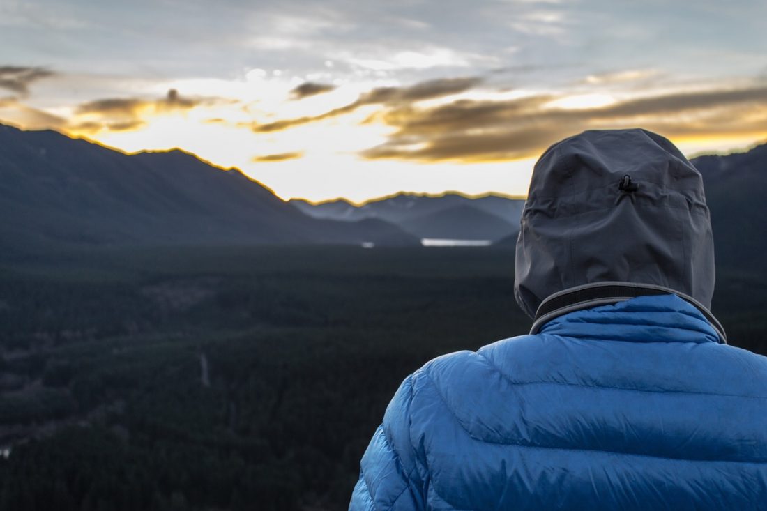
 When describing this local backpacking trip to friends as a traverse of the “Mormon Ladies Lakes”, I received more than a few blank stares. Apparently the lakes along this route are named (according to Mountaineers Trail book authors Ira Spring and Harvey Manning) for the many wives of Brigham Young – including Edna, Mary, Margaret, Florence, Alice, and Flora. Regardless of the name or ultimate destination, the scenery on this trip was a feast for the eyes. We decided on a one-way route, starting from the end of the Icicle Road on the Icicle Creek Trail, then continuing onto the Frosty Creek and Icicle Ridge trails, and finally descending via Chatter Creek. The first 5-plus miles along Icicle Creek are pleasant and nearly flat; the real work starts on Frosty Creek and the real views begin near the crest of Frost Pass at 5,700 feet. From there to Lake Edna, high alpine scenery awaits with views stretching from Mt. Baker down to Rainier and all the peaks in between. Our visit in mid-September was highlighted by a beautiful array of fall colors, with just the slightest hint of yellowing larch trees – particularly around the Lake Edna basin.
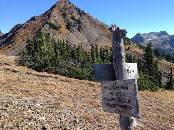
 Two surprises affiliated with this trip? First, strong, gusty winds drove us from making camp at Lake Edna to a slightly lower basin (which was still windy, but provided some relief from the howling winds around the lake). Second, the exit from Lake Edna proved more challenging than expected – the upper sections of the Chatter Creek Trail, while easy to follow, were rough and had a number of ups and downs before we hit the constant and monotonous descent leading to the trailhead back along the Icicle Road (3.5 miles farther downstream from where we started).
As of September 2015, all sections of this route (aside from Frosty Creek which clearly sees less traffic and was overgrown in places) were well-maintained. In a typical summer a few creek crossings could pose modest challenges, but during this summer of drought many of the creek beds hadn’t seen water for months. We didn’t track total distance or elevation, but I’d estimate about 18-20 miles and total elevation gain of 6 – 7,000 feet. Our trip was leisurely, spread over two nights, but Lake Mary or Lake Florence would make a logical overnight stop for those wanting to do this route more quickly.
Details, Details
Activities: Hiking, backpacking, trail running, horseback riding.
Access: Follow US Highway 2 West through Leavenworth and turn left at the end of town on Icicle Road (follow signs to the Leavenworth National Fish Hatchery, there is a large gas station at the corner). If you are traveling Eastbound on Highway 2 over Stevens Pass go right on Icicle Road when you first enter Leavenworth.
–The main road hooks right before the entrance to Sleeping Lady Resort.
–From here, follow the Icicle Creek Road to mile 17.25 the Icicle Creek Trail, park here and begin your hike onto the Frosty Creek trail.
A Tip For Your Trip: Bringing a mountain bike is a good way to handle the car retrieval. We suggest hiding a bike near the Chatter Creek Trailhead as you drive by, then head to the trailhead to begin your adventure.
Fitness: 3 (advanced) as a day trip, 2+ (hard intermediate) as a 2-day trip, 2 (intermediate) as a 3-day trip
Skill: 2 (intermediate)
Nearest Town: Leavenworth
Distance and Elevation: 18-20 miles with a total elevation gain of 6-7,000 feet.
Maps: View our topo map. Note:This is PDF map and if loaded into an app like Avenza PDF Map it will be geo-referenced to work with the GPS functions of your smartphone.
Permits: A Northwest Forest Pass is required for parking at the trailheads. You’ll also need to pick up self-issued wilderness permit at the trailhead as you leave the parking area.
Leave It Better Than You Found It. This should be every outdoor user’s goal. Pick up trash left by others, pull some noxious weeds along your route, throw branches over unwanted spur trails, don’t ride or walk wet trails when you’re leaving ruts/footprints deeper than ¼ inch…
Disclaimer. Treat this information as recommendations, not gospel. Conditions change, and those contributing these reports are volunteers–they may make mistakes or may not know all the issues affecting a route.You are still completely responsible for your decisions, your actions, and your safety. If you can’t live with that, you are prohibited from using our information.
