Attractions: A trip that starts in the fast, smooth current of the Columbia (below Chief Joseph Dam) and finishes on the calm water of Pateros Lake. For birders, the Bridgeport Bar State Wildlife area is rich with all manners of birds, from sparrows and swallows, to sandpipers and killdeers, to herons and pelicans. When we paddled the route in mid-August, the American white pelicans (with their 8- foot wingspans) and the blue herons (whose wings are equally huge) were particularly fun to watch. Besides the wildlife, the scenery is diverse and enjoyable, ranging from a desert landscape near the dam to lush wetlands in the Bridgeport Bar area.
Skill: 1 (easy). There is fast moving current but no rapids at the start of this trip and water with almost no current in Pateros Lake.
Fitness: 2 (intermediate) to paddle Bridgeport to Brewster. Paddling the entire circuit around Pateros Lake is longer and rates as more advanced fitness level (3)
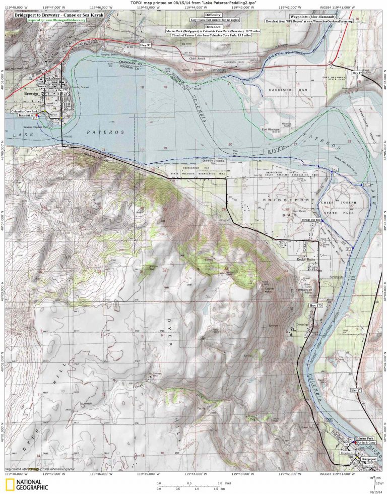
Distance. The paddle from Bridgeport to Brewster is about 10.75 miles one way. To do a complete circuit of Pateros Lake (start and end at Columbia Cove Park), is about a 15.5 miles loop.
Put- in at Marina Park in Bridgeport by following Seventh Avenue to its eastern end. The park is operated by the city and has camping spots ($15 for tents, $25 for hookups), water, toilets, and a boat launch. Day-use of the park is free.
Take-out at Columbia Cove Park in Brewster. Access this by leaving Highway 97 and driving south on Seventh Avenue about 0.6 miles until it ends at the park. This park has pit toilets, a picnic shelter, and easy access to the lake but has neither running water nor camping.
Permits: None required 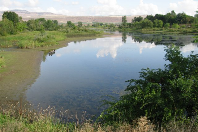
Map: See map below for more information.
Waypoints: Download the waypoints from our map here.
First posted: by Jan and Andy Dappen, July 2013.
Leave It Better than You Found It. This should be every user’s goal. Do no damage and pick up trash left by others.
Disclaimer. Treat this information as recommendations, not gospel. Conditions change and those contributing these reports are volunteers–they may make mistakes or not know all the issues affecting a route. You are responsible for yourself, your actions, and your safety. If you won’t accept that responsibility, you are prohibited from using our information.
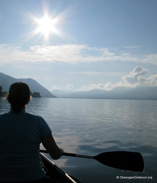
Photo Below: Late afternoon on Pateros Lake