
Story and Photos by Andy Dappen
“You guys are morons,” she tells me at the party.
It’s 9 p.m. on June 21 and in eight hours I’ll be meeting my fellow imbeciles, driving to the trailhead, and hiking 6.5 miles up Phelps Creek to upper Spider Meadows. Then, if we are lucky, we ‘might’ find snow leading three thousand vertical feet up Dumbell Mountain. If are unlucky, the slopes will have lost their winter coat and we’ll have carried ski gear for added hurt rather than added fun. That’s why she is making herself so endearing.
“So you think this adventure should be called, ‘Three morons and a dumbell?'” I ask.
She gives a dismissive laugh, turns her back on me, and goes looking for intelligent company.
The next morning around 10 a.m. her assessment lingers with me. The 6.5-mile approach has gone slowly — there have been graveyards of trees where avalanches deposited lumber over the trail, foot-soaking stream crossings, and just enough snow over the trail to slow hiking but deter skiing.
Now we stand at bottom of a massive mountain amphitheater, heads craned back to take in the surrounding sentinels, and eyes straining to find continuous ribbons of snow that might lead the three dumbells upward. Continuous lines seem to have evaporated in the summer heat.
“I was seriously thinking of leaving the skis behind and just bringing hiking boots,” Tom says as we study the slopes ahead, “but that would have been the smart thing to do.”
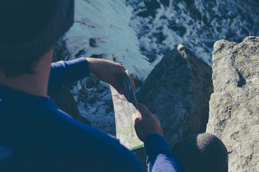
Our route goes up over there,” Coron says looking at the map and pointing to the corresponding part of the amphitheater. “The little drainage we’ll follow is hidden behind that rocky ridge.”
“Have faith, fellow geniuses,” I tell them, “It’s going to be good.” Fifteen minutes later we are able to look up our hidden drainage and, for the first time, hope floats — a finger of snow leads up the lower drainage. We kick up that snow and as the upper drainage scrolls into view the snow fields get wider and deeper.
We follow snow all the way up to the 8,000-foot level where our white blanket yields to the charcoal rocks of the summit pyramid. The exit from snow to rock has us worried. To enter the third-class gulley system providing the easiest climbing, we must kick steps across a truck-sized block of snow perched tenuously on a rock slab. Running water produced by the mid-afternoon sun erodes the bonds keeping that block glued to its moorings.
It all looks like a trap ready to spring. I mention an acquaintance who was crushed and killed twenty years ago when a similar block he was moving across broke and slid on Sloan Peak. We study the block longer and time enhances our anxiety.
“I’m OK skiing down from here,” Tom says. “This is the high point of the snow and I came to ski.”
I second Tom’s motion, which leaves Coron out of luck whether he wants to summit or not. “I’m good with that,” Coron concedes gracefully. “That gives me reason to come back later,” he says gorging his eyes on the vertical world surrounding us.
So we ski.
The run down to Spider Meadows is long, the snow is creamy, the upslope view is dominated by the rock turret we had hoped to vanquish, and the downslope view features a rim of white teeth with other lines to ski. We’re all feeling like geniuses by the time the skis glide off the snow 3000 vertical feet lower onto a carpet of glacier lilies.
Later when I call, she cuts me off as I’m about to suggest that she had misjudged us. “You traveled 17 miles, climbed 5,000 vertical feet, were on the trail for 12 hours… and you didn’t tag the summit?” she states incredulously. “Man, you three really are morons. “
DETAILS, DETAILS: Skiing/ Climbing Dumbell Mountain (el: 8,421 feet)
Length: Roughly 17 miles roundtrip. Elevation Gain: 5,000 feet.
Fitness: 3 (advanced) as a day trip, 2 (intermediate) as an overnight trip.
Skill Level: Skiing is 2+ (advanced intermediate) until about 300 or 400 vertical feet before exiting the snow which is steep (advanced). Intermediate skiers should consider leaving skis below these steeps and boot up to the rock gulley leading to the top. Third class scrambling on loose rock leads about 300 vertical feet to the top.
Access. Follow Highway 2 to Coles Corner, then drive 4.4 miles on Highway 207 in a northeasterly direction past Lake Wenatchee State Park to a bridge crossing the Wenatchee River. Shortly past the bridge, leave Highway 207 by staying right at a fork and then veer right again at the next fork onto the Chiwawa Loop Road. About 5.75 miles from Coles Corner, the Chiwawa Valley Road branches off to the left (maps also refer to this as the Meadows Creek Road). Turn left and follow the road about 2.7 miles to a bridge across the Chiwawa River. Cross the river and, about 0.3 miles later, curve left (remain on the paved road). The paved road becomes State Highway 3, which is also called the Chiwawa River Road. Keep following this in a northwesterly direction and (about 8 miles from the bridge across the Chiwawa River) the road turns to gravel. Go another 10.75 miles and, at a prominent fork, veer right onto the Phelps Creek Road. Drive uphill more steeply for 2.25 miles until the road ends at the trailhead (elevation 3,500 feet). A Northwest Forest Pass is needed for parking.
Maps: See maps below for more information.
Trip Instructions. From the 5400-foot level in Upper Spider Meadows (waypoint s3), head north to the 6200-foot level where the pitch of the slope before you steepens considerably. Now travel east up a little drainage that provides easy walking through the many rock slabs armoring the surrounding slopes. At the 7000-foot level, head northeast up toward the notch at the base of the southeast ridge (d2). This notch is used if you intend to climb Greenwood ( the 8415-foot peak that’s northeast of Dumbell)—you’ll need to contour exposed, third-class ledges around the east side of Dumbell to do this (d3). For Dumbell proper, climb steep snow 100 to 200 yards left of the notch up toward the right side of the south face where you’ll find the easiest gulley system to get going on the rock. A little scrambling gets you on easier ledges that zig-zag up to the west ridge. Scramble the west ridge a few hundred feet to the top.
Land Ownership. Forest Service. A few miles from the start of this route you enter the Glacier Peak Wilderness.
Allowed, Not Allowed. Motorized vehicles of any sort and bikes are not allowed in the wilderness. Horses and dogs are allowed at Spider Meadows.
Permits. A Northwest Forest Pass is required for parking at the trailhead. Also check at the kiosk by the trailhead to see whether you need to fill-out and carry a self-issued wilderness permit.
Leave It Better Than You Found It: This should be every outdoor user’s goal. Pick up trash left by others, pull some noxious weeds along your route, throw branches over unwanted spur trails, don’t ride or walk wet trails when you’re leaving ruts/footprints deeper than ¼ inch..
Disclaimer. Treat this information as recommendations, not gospel. Conditions change and those contributing these reports are volunteers–they may make mistakes or not know all the issues affecting a route. You are responsible for yourself, your actions, and your safety. If you won’t accept that responsibility, you are prohibited from using our information.


