Mt. Maude is one of the three 9,000 footers that comprise the spectacular headwaters cirque of the Entiat River. One of the major drainages on the east of the Cascade crest and a tributary of the Columbia River. This peak although a bit intimidating with intense winds on the day hiked, was quite reasonable with a well worn path and a safe climb to the top. Surprisingly many low lying flowers sprinkle Mount Maude near the top of peak along with bumble bees and butterflies.
The views from the top of Mount Maude are amazing, with peak views in all directions. Ice lakes sits below, with brilliant blue waters and white pumiced lined beaches.
Nearest Town: Leavenworth/Plain
Uses: Mountaineering/Scrambling
Skill: 1 (a walk-up peak)
Fitness: 2+ to 3- (hard intermediate to easy advanced).

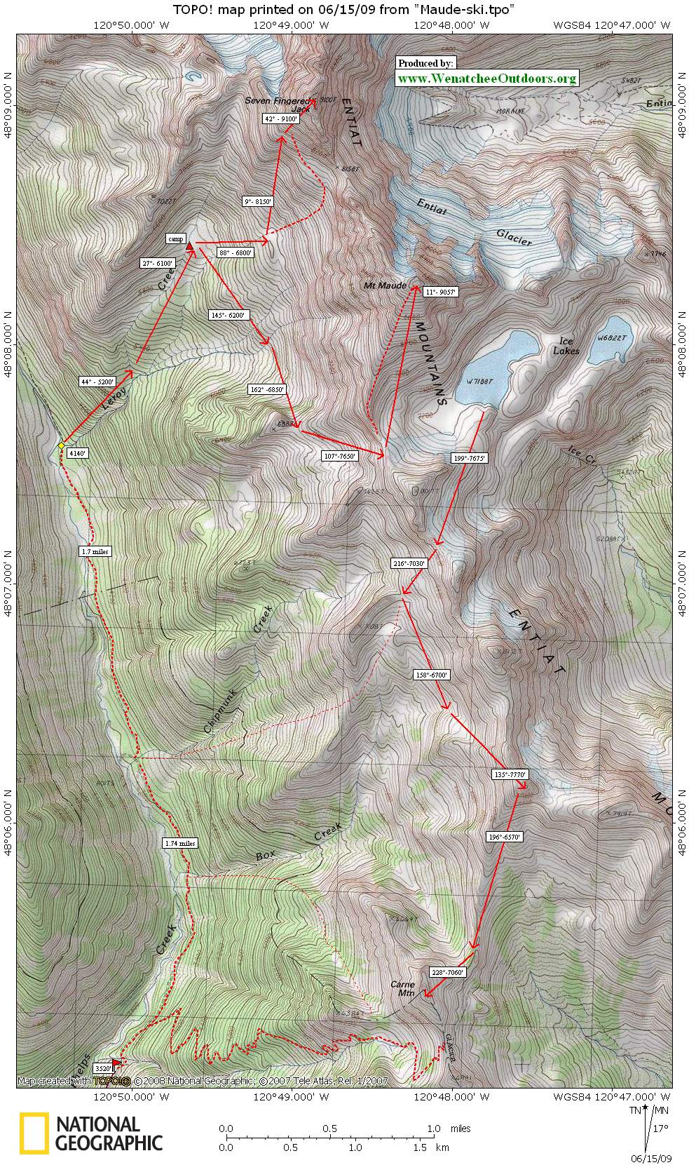
Access: Drive US Highway 2 and turn north toward Lake Wenatchee. After the Wenatchee River bridge go right at a Y, then drive 1.1 miles on county road 22 and turn left on Chiwawa River forest road number 62. Drive 24 miles to near the end of the road and turn right on the Phelps Creek Road. Drive to the end of this road to the trailhead. Walk about 3.5 miles up Phelps Creek then follow the climber’s trail on the north side of Leroy Creek up to a high camp used for climbing both Seven-Finger Jack and Mt. Maude.
For the east approach, drive north from Wenatchee on the highway west of the Columbia River to Entiat (97A). Turn west on the Entiat River Road and follow it to the end. Hike the Entiat River trail No. 1400 for 8¼ miles to the Ice Creek Trail. The Entiat River must be crossed on logs, and there may be a large log jam south of the trail if no log is present at the trail. You’ll need a Northwest Forest Pass for the parking.

Last Updated: This guidebook post was last updated on 8/28/19 by Sarah Shaffer.
More Details. This entry about backcountry skiing up Seven-Finger Jack and Maude has most of the pertinent information needed for climbing the south side of Maude. Summit Post details this trail nicely and includes photographs. Click here to view the post.
Map. See map below for more information.
Leave It Better than You Found It. This should be every user’s goal. Pick up trash left by others, pull noxious weeds along your route, throw branches over unwanted spur trails, etc.
Disclaimer. Treat this information as recommendations, not gospel. Conditions change and those contributing these reports are volunteers–they may make mistakes or not know all the issues affecting a route. You are responsible for yourself, your actions, and your safety. If you won’t accept that responsibility, you are prohibited from using our information.