![Peshastin%20Pinnacles%20164%20Rosw%20of%20slabs%20with%20grass%20between[1]](http://wenatcheeoutdoors.org/wp-content/uploads/2016/06/Peshastin20Pinnacles2016420Rosw20of20slabs20with20grass20between1.jpg)
Lisa Robinson took advantage of our beautiful spring weather to visit the Peshastin Pinnacles State Park. Although her parents lived just across the river from the park for 10 years and her grandmother owned the orchard there since before 1949, this was the first time Lisa deliberately took some time to explore the park.
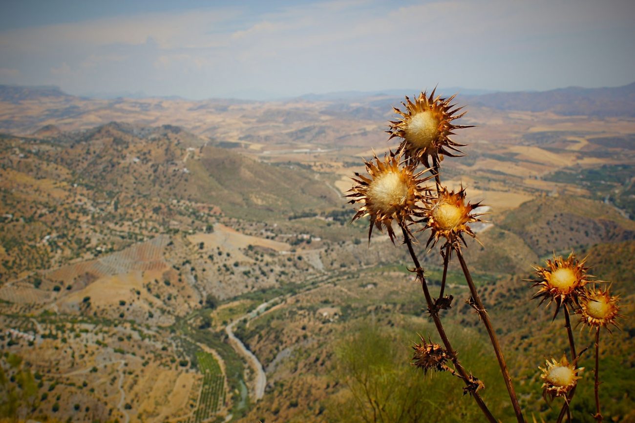
It turned out to be the perfect walk that makes you sweat a bit (the trails either climb or descend) exposes you to flowers, views of the Enchantments and Wenatchee River orchards, and takes you under crags where weekend climbers wage war. All in our backyard!
A climbing haven for locals and visitors alike, the Pinnacles also provide an interesting backdrop for hikers. Check out Lisa’s slideshow illustrating her walking tour of the pinnacles. Lisa arbitrarily decided to walk the loop counter clockwise, although it can be done in the opposite direction. Her route took her to the right of Dinosaur, over Sunset Slab, to the back of Grand Central, switchbacking down the side of Grand Central and along Orchard Loop back to where it all began.
Peshastin Pinnacle State Park covers 34.4 acres and offers six picnic sites, 8,350 feet of trail, and is home to unique sandstone spires and formations that are contained in this rock climbing park. The state park has some facilities (vault toilet, picnic tables) for picnics or gatherings and it’s a great place to take a short walk or to park for a road ride through the surrounding orchard lands.
Details, Details: Peshastin Pinnacles
Length: A little more than a mile.
Elevation Gain: 500 feet
Skill Level: 1+
Fitness Level: 1+
Access: Follow Highway 2 some 0.2 miles west of Milepost 109 and turn onto N Dryden Road, following signs to Peshastin Pinnacles State Park. In 0.5 miles reach the entrance to Peshastin Pinnacles State Park. The state park has some facilities (vault toilet, picnic tables). It’s a good place to take a short walk and to park for a road ride through the surrounding orchard lands.
Map: See map below for more information.
Instructions: Go through the gate into the trails and use the sign with a schematic of the trails (which is included in our slideshow) to determine which trail to walk and in which direction. The slideshow included by Lisa Robinson takes a counter clockwise walk through the trails system. Take a look at the pictures illustrating this walking tour
Additional Information: Peshastin Pinnacle State Park covers 34.4 acres and offers six picnic sites, 8,350 feet of trail, and of special interest is the unique sandstone spires and formations that are contained in this rock climbing park.
Other Uses: Climbing, trail running. See the Peshastin Pinnacles entry in our on-line rock climbing guidebook for detailed climbing information.
Nearest Town: Cashmere
Best Seasons: Spring and fall
Land Ownership: Washington State Parks. Outlying sandstone crags near Swauk Pass (along Highway 97) lie on Forest Service land (Wenatchee National Forest). Some other sandstone crags in the area are on private property. Please respect property rights and obey all no trespassing and no camping signs.
Seasonal Closure: The park is closed during the winter. The stated dates of closure are Oct 15 to March 15 but these are soft dates and typically the park is open well into November if conditions are suitable for climbing. The park often opens a week or two before mid-March as well. To find out about the park’s status at any given time cal 509-664-6373 or email Wenatchee.Confluence@parks.wa.gov
Hours: The park is open during daylight hours (6:30 am to dusk).
Permits: Washington State Discover Pass
Reporter: Lisa Robinson and Molly Steere 4/23/10.
![Peshastin%20Pinnacles%20072%20View%20toward%20Enchantments%20i%20think[1]](http://wenatcheeoutdoors.org/wp-content/uploads/2016/06/Peshastin20Pinnacles2007220View20toward20Enchantments20i20think1.jpg)
Leave It Better Than You Found It. This should be every outdoor user’s goal. Pick up trash left by others, pull some noxious weeds along your route, throw branches over unwanted spur trails, don’t ride or walk wet trails when you’re leaving ruts/footprints deeper than ¼ inch…
Disclaimer. Treat this information as recommendations, not gospel. Conditions change, and those contributing these reports are volunteers–they may make mistakes or may not know all the issues affecting a route. You are still completely responsible for your decisions, your actions, and your safety. If you can’t live with that, you are prohibited from using our information.

