![Snowshoe-Miller-sm[1]](http://wenatcheeoutdoors.org/wp-content/uploads/2016/08/Snowshoe-Miller-sm1.jpg)
Attractions: Squilchuck State Park offers an easily accessed snowshoe (or ski) through frosty forests with fleeting vistas of nearby landscapes. It’s super fast to reach from Wenatchee, it’s pretty, and it’s a good place to exercise. From the eastern border of the park, you can also follow old roads up into the Stemilt Basin, gathering good views of the surroundings as you climb and accessing miles of snowed-over roads near Upper Wheeler and Spring Hill reservoirs.
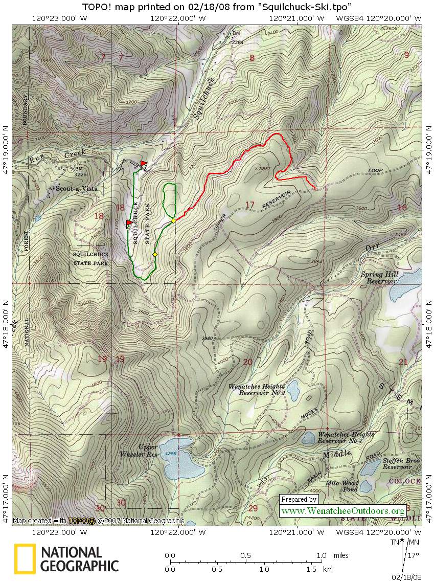
Map: View our topo map below (8.5’x11” portrait).
Note: use ‘Print Preview’ before printing to properly scale this map to a full sheet of paper.
Activity: Snowshoeing or cross-country skiing.
Nearest Town: Wenatchee.
Skill Level: 1 (easy) for snowshoeers. 2+ (strong intermediate) for cross-country skiers.
Fitness Level: 1 (easy) for park loop. 2 (intermediate) for Stemilt Basin option.
Recommended Season: late December through February.
Elevation Gain: 550 feet for park loop, 850 feet for Stemilt Basin option.
Distance: Round-trip of 2.5 to 3 miles for park loop and 6.5 miles for Stemilt option.
Hours: Summer hours are from 8am until dusk. Winter hours vary from year to year, depending on the park’s budget. In recent years the park has typically been open from 8am until dusk on weekends. When open, you can park by the sledding hill and use the bathroom next to the parking lot. When closed, you can still park outside of the entrance (there’s a pullout just uphill of the gate blocking the entrance road) and walk/ski/snowshoe in the park. Find a ranger and ask about the old Squilchuck Ski Bowl and Weeks Family Farm – part of the interesting history of the park property.
Access: Leave Wenatchee on South Mission Street. This merges with the Squilchuck Road. Follow Squilchuck Road about 7 miles to Squilchuck State Park (4 miles before the Mission Ridge Ski Area). If the park is open, drive 0.45 miles up the park road and park in a lot below the lodge. More often than not the park is not open, so make a hard right turn as if you’re heading to the Mission Ridge Ski Area and park 50 yards farther along on the left (south) side of the road.
Trip Instructions:
–Starting from parking area outside of the park either 1) walk around the gate blocking the entrance road to the park and walk 0.45 up the road to the upper parking area or 2) snowshoe/ski straight uphill of the car past a maintenance shed that’s roughly 100 yards uphill of you and beeline 0.45 miles up to the upper parking area.
–From the upper parking area, keep heading uphill (traveling south) and head into the camping area past the numbered camping stalls. Follow the snowed-over road through this very small camping area and head into the woods. The road hooks around and eventually heads north.
–About 0.6 miles from the upper parking area, you’ll come to a fork in the road. Stay right.
–In another 0.2 miles, reach a second intersection. Again stay right. Shortly after this second intersection the trail reaches the eastern boundary of the park where there is a small sign marking the 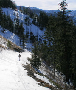 boundary. If you’re headed to the Stemilt Basin, you’ll branch off to the right here. If you’re taking a shorter trip and remaining in the park, just stay on the trail and it will loop around and return to the second intersection. From the second intersection, retrace the route to the start.
—If you’re headed to the Stemilt Basin, split off to the right at the park boundary and ski or snowshoe on a relatively flat contour. It’s a bit confusing here as to whether the road bed climbs or not. For the first 100 to 150 yards the route is quite flat, then it ramps up just a bit and starts a steady climb. If you follow the road for about 1.8 miles you’ll eventually hit Upper Reservoir Loop Road. This road should not be skied with extremely light Nordic skis and boots—metal edged cross-country skis, 3-pin binding, and a slightly heavier boots are recommended. Depending on the snow conditions, you may also want skinny skins.
Cons / Hazards:
–The trails in the park are not groomed. This is not an issue for snowshoers but cross-country skiers may find lumpy conditions from all the foot traffic and frozen snow. This area is difficult to ski with extremely light Nordic skis and boots—metal-edged cross-country skis, 3-pin binding, and stiffer boots are all recommended. Depending on the snow conditions, you may also want skinny skins.
— The road up to the Stemilt Basin can also be quite a mixed bag of snow conditions and can be sun crusted and wind swept. Skins may be useful for going up it and sometimes might even be recommended for the descent.
 Other Resources: State Park Map
Allowed: Snowshoeing, cross-country skiing, hiking, and sledding.
Not Allowed: Snowboarding, snowmobiling, metal-edged sleds, and dogs off leash.
Land Ownership: Washington State Park.
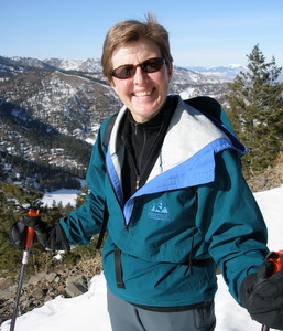
Reporter: Andy Dappen 2/2008
Fees/Permits: A Discover Pass is necessary for parking at Squilchuck State Park. Annual passes are available for $30 through Washington State Parks.
Leave It Better Than You found It. This should be every outdoor user’s goal. Pick up trash left by others, pull noxious weeds along your route, disperse old fire rings, throw branches over spur trails and spurs between switchbacks (make it harder to do the wrong thing than the right thing).
Important Disclaimer: Treat this information as recommendations, not gospel. Things change, conditions change, and those contributing these reports are volunteers–they may make mistakes, fail to give complete information, or may not know all the issues affecting a route. So forget about finger pointing: If things go wrong, you are completely responsible for yourself and your actions. If you can’t live with that, you are prohibited from using our information.