
The Loomis Natural Resources Conservation Area (NRCA) is a chunk of state forest managed by the Department of Natural Resources (DNR) that sits just east of the Pasayten Wilderness and just

south of the Canadian/US border. The lands are a mixed bag of both old and semi-old logging activity, healthy forests, and motley stands of second growth. The recreational opportunities here are also quite a mixed bag. Whether you’re hiking, trail running, mountain biking, or horseback riding, you’ll find some of the routes within the conservation area’s trail network blissful and others awful. In this guidebook entry, we’ve identified different routes and loops to sample, and made judgment calls about who would and who would not enjoy these routes.
The Chopaka Mountain Quad. For hikers, trail runners, horseback riders, and mountain bikers, this route  is the conservation area’s crème de la crème. It rises as the route you should do with limited time. It’s also the route that gets you to the top of four of the highest peaks in the area (Disappointment, Joe Mills, Hurley, and Chopaka). To take in all four peaks entails 12.5 miles of travel (pretty modest for tagging four summits), but you can shorten the route considerably by taking in fewer summits. Mountain bikers can do about half the distance as a ride and the rest as a hike, but pedaling into the hub from where the peaks are climbed makes for quick access and even quicker egress.
- Starting from Cold Springs Camp, follow the main road uphill for 0.25 miles to the pullout at R1, and then follow the Silver Jeep Trail 2.6 miles to the pass at waypoint S5 where you’ll start the short climb to the top of Disappointment Peak. After the climb, come back down the Silver Jeep Trail a quarter mile to a gate at waypoint S4. Go through the gate (leaving the bike behind if you rode) and walk a rocky, overgrown road steeply uphill to waypoint C1. From C1, the summits of Joe Mills, Hurley Peak, and Chopaka Mountain can all easily be scaled in the course of several scenic hours of travel. Enjoy it – places don’t get a lot more scenic than this! Bag as many peaks as energy allows, then return to the gate at S4. If you brought a bike, enjoy the quick, gravity-assisted ride back to Cold Springs Camp. If you’re on foot, enjoy the plod.
- Skill: 2 (intermediate). Fitness: 2 to 3 (intermediate to advanced, depending on how many peaks you climb). Elevation gain: 4,350 feet. Click here for more details.

Ollalie Trail Northern Loop. While hikers will find the Chopaka Mountain Quad the best bang for the miles walked, this 10.5-mile loop gives mountain bikers and trail runners better trails for rolling and jogging. Horseback riders will also enjoy the route.
- Starting from Cold Springs Camp, follow the main road uphill for 0.25 miles to the pullout at R1, and then follow the Silver Jeep Trail 2.6 miles to the pass at waypoint S5 where you’ll want to take a short side trip up to the top of Disappointment Peak. Return to S5 then drop 1.3 steep miles down an old, steep road to S6. Now turn left onto the Olallie Trail. The Ollalie Trail is rough, narrow, and swampy – runners will want to take it slow so as not to slip or stumble, and mountain bikers will find themselves pushing the bike over much of this trail’s 1.2-mile length. At waypoint B6, turn left and follow the Fourteen Mile Trail (an ATV road) gradually downhill for 1.25 miles to B4. Turn left again and follow the Snowshoe Trail for 2.9 miles to waypoint R1. Mountain bikers will find most of the Snowshoe Trail ridable but the last 0.6 miles has swampy and sandy sections that will require some uphill pushing. At R1 follow the main road downhill for 0.25 miles to Cold Spring Camp.
- Skill: 2 (intermediate). Fitness: 2+ (hard intermediate). Elevation gain: 2,000 vertical feet.
Johnny Beall Long Loop. The limited scenery and the 2.5 miles of double-track road along this 8.75-mile loop makes this forested route an uninspiring hike. Mountain bikers and horseback riders, however, will enjoy the six-plus miles of single-track trail riding the route offers. Trail runners, meanwhile, will find the hills and forest setting provides a very pleasant backdrop for working out.
- Start on the Johnny Beall Trail leaving right from Cold Springs Camp and ride 3 miles to the Disappointment Trailhead. Note: Waypoint P4 is a subtle intersection and it’s very easy to merge
 with the North Fork Trail without even noticing it—pay attention and fade left here. At the Disappointment Trailhead, follow the Fourteen Mile Trail (which is actually a large, double-track road) uphill for 2.4 miles to waypoint B4. Turn right and follow the Snowshoe Trail for 2.9 miles to waypoint R1. Mountain bikers will find most of the Snowshoe Trail ridable but the last 0.6 miles has swampy and sandy sections that will require some uphill pushing. At R1 follow the main road downhill for 0.25 miles to Cold Spring Camp.
 - Skill: 2 (intermediate). Fitness: 2 (intermediate). Elevation gain: 1,600 vertical feet.
Johnny Beall Short Loop. Once hikers have knocked-off the Chopaka Mountain Quad, with its alpine terrain, they might opt to complete this 6.6-mile forested loop for a contrasting experience. It’s far from spectacular but it is pleasantly forested and provides a number of nice views of Snowshoe Mountain and Goodenough Peak. This route is also a good trail run and horseback ride. Finally, as a mountain bike ride, consider nesting this loop inside the last ride by riding the Johnny Beall Long Loop in a clockwise direction, and then riding this loop in a counterclockwise direction.
- Starting from Cold Springs Camp, ride the main road uphill for 0.25 miles to the pullout at R1 with its large, wooden schematic map of the area. Then, follow the Snowshoe Mountain Trail for 2.9 miles over to the Fourteen Mile Trail, which is actually a double-track road. Turn left and follow the road a short distance to waypoint B3 where you’ll turn left onto the North Fork Trail. Follow the North Fork Trail for 1.6 miles to waypoint P4. Waypoint P4 is an obscure and easily missed intersection where you’ll want to turn left onto the Johnny Beall Trail. Follow the JB Trail 1.6 miles back to Cold Springs Camp.
- Skill: 2 (intermediate). Fitness: (2) Intermediate. Elevation Gain: 1,100 vertical feet.
Border Camp Loop. Frankly, most outdoor enthusiasts will choose to avoid the Border Camp Trail (the green trail on the schematic map pictured above) because of its deadfall, brush, mud, marshes, and tricky navigation. All the same, if you have an adventurous heart and like challenging yourself, take on this challenging 17.5-mile loop. Also if you’re a dedicated peak bagger, you’re  used to obstacles blocking your way, so the route leading to Border Marker 106 and to the ridge leading to the summit of Snowshoe Mountain won’t seem out of the ordinary. Meanwhile, the mile-long ridge and the views from the summit of Snowshoe Mountain will seem worth the toil.
- Starting from the Disappointment Trailhead (waypoint B1), follow the Fourteen Mile Trail for 3.7 miles to waypoint B6. This is initially a large double-track road that narrows down to an ATV road. On this part of the route (which you’ll also follow at the end of the day) a mountain bike is very useful. If you do bring a bike, ditch it near waypoint B6. At B6 we recommend staying left on the Snowshoe Trail and doing the route in a clockwise direction. Follow the trail (which is often muddy and rocky) to Snowshoe Meadows and then follow the route as best you can to Monument Marker 106 (waypoint G10) on the US/Canada border. The route is not well signed, and there are many cattle spurs leading in different direction so you’re likely to lose the trail in places. Using a GPS unit with our GPX file loaded in (see below) will make following this route much easier. At the border monument, head southwest along the ridge to the top of Snowshoe Mountain, then return to the border monument (G10). Now, either retrace the route traveled so far, or complete the loop. The loop is much less traveled beyond this point and often the trail will not be a tread in the dirt but a route following tree blazes and orange plastic diamonds nailed to trees. Our waypoints were taken on the route and will keep you from becoming seriously lost. At G1, the route hits a decommissioned road that will be followed for a mile to the Ollalie Trail at S6. Turn right. The Ollalie Trail is rough, narrow, and swampy but, compared to the Border Camp Trail it is easy to follow. Back at waypoint B6, retrace the dirt roads you followed earlier to return to the Disappointment Trailhead. If you ditched a mountain bike near B6, you’ll be particularly happy about finishing off the day by letting gravity pull you home.
- Skill: 3+ (advanced). Fitness: 3 (advanced). Distance: 17.5 miles as a loop, about 16.5 miles as an out-and-back to the summit of Snowshoe Mountain. Elevation Gain: 3,500 vertical feet. More about this trail.
Albert Camp Trail. A small portion of the Albert Camp Trail cuts through the Loomis NRCA. This is a beautiful hike leading to Horseshoe Mountain and Horseshoe Basin. More about this route.

 Goodenough Peak and Long Draw Trail. We’ve lied in calling this post ‘All Trails’ in the Loomis NRCA. We have yet to walk, GPS, or map the trails climbing Goodenough Peak or following the Long Draw. We’ll add this information here at a later time.
Details, Details: Information about All Routes
Access. From Loomis, follow the Loomis-Oroville Hwy 2.2 miles north. Turn left on Toats Coulee Road (Road 39), go 7.7 miles. Turn right onto the Ninemile Creek Road. To reach Cold Springs Camp and the trails leaving from area, go straight on the Ninemile Creek Road for 6.3 miles and then turn left into the camp (a Discover Pass is required to camp and/or park here). For the Disappointment Trailhead, go 0.4 miles up Ninemile Creek Road, turn left, and follow Fourteen Mile Road 5.3 miles to its end (a Discover Pass is also required to park here).
Maps: See our topo maps of the Loomis NRCA: northern map (map 1) southern map (map 2)
GPS. Download a GPX file with the waypoints shown on our maps.
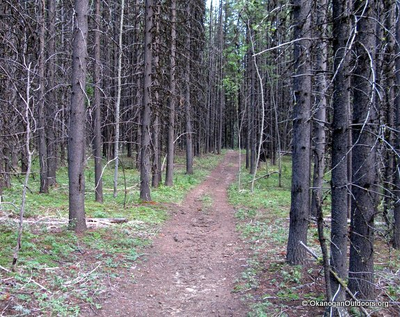
Photo: Orange diamonds mark most of the routes.
Land Managers. These trails are all in the Loomis NRCA, and are managed by the Washington Department of Natural Resources (DNR).
Fees/Permits. Discover Passes are required for parking at the different trailheads.
Camping and Permits. Cold Springs is free for camping if you have a Discover Pass. The campground has fire rings, a vault toilet, a few picnic tables, and access to spring water. We are not sure about the purity of the water and recommend bringing your own drinking/cooking water. The Disappointment Trailhead has a vault toilet and a variety of amenities to help horseback riders unload trailers. About 1.5 miles down the road from the Disappointment Trailhead the Forest Service maintains a primitive campground at the Fourteen Mile Creek Trailhead with vault toilets, amenities for unloading and corralling horses, and access to creek water (bring your own drinking/cooking water). A Northwest Forest Pass is required to use this campground.
Other Trips. For dozens of additional hikes or peaks in Okanogan County see our on-line hiking and our on-line mountaineering guidebooks.
Reporter (and date). First posted 8/31/2014 by Andy Dappen.
Leave It Better than You Found It. This should be every user’s goal. Do no damage and pick up trash left by others.
Disclaimer. Treat this information as recommendations, not gospel. Conditions change and those contributing these reports are volunteers–they may make mistakes or not know all the issues affecting a route. You are responsible for yourself, your actions, and your safety. If you won’t accept that responsibility, you are prohibited from using our information.


