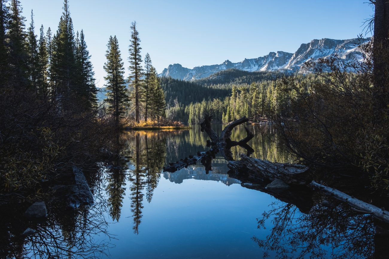
Tucked in a rocky hollow on Isabella Ridge is emerald-green Copper Glance Lake. What the tarn lacks in size it makes up for with impressive granite cliffs, lush meadows, plenty of hungry  cutthroat cruising the waters, and a tough buy-in to get there. The trail, an abandoned mining road, gains 2500 feet in just three miles, most of that all at once. The alpine scenery and a more-than-refreshing dip in the lake will more than compensate, however, making Copper Glance worth the trek. Don’t forget the fishing rod.
Maps. See our topo map. Note: Use ‘Print Preview’ to orient/scale the map before printing.
Activity: hiking.
Nearest Town: Winthrop.
Skill: 2 (intermediate).
Fitness: 2+ (advanced).
Distance: (round-trip) 6 miles.
Elevation Gain: 2600 feet.
Access. From Winthrop drive north on Okanogan County Road 1213 (West Chewuch Rd) to Eightmile Ranch. Take a left onto Forest Service Road 5130 (Eightmile Creek Road) and drive 13 miles to the signed trailhead.
Trip Instructions. Begin on the now-gated Copper Glance mining road. After negotiating a washed-out bridge, arrive at the Copper Glance gold mine. Not even a glance of copper, but abundant pyrite (fool’s gold) lines the entrance to the tunnel. Feel free to poke around, but venturing any length into the tunnel is not recommended. Continuing on, the road has now become a trail and travels through steep, lush meadows, skirting a shoulder of Big Craggy Peak. Just when you begin to think the grade may never relent, the trail plummets 300 feet to Copper Glance Lake’s talus-lined shores, a welcome destination on a hot day.
Allowed. Hikers, horses, and mountain bikes. With that said, the washed-out bridge and stream ford (about 1 mile in) may be extremely difficult for horses. Meanwhile, much of the way is too steep for sensible mountain bike travel.
Peak Bagging. A few easy 8,000-foot peaks along Isabella Ridge (the ridge confining the lake) can be easily scrambled up using the lake as a basecamp.
Fishing. Serious fishermen may not bother with the fishing here (the fish are small) but kids who suffered through the steep hike in will enjoy trying to hook some of the many trout that start jumping early and late in the day.
Fees/Permits. No permit is required for parking at the trailhead (as of August 2014).
Land Ownership: Okanogan National Forest.,
More Info. Hiking info from WTA.org
Leave It Better Than You Found It: This should be every outdoor user’s goal. Pick up trash left by others, pull some noxious weeds along your route, throw branches over unwanted spur trails, don’t ride or walk wet trails when you’re leaving ruts/footprints deeper than ¼ inch…
Disclaimer. Treat this information as recommendations, not gospel. Conditions change and those contributing these reports are volunteers–they may make mistakes or not know all the issues affecting a route. You are responsible for yourself, your actions, and your safety. If you won’t accept that responsibility, you are prohibited from using our information.
This post was originally published on 8/8/14.

