By Coron Polley
 As of late summer 2014, this loop was is in reasonable shape although washed out and rutted in a few places between Stormy Mountain and the top of the Pot Peak Trail. The trail has been rutted by motorbikes in places on steeper climbs and the trail is too narrow to turn your cranks in places climbing back up to the Pot Peak Trail. This is a tough ride and most people would probably enjoy it more as a shuttled ride from the Stormy Trailhead, but I wanted the challenge of doing it all by pedal power. A friend of mine who is in good shape did the ride with me and we spent a little over six hours on the loop — sometimes suffering, sometimes having an awfully good time.
The Devils Backbone route probably has more character and may be an overall better ride, but this route climbs higher and has better views. You still get the great descent on this ride of doing the Pot Peak Trail which is fun and fast. Also on this ride, it seems that you spend less time on road and more time on trail because the jeep road is as narrow as a trail most of the way. Stormy Mountain was, of course, stormy as we rode over it. That made the ride all that much better. A ride should live up to its name.
Fitness: 3 (advanced). Skill: 2+ (advanced intermediate).
Distance: 32 miles. Elevation gain: 7,200 feet.
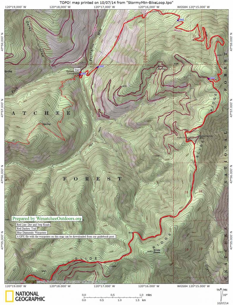
Access. Drive along the southern and western shores of Lake Chelan to Twenty-Five Mile State Park. About 0.4 miles up lake of the state park (milepost 10.3), turn left onto the Road 5900 signed for Snowberry, Shady Pass, Entiat Valley, and more. The first 2.5 miles of the road is paved. The roads beyond here may be rough passenger cars in a few places, but as of 2013 Subaru Outbacks, SUVs and pickup trucks had little trouble with road conditions. After 2.5 miles, turn left onto Road 8410 and follow this 0.5 miles to Ramona Park/Snowberry Bowl Campground (el: 1,900’). Park a vehicle here at the bottom of the Pot Peak Trail. No permit needed.
Topo Maps: Map 1 (start of route), Map 2 (continuation of route).
GPX File. This file contains the waypoints noted on our two topo maps.
Trip Instructions:
- Ride past Ramona Park/ Snowberry Campground toward Slide Ridge on Road 8410.
- In about 0.6 miles, rurn left on FS spur road 125
- Follow this spur for a little over 2 miles until it narrows to an overgrown jeep road
- Follow jeep trail (noted as spur road 233 on the map) for about 3.5 miles until it meets Road 8410 (the Slide Ridge Road) again.
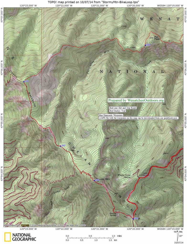
- Ride the road (pretty fast) for 9 miles to Trail 1448 leading up Stormy Mountain.
- Ride and push about 1.5 miles up to the top of Stormy (75% rideable).
- Descend about 1.4 miles from 7,200-foot summit of Stormy on Trail 1448 to a pass at 5800 feet.
- Ride/push the roller coaster ridgeline of Backbone Ridge for 1.9 miles to the top of the knoll (6,670 feet) where the Pot Peak Trail (Trail 1266) begins.
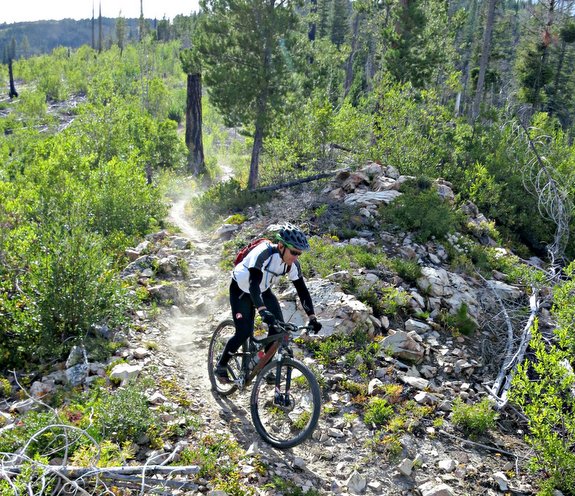
- Descend the Pot Peak Trail — a fun, speedy descent with almost no breaking and only a little pedaling – for ten miles back to the start.
Permits. None needed.
Leave It Better than You Found It. This should be every user’s goal. Do no damage and pick up trash left by others.
Disclaimer. Treat this information as recommendations, not gospel. Conditions change and those contributing these reports are volunteers–they may make mistakes or not know all the issues affecting a route. You are responsible for yourself, your actions, and your safety. If you won’t accept that responsibility, you are prohibited from using our information.
This post was originally published on 10/7/14.