
While we watched our daughter’s play soccer, John was grilling me about a mountain-biking circuit in the Devils Gulch environs. “I’ve heard it’s one of the best rides in the area, so why doesn’t the website have a guidebook entry for the Red-Hill-Devils-Gulch Loop?”
“Because I haven’t done it in several years and no one else has submitted the details for an accurate trip report,” I told him. “So why don’t you do the route, send me the details, and I’ll post a guidebook entry in your name?”
John bowed out with the all-too-frequent, ‘too-little-time’ excuse, but that didn’t keep him from putting the screws to me, “So do you think you’ll get that loop written up soon? You shouldn’t leave out some of our best rides.”
A few hours later after watching two Saturday soccer games, the family plans took a jog. My wife had gotten a better offer than the afternoon walk I was suggesting. She decided to attend a movie with several other soccer moms.
“What are you going to do?” she asked.
“Carpe diem” I told her.
She understood–I was wanting to pack a quick adventure into a small chunk of time. Quick access for quick fun was, after all, central to why we moved to Central Washington a decade ago. I headed home, assembled my riding kit, grabbed my headlamp, and then deadheaded for the Sand Creek Trailhead.
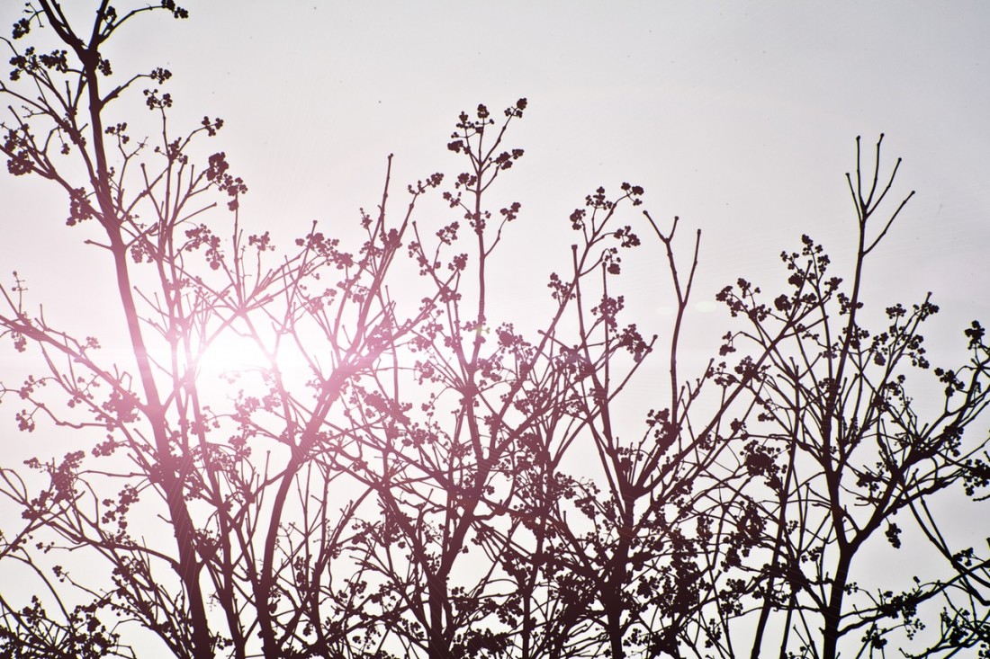
By 4:45 p.m. I was riding. I was also racing darkness. With a low-lying sun transforming the surrounding bunch grasses into glowing golden strands, I cranked up 2,000 vertical feet of nicely graded trails to ridge system studded with beautiful glades of ponderosa pines and steeped with expansive views over the Enchantments.
Then came a rapid plunge down the Red Hill Spur into Devils Gulch where, over the course of 15 minutes, I dropped from brilliant ridge-top sunlight into a shadowed valley. Darkness nipped at my heels by the time I intersected the five-mile-long Red-Devil Spur near the Lower Devils Gulch Trailhead. I pumped hard and managed to complete half the traverse and all of the 800-vertical feet of climbing before darkness swallowed me.
Out came the headlamp and during the last few miles as gravity sucked me back to the car I had to admit that John was right: This loop with its beautiful ponderosa forests, buffed-out trails, well-graded climbs, ridgeline vistas, and rapid descents deserved to be called one of the region’s best. Someone should have written it up sooner—the devil was simply in getting the details.
 Red Devil Loop – Details Details:
Attractions. Whether you’re a mountain biker or a trail runner, this loop spans nicely graded trails that are well maintained and quite buffed out. The trails dissect beautiful glades of ponderosa pines and pine grass, traverse ridges with views out to the Enchantments and Mission Ridge, and also cuts through cooler, darker stands of Douglas fir. This loop makes a superb ride or run but hikers might find that, for the distance travelled, not enough time is spent up high where the views are best.
Difficulty: For mountain bikers on cross-country bikes: Fitness level of 2+ (strong intermediate and better) and technical abilities of 2+ (strong intermediate or better). For trail runners: fitness level of 3 (advanced) recommended.
Distance: 12.75 miles
Elevation gain: 3,000 feet
Map: See our topo map (print it on 8.5” x 11” paper in portrait mode). This Forest Service schematic is also useful.
Recommended season: Summer and fall.
Access. From Pioneer Drive in Cashmere (across from Vale Elementary), turn south onto Mission Creek Rd, following signs for Devils Gulch. Go 0.45 mile to a T-intersection, turn right, cross the creek, and then turn left onto the continuation of Mission Creek Road. Go to pavement’s end (6.7 miles from where you turned off Pioneer Drive). At the end of pavement, enjoy the incredible junkyard flanking the road. It looks like you can’t continue and a pack of barking dogs is likely to greet you. Ignore all this—this is a county road. Cross a little bridge and, immediately afterwards, take the right fork in the road. In another 75 yard you’re out of this misplaced piece of Appalachia disrupting the space-time continuum. In another mile, the road ends at the Red Hill/Sand Creek trailhead. Facilities here include a pit toilet and primitive camping spots (bring your own water).
Trip Instructions.
- Start up the Red Hill Trail from the trailhead (el 1,580’) at the end of the parking lot near the toilet. Cross a stream immediately and in 50 yards go straight across a gravel road.
- Mile 0.15. At a trail junction take the right onto Red Hill Trail (No 1223). The other trail is the Red Devil Trail (No. 1221) and you’ll be returning on it.
- Mile 0.6. At another trail junction stay left on the Red Hill Trail. The trail climbs steadily uphill on a nicely graded path, making a number of switchbacks.
- Mile 2.25 (el 2,660’). Go straight across an old road and keep climbing.
- Mile 3.9 (el 3250 feet). Reach a T- intersection and turn left on the Red Hill Spur Trail (No 1223.1). The trail ahead will climb a little, follow a very scenic ridge for about a mile and then drop into Devils Gulch. Note: If you actually want to summit Red Hill (el 3,850’), do an out and back by going right at this intersection and climbing another 1.25 miles. Red Hill isn’t a very notable summit, but the trail to it is fun to ride.
- Mile 7.2. At an intersection with the Devils Gulch Trail #1220 (el. 1,860’) turn left and keep heading downhill.
- Mile 7.95 Mission Ridge Trail branches off to your right. Keep going straight.
- Mile 8.05 Intersection with the Red Devil Trail #1221 (el. 1670’), go left and start climbing again. Note: If you go straight, you’ll reach the Lower Devils Gulch Trailhead in about 150 yards—obviously you could do this route starting at this trailhead as well.
- Mile 9.6. After climbing steadily for about 1.5 miles, you’ll reach a shoulder at 2,460 feet. From here the trail will drop a little and climb a little for 1.5 miles and then drop steadily back down the car for another 1.7 miles.
- Mile 12.60. Return the trail junction you visited near the start of the trip. Go straight.
- Mile 12.75. End of trip.
 Permits: A Northwest Forest Pass is needed to park at the trailhead and day passes can be purchased at the trailhead. Note: There a number of pullouts on the side of the access road about ½ a mile from the trailhead that can be used free of charge.
Allowed: Hikers, runners, bikers, motorcycles, and horseback riders are all allowed to use these trails.
Trip Reporter: Andy Dappen, September 2008.
Don’t Ride Soft /Wet Trails. Please stay off trails and when they are wet/soft and you’re leaving wheel ruts that are deeper than 1/4 inch (these become grooves for water and greatly accelerate erosion). A rule of thumb to consider: Could 100 people ride the trails in this condition without messing up the surface? If the answer is ‘no’ please turn around.
Don’t Just Be a User. These trails need frequent maintenance and much of the work is done by volunteers. If you use this trail, help maintain it. To join trail maintenance parties, contact Das Rad Haus in Leavenworth (509-548-5615) or Central Washington Chapter of Evergreen.
Leave It Better Than You Found It: This should be every outdoor user’s goal. Pick up trash left by others, pull some noxious weeds along your route, throw branches over spur trails that are not part of the formalized trail system (make it harder to do the wrong thing than the right thing).
Important Disclaimer: Treat this information as recommendations, not gospel. Conditions change, and those contributing these reports are volunteers–they may make mistakes or may not know all the issues affecting a route.You are still are completely responsible for yourself, your decisions, and your actions. If you can’t live with that, you are prohibited from using our information.

