
Attractions:
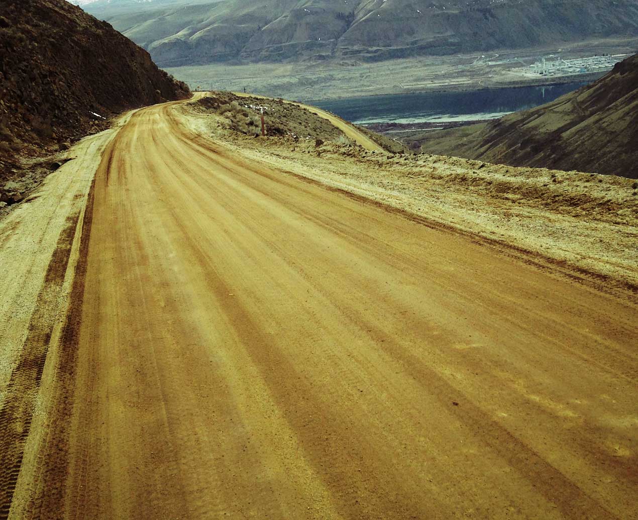
- This is a good out-and-back ride for training and a good one to sample some of the region’s extremes. The initial climb is steep and you’re looking over lava cliffs and sagebrush country before reaching the Waterville plateau with its cultivated fields. Starting near the Rock Island Dam, this ride also showcases our regional economy as you look down on the Columbia River at the Rock Island Dam (electricity) and the Alcoa aluminum plant (industry). When the ride reaches the plateau high above the river, you cut through big, sprawling wheat fields (agriculture). The views are equally varied as you look over rivers, sage brush, lava flows, tilled fields, and the high Cascades. What kind of place is this, you’ll ask yourself, that has Kansas, Lebanon, and the Alps all scrambled together?
- Done in its complete form, this is a hearty training ride with plenty of elevation gain. By tailoring your starting and ending points, however, virtually anyone, regardless of their ability or fitness level, can enjoy parts of the ride. If you want to make the ride easier, park at mile 2.2 or miles 3.3 as described below in the trip instructions.

Skill: 2 (intermediate)
Fitness: 2 (intermediate) more like a 2 plus because climbing is steep and sustained
Distance: 15.5 miles (roundtrip)
Elevation: 2,000-foot gain
Maps. See our map below for more information.
Access: From East Wenatchee, head east on Highway 28. At milepost 10.5 turn left (north) onto the Rock Island Grade and park after 75 to 100 yards in a pullout on the right side of the road. This is past the Shell station if coming from Wenatchee. There is a turn pocket you should get into, for your exit onto Rock Island Grade. There will be a building on your left once you turn onto Rock Island Grade with trees and across from this is where you park. This is not a formal parking lot but the wide-spot in the road can accommodate quite a few cars.

Trip Instructions:
- Mile 0. Pedal uphill from the parking area. After a quarter mile, the road turns to gravel. The road climbs steadily for the first 3.5 miles–get ready to grunt.
- Mile .45. You’ll see a PUD hopper and parking area on the right. Keep climbing.
- Mile 2.2. You’ll reach a big switchback in the road. If you want to eliminate a substantial amount of the climbing, park at a little pullout on the left just before the switchback.
- Mile 3.3. You’ll see a red gated road on your right. This is just before the road reaches the crest of the plateau and is a good place for families to start riding if they want to give their kids a scenic ride on a dirt/gravel road that has very little traffic.
- For the next few miles the road rolls up and over hills bordering the rim of Rock Island Creek, which is quite pretty– particularly with the slanted light or early morning or late afternoon.
- Mile 7.75. Several minutes after passing a gravel pit on your left you’ll reach a highpoint where the road ahead goes dead straight for about 4.5 miles. This is a good place to turn around and retrace the route. Riders wanting a longer ride, or families who started up high at the 3.3-mile, can push on along the road for as long as time and energy allows.
- Mile 15.5. Back at the car after retracing the route.
- Note: For a long loop ride starting and ending in East Wenatchee and climbing the Rock Island Grade but returning to East Wenatchee via the Badger Mountain Loop, see the Rock Island Loop entry in the mountain-biking guidebook.

Hazards: This is exposed country and can be hot and dry in summer (bring plenty of water) and cool and breezy in the shoulder season (bring wind protection).
Ownership: County roads.
Maps: USGS 7.5-minute Series: Rock Island Dam
Trip Reporter: Original report by Andy Dappen on 9/9/2007. Report and pictures updated on 2/26/2016 by Sarah Shaffer.
Leave It Better than You Found It. This should be every user’s goal. Pick up trash left by others, pull noxious weeds along your route, throw branches over unwanted spur trails, etc.
Disclaimer. Treat this information as recommendations, not gospel. Conditions change and those contributing these reports are volunteers–they may make mistakes or not know all the issues affecting a route. You are responsible for yourself, your actions, and your safety. If you won’t accept that responsibility, you are prohibited from using our information.

