ATTRACTIONS. An interesting and aesthetic tour following a fairly open ridge system that climbs steadily to Tronsen Ridge. A variety of slopes found along the route give skiers fun detours ranging from 600 to 1000 vertical feet in length. A very nice tour for telemark and alpine-touring (randonnee) skiers as well as for snowshoers.
Skill Level: 2 (intermediate). Fitness: 2 (intermediate).
DISTANCE. Roughly 4.5 miles of travel (one way) from Highway 97 to the unnamed peak at 5,910 — a nice endpoint with fabulous views.
ELEVATION: 3,775 (start) to 5,910 feet (end). Roughly 2,150.
ACCESS. From the Highway 2 / 97 junction (Y junction), drive Highway 97 south. About 1.2 miles from Blewett Pass, look for a small, unmarked pullout (large enough for a few cars) on the east side of Highway 97 (milepost 165.2). Note: Tronsen Road (Rd 7240) is 0.4 miles south (uphill) of this access point.
TRIP INSTRUCTIONS:
- Follow the road (Rd 7230) away from the parking area in a northerly direction.
- 0.3 miles from the car, the road makes a big switchback. Leave the road here and climb the lightly forested ridge before you (you’ll want climbing skins) along a bearing of 122 degrees true north.
- At 4,800 feet you’ll reach the jangling manmade structure we named this ridge for. We’re not telling what it is, but you’ll know it when you see it.
- From this structure follow the ridge along a true bearing of 133 degrees to point 5,345′, then a true bearing of 70 degrees to point 5,575′, and finally a true bearing of 145 degrees to a peaklet at an elevation of 5,910′.
- There are quite a few return trip possibilities. The easiest is to retrace the route, taking time to yoyo some of the good ski slopes you passed along the way. Note: Snow pack along the ridge is likely to be wind and snow affected and will be quite thin in places.
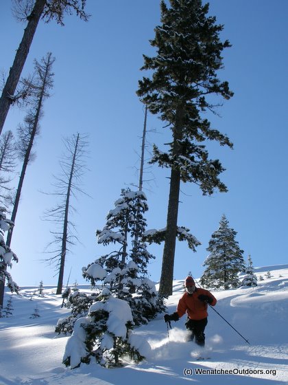
Photo: Skiing a side bowl accessed from Bojangle Ridge.
RECOMMENDED SEASON: Winter and spring.
USES ALLOWED: Cross-country skis, backcountry skis, and snowshoes are all allowed. The route is appropriate for backcountry skiers on light metal-edged skis, heavy telemark skis, and alpine-touring (randonnee) skis. It’s also a fine snowshoeing route.
USES NOT ALLOWED: Snowmobiles are not allowed at the beginning of this route but are allowed on parts of the route. You’re likely to intersect their tracks in places.
HAZARDS: Avalanches are a possible hazard along parts of this route. The ridge system followed as described above is quite safe in most snow conditions. Slopes you may be tempted to ski dropping off the ridge, are more prone to avalanches and require a higher level of expertise to evaluate.
LAND DESIGNATION: Forest Service.
MAPS. See our maps below for more information; (map 1) to identify this route. Also see our Blewett Pass Winter Map (map 2) for other nearby trips.
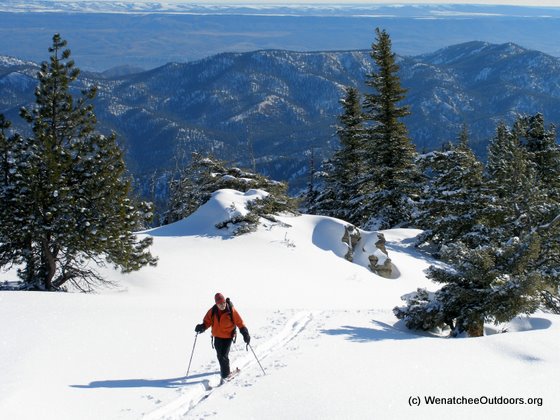
Photo: Touring along Tronsen Ridge after reaching the top of Bojangle Ridge.
PERMITS: None required.
TRIP REPORTER: Andy Dappen 3/19/06. Updated April 2011.
Leave It Better Than You found It. This should be every user’s goal. Pick up trash left by others, pull noxious weeds along your route, disperse old fire rings, throw branches over unwanted spur trails…
Disclaimer. Treat this information as recommendations, not gospel. Conditions change and those contributing these reports are volunteers–they may make mistakes or not know all the issues affecting a route. You are responsible for yourself, your actions, and your safety. If you won’t accept that responsibility, you are prohibited from using our information.