by Andy Dappen

 To celebrate the last day of the year, Tom Janisch and I opted to do a-something-old-and-something-new ski tour. Both of us had skied most of the peaks accessible from the Smithbrook Road, making this old terrain, but we wanted to put things together in a new way by circumnavigating Lichtenberg Mountain.
From the parking area a few miles east of Stevens Pass, we strode up the Smithbrook Road and then skied through north-slope forests up to Lichtenwasser Lake. The map makes this look like easy going, but steep rolls in the terrain make the slope problematic. Today was no exception and, with a few feet of new snow making our progress more difficult than usual, we floundered in places as we zig-zagged around phantom steepnesses hidden between the map’s contour lines.
From the lake, we headed up the northeast facing drainage to the col south of the summit of Lichtenberg. Here a strong, cold wind welcomed us to the last day of the year. So did beautiful views of Cascadian peaks — Stuart, Glacier, and Sloan– sticking up through a blanket of incoming clouds. We rushed to the summit sheltering our cheeks from the stinging wind.
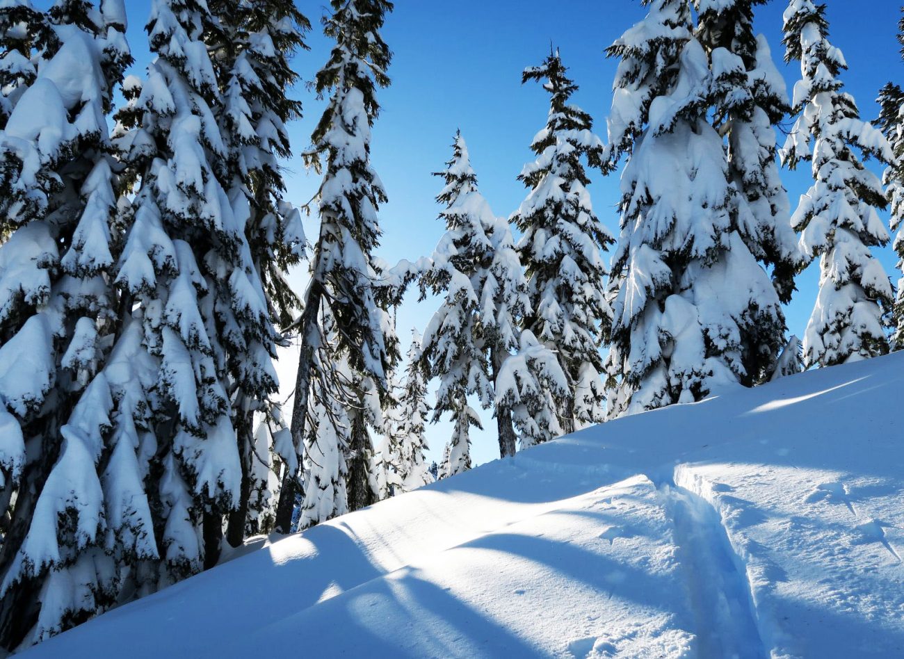
Now the new part of the tour awaited us. Rather than returning the way we had come, we dropped off the exposed and sometimes avalanche-prone southwest-facing slopes of Lichtenberg. The snow  started as a firm, wind-hammered surface but a few hundred feet off the summit became stiff powder. A few hundred feet lower still, the wind abated and we enjoyed soft turns downward into stately old-growth forests of hemlock.
 At the 4,400-foot level, we re-skinned the skis, and trudged through the deep snow to Lake Valhalla. The world was whited out now — the low blanket of clouds we had seen on the summit of Lichtenberg had risen to devour the blue sky we had enjoyed for most of the day. Onward we went as we climbed through a gap east of the lake. Thankfully we intersected other tracks here and we followed in the trough of someone else’s labor to the summit of Mount McCausland (Peak 5,747 on the topo map).
Light was draining from the day now and we quickly stripped the skins and made the mile-long traverse through old, well-spaced trees leading back to the the Smithbrook Road. By the time we had glided down the road and reached the car, darkness was minutes away.
“What have you got going tonight for New Years Eve?” Tom asked as we loaded skis into the car.
My legs were shot from a day of heavy trail breaking. “I think something old, like a soak in the hot tub, followed by something new for New Year’s Eve — like hitting the sack around 8:00.”

Details, Details:
Stats: Distance of this circuit: 13 miles.
Vertical Gain: 4,000 vertical feet
Map: The map attached above is a PDF map and, if download into the Avanza app, will be geo-referenced to work with a smartphone’s GPS capabilities.
Hazards: The route is exposed to avalanche hazard — know how to assess and avoid the hazard.
Permits: None needed.
Snow conditions: Use our ‘Skiing’ Condition Reports under “Weather” on our homepage to evaluate the snow and avalanche conditions before you head out. Also, check the Snow & Ski User Reports to see what others are reporting about the current backcountry conditions.
Directions:
North side route:
- Park at the bottom of the Smithbrook Road about 2 miles east of Stevens Pass (milepost 68.7). No permit is needed to park here. Note: Highway 2 is divided here and you must be in the west-bound lane. Park on the wide shoulder on the north side of this lane.
- Ski about 2.6 miles up Smithbrook Road. A few hundred yards before the road makes a big switchback (al an elevations of 3,970 feet) leave the road and follow a true bearing of 180 degrees up to Lichtenwasser Lake. This area can be deceptively tricky because small cliff bands that don’t show up on the map complicate traveling in a straight line.
- From the south end of the lake, follow a true bearing of 248 degrees up to a 5,640-foot saddle on the south side of the summit. Follow the southeast ridge to the summit 5,844-foot summit.
South Side Route:
- Park in the general Yodelin area about 1.3 miles east of Stevens Pass (milepost 66.25) or at Stevens Pass. If you park in the Yodelin area get permission from people at the lodge if you’re parking on the east side of Highway 2. Or get permission from a homeowner to use the private lot on the west side of the highway. Parking in these areas is usually not a problem on weekdays but you’re likely to be unwelcomed on weekends. On weekends you can always park at Stevens Pass and then ski under the powerlines on the west side of the highway to get back to the Yodelin area.
- From Yodelin Place Road (see map) , follow the snowed over road north and then west for 0.8 miles until it ends. Then head up Nason Creek on a true bearing of 298 degrees until you reach an elevation of 3,720 feet. Here, follow a true bearing of 2 degrees to a flatter shelf at the 4,800-foot level. Above here the ground steepens considerably. Zig-zag upward in a northeasterly direction following little ribs to reach a notch at 5,640 feet. Now follow the southeast ridge to the summit (5,844 feet).
Leave It Better than You Found It. This should be every user’s goal. Do no damage and pick up trash left by others.
Disclaimer. Treat this information as recommendations, not gospel. Conditions change and those contributing these reports are volunteers–they may make mistakes or not know all the issues affecting a route. You are responsible for yourself, your actions, and your safety. If you won’t accept that responsibility, you are prohibited from using our information.
