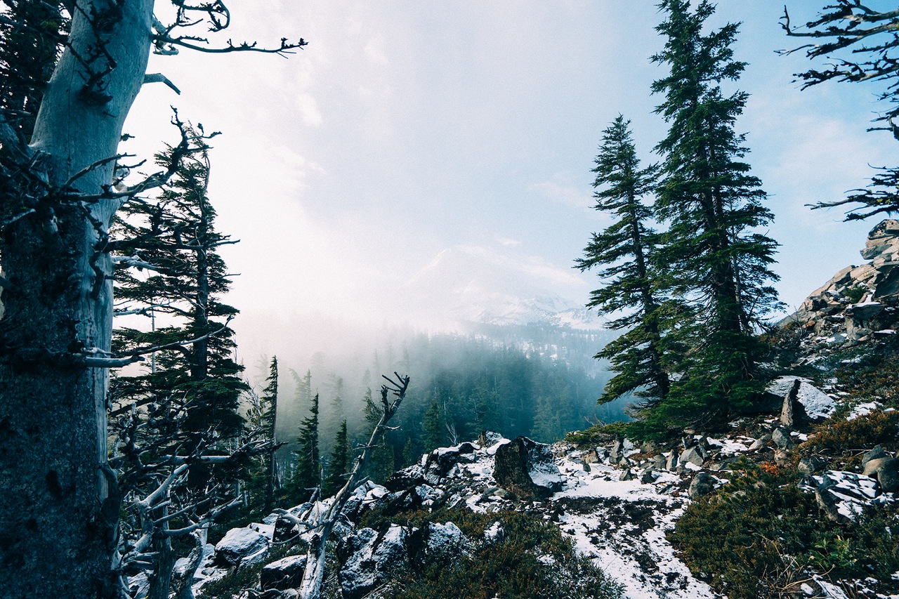

ATTRACTIONS. Interesting route finding, nice winter atmosphere, good escape from motorized vehicles, beautiful scenery. Good overnight trip or long day trip.
ACTIVITIES. Snowshoeing and backcountry skiing. This is best suited for lightweight backcountry skiing because the terrain undulates and is not particularly steep.
DISTANCE. 15 miles round trip to summit and back to Old Blewett Pass. Because of the distance and undulating terrain, this is a good route for lighter weight metal-edged Nordic skis and light leather boots. It’s more of a Nordic tour than a randonnee tour.
ELEVATION. 2,700-foot gain
Skill Level: 2 (intermediate).
Fitness: 2 to 3 (intermediate to advance).
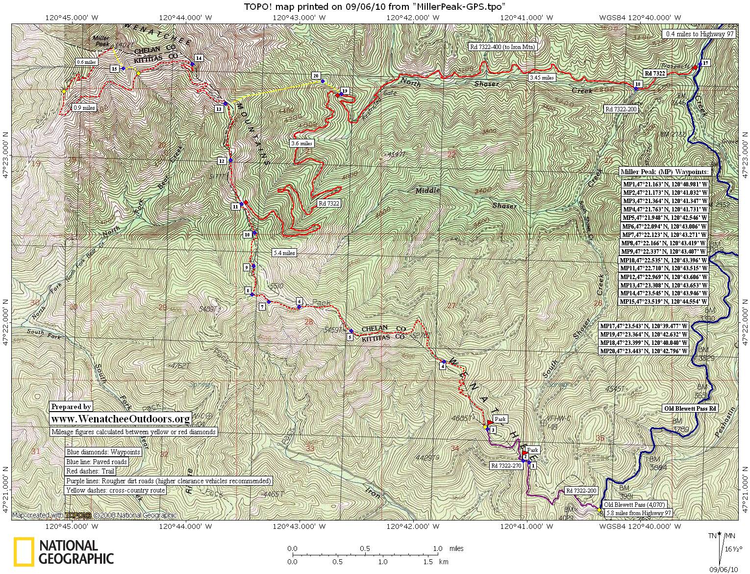
ACCESS. Start from Old Blewett Pass. From the Y Junction at Highway 2, drive south on Highway 97 toward Blewett Pass. At Milepost 172.5, turn right (west) on the Old Blewett Pass Road and follow this for about 6 miles to the pass. Park at the pass. (Elevation 4,061 feet).
MORE ABOUT ACCESS. The road to Old Blewett Pass is not plowed throughout the winter. You’ll want to try Miller Peak as a day trip only when there is adequate snow for skis up higher but not so much snow to keep you from driving to the pass. That means doing this in late fall, early winter (before snows pile up) or in late spring right after the road melts out but when there is still snow for skiing up high
TRIP INSTRUCTIONS:
-
Follow the smaller (dirt) road uphill on the west side of the pass. In about .25 miles, the road Ys, go left on Road 7322-200 (also marked Trail 1226–The County Line Trail). Use our map, follow signs on the logging roads, and take some small segments of trail for 1.75 miles until you reach the true trail portion of the route.
-
After 1.75 miles a trail branches left from a road that dead-ends in 30 yards. Take the trail (it is signed Trail 1226). This trail switchbacks through the woods, to reach a minor ridge, traverses through the woods some more, then climbs south on another minor ridge to gain peaklet 5,276.
-
Now for several miles you’ll parallel a ridge system that has you undulating between 5,500 feet and 5,000 feet. Note: While you’re paralleling this ridge system, you’re not always on the crest of the ridge.
-
Once over to the main bulk of Miller Peak and at an elevation of 5,700 feet, the actual trail makes a 1.3-mile-long westerly traverse under the south face of Miller Peak to reach the SW ridge. Upon reaching the SW ridge, the trail turns right and heads up to the summit (6,402 feet). This is an impractical route during the snowy months. It’s much faster and there is generally less avalanche hazard if you follow the county line along the East Ridge to the summit.
-
Return by retracing your route.
MAP. See our topo map below for more information.
Other Winter Routes: Later in winter when you can’t drive to Old Blewett Pass, access Miller Peak via North Shaser Creek.
Leave It Better Than You found It. This should be every user’s goal. Pick up trash left by others, pull noxious weeds along your route, disperse old fire rings, throw branches over unwanted spur trails…
Disclaimer. Treat this information as recommendations, not gospel. Conditions change and those contributing these reports are volunteers–they may make mistakes or not know all the issues affecting a route. You are responsible for yourself, your actions, and your safety. If you won’t accept that responsibility, you are prohibited from using our information.