![156424_10151101360176662_268163838_n[1]](http://37.60.255.97/~wenatche/wp-content/uploads/2016/05/156424_10151101360176662_268163838_n1.jpg)
Photo by Sarah Shaffer.
This scenic loop hike along the Icicle River offers beautiful views of the river, the surrounding cliffs, and of nearby peaks. The hike is a good one for children and for families with a wide age spread — the trail is relatively flat and the river, sometimes calm, sometimes boiling, offers lots of distractions. During the hot days of summer, the trail is well shaded and there is a great swimming hole at Rock Island Campground on the western end of the loop. Meanwhile in late fall, the trail often only has a dusting of snow and hikers will enjoy the interesting ice formations forming along the edge of the water as the Icicle River starts to ice over.
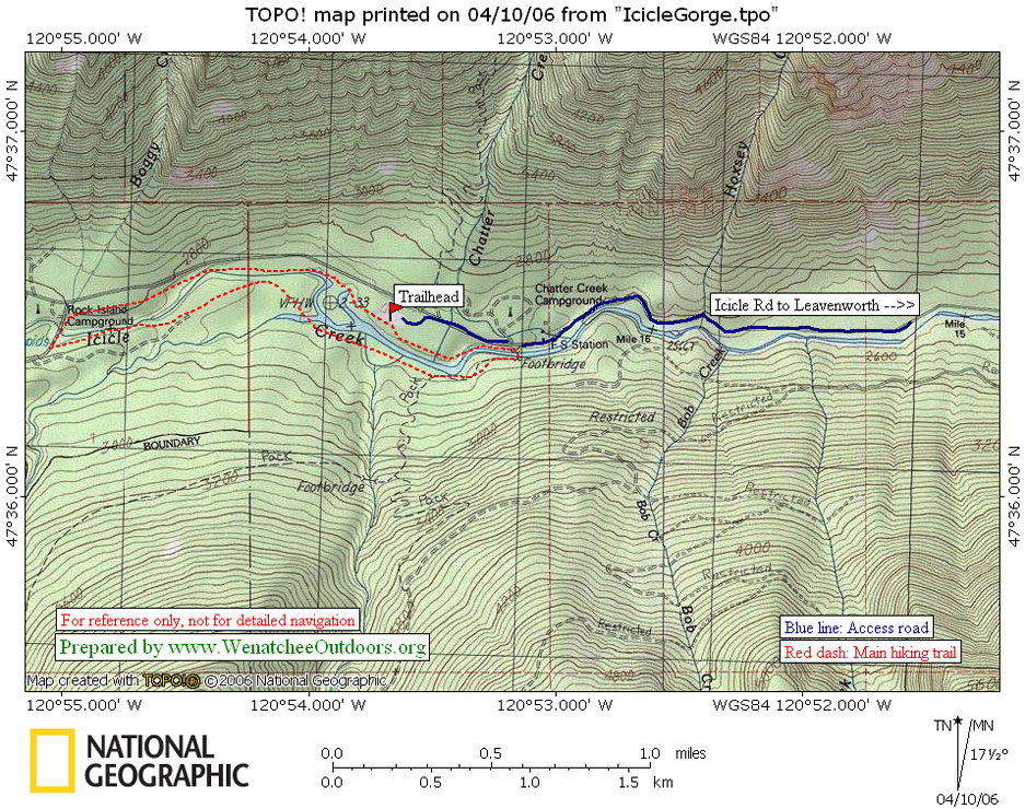
Maps: View our topo map below for more information.
Note: use ‘Print Preview’ before printing to properly scale this map to a full sheet of paper.
Activity: Hiking, Family Fun, Trail Running.
Not allowed. Mountain biking is not allowed; neither is any form of motorized travel.
Nearest Town: Leavenworth
Skill Level: 1
Fitness Level: 1
Distance: A 4-mile loop trail that is basically flat
Access: Follow US Highway 2 West through the town of Leavenworth and turn left at the west end of town on Icicle Road (there is a large gas station at the corner). If you are coming from the East on Highway 2 over Stevens Pass go right on Icicle Road when you first enter Leavenworth. Follow Icicle Road for about 16.5 miles to Chatter Creek Campground. About 0.75 miles past Chatter Creek Campground, turn left into the well-marked parking lot for this trail.
Trip Instructions: This loop traverses both banks of the Icicle River and you can follow the trail in either direction. One side of the river (south side) is dry and far more thinly vegetated, the other side is quite heavily forested. At the west end of the hike, the trail crosses the Icicle River at Rock Island Campground and there is a good swimming hole to enjoy here. Obviously, all the warnings about swimming at your own risk and using good judgement apply.
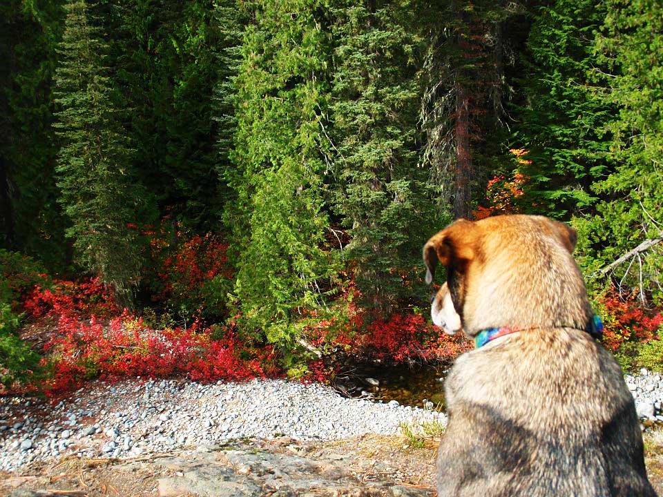
Photo by Sarah Shaffer.
![63122_10151101360506662_1282822201_n[1]](http://37.60.255.97/~wenatche/wp-content/uploads/2016/05/63122_10151101360506662_1282822201_n1.jpg)
Wildflowers. Throughout June this hike is usually a wildflower extravaganza that is thick with lupine, dogwoods, wild roses, stone crop, queen’s cup, huechera, tiger lily, columbine, goatsbeard, Oregon grape, spring beauties, false solomon’ seal, hawksbeard Indian paintbrush, yarrow, thimbleberry, and salmon berry.
Trail Runners: If you want a longer outing, run the trail clockwise and then run it again counterclockwise–the terrain will look completely different. Scenic and thick with wildflowers in spring and early summer, this trail is also well shaded for hot-weather running. If it’s a hot day, consider starting the loop another 1.5 miles up the road at the Rock Island Campground. There’s a nice swimming hole here for a cool-down after your run.
SPRING 2008 UPDATE: The Icicle River Road was washed out by a massive land/snow slide in mid May near Doctor Creek. Motorized access to the trail was not possible for several years.
SEPTEMBER 2011 UPDATE. Funding was eventually secured to redesign and rebuild the portion of the road that was destroyed by a landslide in 2008. The new segment of road has been completed during the summer and now you can drive to the trailhead of this hike once again.
Land Designation: Forest Service
Fees/Permits: NW Forest Pass is needed for this hike.
More Info/Links: Click here to see the report prepared by the Leavenworth Chamber of Commerce.
Leave It Better Than You Found It. This should be every outdoor user’s goal. Pick up trash left by others, pull some noxious weeds along your route, throw branches over unwanted spur trails, don’t ride or walk wet trails when you’re leaving ruts/footprints deeper than ¼ inch…
Disclaimer. Treat this information as recommendations, not gospel. Conditions change, and those contributing these reports are volunteers–they may make mistakes or may not know all the issues affecting a route. You are still completely responsible for your decisions, your actions, and your safety. If you can’t live with that, you are prohibited from using our information.