by Ray Birks
As tailwinds go, usually if you get a nice one you tend to pay for it later. Most often Karma seems to be in cahoots with Mother Nature, evening things out to keep you humble. But sometimes the  shifting pressures work in your favor or the cycling gods decide to smile upon you, or maybe you’re just lucky and the universe owes you a favor. In our case, I’ll avoid the latter, because that seems like a recipe for future disaster, and I’ll embrace the former. Tailwinds galore, could have been our rallying cry for this outing.
I’d ridden to Ellensburg a few times in the past, once with the venerable Andy Dappen in the Battle of the Bikes, a challenge that saw us competing against other cyclists, road and dirt, to see who could leave from Lincoln Park in Wenatchee and be the first to a bar in Ellensburg. Another time a riding buddy and I rode there just to put on some miles and visit my sister, who was living near CWU at the time. Both times were in the fall when there were more hunting trailers than actual animals being hunted, and I had to consciously dress brightly so as not to be a statistic in a hunting or mountain biking magazine.
I’d ridden back from Ellensburg too with my brother in law, from my sister’s house, but we’d cheated a bit and picked up a ride from town to the base of the hills to avoid the long slog on paved roads on knobby tires. In my mind it wasn’t as pure an adventure as it could have been, the type that nag at you in the future because you’re heroic mileage intentions seem muddied by support from a minivan with a coffee-starved chauffeur.
But this time was different. My intent was to ride door to door on as much dirt as possible, with as little support as possible. I had three routes in mind and had them mapped out. One involved riding up Number Two Canyon, down Peavine and then up Mission Creek road to Liberty/Beehive. This one afforded us the most dirt but but we would lose a substantial amount of elevation descending Peavine Canyon and then climbing back out.
Another option was to ride up Squilchuck road on the pavement to Liberty/Beehive road adding a bunch of paved miles but saving us from additional elevation.
A third option, that never gained much traction was to ride to Cashmere and then up Mission Creek road but that seemed too far out of the way just to save the legs from some climbing. In the end my partner’s schedule made the decision for us as he couldn’t make it to Wenatchee until noon. After a burrito lunch, sorting gear and packing bags we clipped in at 2:15pm. Although we had plenty of daylight to burn, in the end we didn’t want to add additional miles and elevation.
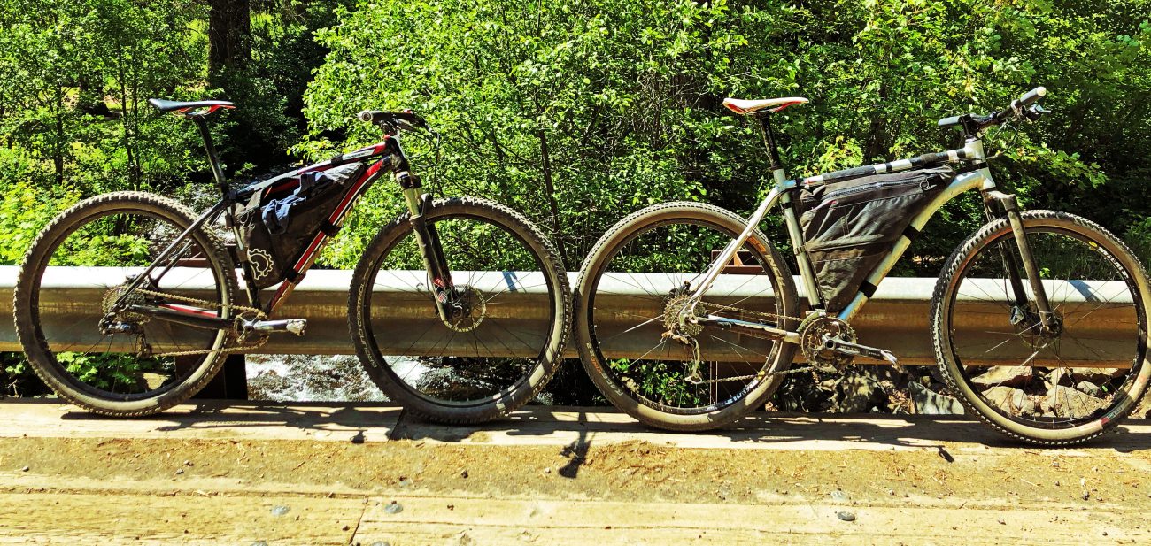
We set out from my house, stopping to adjust seatposts and sunglasses within the first hundred yards. Shoes were tightened. Jackets tucked away. The bulge from the frame bags was noticeable but not because weight, but of how it altered with the center of gravity of the bike itself. Since the weather was forecasted to be warm both days and we only had to carry the food we would need for the ride, our bags were somewhat light. We carried our tools, food, bike lights, “courtesy shorts”, flip-flops and assorted phone accessories for mapping and charging. I use MapMyRide to keep track of all my rides and one great feature is the ability to map out a route ahead of time and then load it onto my phone. Our settled upon route was up Squilchuck to Liberty/Beehive road, past Devil’s Gulch and Mission Ridge trailheads to a mystery turn that would send us down Naneum Creek and into Ellensburg. I admitted I had only ridden past Upper Mission Creek trailhead once in a trip up Mount Lillian onto Tronsen Ridge and down Red Hill. A certain uneasiness settled in my gut that often comes with the unknown trail, mysterious road or future turn that we would have to navigate so as not to add additional miles or send us home, tail between legs.
 Our bail out, if we got lost, was to either ride past Haney Meadows and left toward Lion Rock, which I knew was signed and would take us down FS Road 35 onto Reecer Road and into Ellensburg. Or all the way to Blewett Pass, call the wife and hope she wasn’t already pajama-ed and half asleep.
The winds pushed us away from the garage and I steered us onto the canal in my effort to avoid as many cars as possible on our way out of town. We wandered up Miller, down Circle street and onto Methow as the climbing started. I knew the stretch on Squilchuck would be an uphill grind with speeding cars but assured my buddy that traffic would die down after we passed Wenatchee Heights. At times the tailwind was noticeable, making the slog manageable. We joked how nice it would be to have a sail and sat up on our bikes to mimic the wind pushing us forward. Even the interminable stretch where the passing lane starts to Squilchuck State Park passed by with relative ease. The legs felt good.
We hit Liberty/Beehive Road under warm temps and partly cloudy skies, perfect for climbing. I had arm sleeves and a light jacket in my pack and I started to get the sense I’d be needing them before today was over. Liberty Beehive is a nice climb, at times bordering on steep but never overly obnoxious. Once we got past Beehive Reservoir the grade relaxes for a few miles until you get to Upper Devil’s Gulch trailhead where it ramps up for a few miles until the Upper Mission Ridge trailhead. The views opened up toward Twin Peaks, which would be our constant companion for most of the late afternoon. My buddy often commented on how green things looked as we gazed off toward Glacier Peak and Wenatchee Valley.
Beyond Upper Mission Ridge I knew we descended and climbed again and my mind continually nagged me about our upcoming turn. From all of the maps I stared at and Google searches, our left turn should be pretty obvious and hard to miss. But there’s always a tiny bit of doubt and fear of the unknown to make things interesting. Two memories came back during this stretch. I had skied this part of the road back when the Hog Loppet was still in full swing so I had a good sense of ups and downs ahead of us. My second, more vague memory, was an overheard conversation from a rider during the Battle of the Bikes back in the day as he described the route we were attempting. One thing was burned into my memory cells, his recollection that there was a lot more climbing after the turn when he thought he should be descending. That added to the anxiety.
Liberty Beehive Road is a beautiful route along the backside of Mission Peak with staggering views of the Wenatchee Valley. The road surface itself ranges from decent to spectacular, which played against us in the near future. There were two medium-sized washouts above Upper Mission Ridge trailhead, marked with a hand-written sign warning you that cars and trucks would not make it through. It will take quite a bit of effort to move the dirt necessary to fix the washouts but for bikes it was a few extra concentrated pedal strokes to make it out of the small ravines. There were quite a few cars down near Beehive Reservoir but we wouldn’t see another soul until we were well down Naneum Creek.
Our spectacular forest service road numbed our directional senses as we made good time on smooth dirt, took in the views and chatted about how lucky we were to be exactly where we were, on our bikes, in the sun, with amazing views and in good company. As the road started to descend I made a mental note to look for our left turn, as obvious as it should be I was confident we would soon be rocketing down into Kittitas County. We passed a few trails that were slightly overgrown but only gave us slight pause, enough to tap the brakes and give a quick shake of the head. After ten minutes of general descent we decided we really should check our map to see if we were in the ballpark. As we were descending we skirted a few valleys that seemed like they should contain obvious downhill escapes but nothing jumped out at us. Alas, the map showed we had missed our turn and would have to backtrack or continue on toward Haney Meadows. A quick hand check on the horizon told us we had about an hour left before the sun would set leaving us to the remains of the daylight and our bike lights after that. We decided that even though we didn’t know the exact route or where the turn was, our map would at least get us onto the road we needed and then we would be descending and making up the miles.
The air temperature had started to cool and we were still riding sleeveless but we both put on our “courtesy shorts” to add a little warmth for the expected downhill, wherever that was. I kept my phone out as we climbed back up toward the red line on the map and eventually we came to a slight hairpin turn where the dot signified us was right on top of the line that signaled our turn, but it was nowhere to be seen. When we had passed this area before we commented that it looked like there was a good view down toward Ellensburg but we didn’t investigate because we were looking for the road. A quick climb up a short hill showed us what we should’ve seen an hour ago, a road hidden on the backside of the corner trending downward through the trees. A slight sense of peace overcame us because we were back on route but that was quickly erased as our descent stopped and we stared at a nasty, rocky climb. Thoughts of my overheard conversation at that bar in Ellensburg roared back, “there was a lot more climbing after the turn than I had expected.”
There were about four sections of mostly hike-a-bike peppered with rocky, gravelly descents that threatened to let the air out of our metaphorical tubeless energy reserves but we were buoyed by the reminder that this was an adventure and adventures that play by the rules are not as memorable. At this point we also remembered we had someone waiting for us in Ellensburg, where we would be staying the night, who thought we were due sometime after dinner. In my mind “sometime after dinner” gave us quite a bit of latitude, but we switched my phone off Airplane Mode long enough to shoot out a text saying we were a bit behind schedule but doing fine. My interpretation of “latitude” sometimes gets me in trouble.
After one more sliding, sitting far back on your saddle, “why don’t I have a dropper post?” downhill we were onto a proper gravel road and into more unfamiliar territory. The views were less spacious but equally stunning. Green meadows and copious wildflowers kept us making the same exclamations about beauty, tranquility and gratefulness for someone’s foresight to put a road back there. We were now paralleling a wildly flowing creek bordered with sparse trees and a gentle downhill, lit by the last reaches of the sun as it dropped out of sight to our right. It was at that point the elk decided it was time to make an appearance. First one, then two, then dozens scurrying for higher ground, staring blankly and bounding effortlessly as we passed them and picked up speed on the increasingly wider and better road surface. Now was the time to make up some time, and that we did. We weren’t sprinting but with the quality and grade of the road and the incessant tailwind we were suddenly rocketing down toward pavement. This stretch of 12-15 miles of dirt was glorious, not just because it was fun but because we knew our destination was assured for the evening.
We stopped at a closed gate about two miles from asphalt to check our phones only to see a smattering of text messages from my wife, my sister and our host for the night, including a couple of missed calls and voicemails, all with a hint of worry in their tone. We were still on the cusp of cell range so a broken phone call to our friend in Ellensburg and a few texts that bounced around the satellites until they finally hit their mark assured everyone involved that we were still en route and not wandering aimlessly on Blewett Pass.
Pavement again as the dirt ended and we skirted under one more gate and took a quick break to stretch and get our bearings. From here we knew we had only a few more turns and about 10 miles to get near CWU where we would stay the night. The gentle descent continued and we rode in the warm dark past farmhouses, barking dogs and more hooved animals gazing our way, with the occasional “moo”; a proper Ellensburg greeting. Another magical stretch of biking with no cars, a tailwind and the last remnants of dusk fading quickly. I pulled out my light more to be seen than to see but we could’ve easily navigated by the moonlight and the fence lines. One turn south and our first small headwind of the day greeted us and lasted for the final four miles to town. We tucked into a paceline as the number of cars increased as did the speed limit they were travelling.
All of sudden we both remembered we were really hungry and once we started discussing food that seemed to consume our conversation for the last few miles. We wanted pizza but both of the decent pizza joints I knew would long be closed. Should we just go to Safeway or find another late night, college themed restaurant to take the edge off? As we hit campus it didn’t take long to find our late night food source, Dominos. A few pizzas and chicken wings later we had refueled and were only a few blocks from our destination. A quick shower and sugar plums were dancing in our heads before you could say, “Maybe I shouldn’t have had that Cherry Coke right before bedtime.”
The first task of the morning was finding a greasy spoon for eggs and potatoes, as well as a cup of coffee and some tomato juice; a breakfast to carry us back over the mountains. My mind was at ease because I knew the anxious route finding was over and we just had 10-12 miles of pavement and 5,000 feet of climbing and descending to land us back on the banks of the Columbia. Our route today included the aforementioned mileage on pavement to Coleman Creek road where we would start heading up toward Four Corners. From there Jumpoff Ridge would take us to Schaller Road and eventually Stemilt Loop and Stemilt Creek and back into town. A quick stop at Safeway for more calories to pack in our bags and a bottle of wine for our host. Through the farms and fields we pedaled enjoying the fact that we weren’t at work or trying to get kids to brush their teeth, just turning the cranks, discussing life and feeling great.
The climb up Coleman Creek is as beautiful and green as was our descent the day before and although we would put in some moderate elevation gain the road doesn’t get too steep or leave you stuck in the blazing sun for long stretches. More cows for companions and a raging creek with a spectacular waterfall. After a few hours of climbing and a right turn the grade slackens as we rode the last few miles toward Four Corners, a junction of roads from Mission Ridge, the Colockum, Ellensburg and the Stemilt Basin. The views expanded noticeably and included Quincy, Rock Island, the Waterville Plateau and long, uninterrupted shots of Wenatchee Heights and the valley below. This area is a bit of a moonscape with power lines, sparse trees and lots of rocks, mostly scattered on the dirt road. We descended a few miles and turned left on Schaller road which I knew from having climbed it twice was very rocky and not so much fun, especially when you’ve climbed a lot and feel like you’ve earned your turns for the way down.
We picked our way down the rocks rocks rocks. I was reminded of what a steep, dreadful climb this had been in the opposite direction on previous trips and promised myself that I wouldn’t do it again. But luckily this time gravity was our compadre and we just had to bend our elbows and knees and steer the front tire, stopping occasionally to shake out the hands and stretch the back. But the pain doesn’t last long and eventually we were back on pavement and the Stemilt Loop road. A left turn and a few miles on a road with painted lines brought us to our right turn down Stemilt Creek road, our last taste of gravel and then a wide-open four mile run down more pavement to the Malaga Highway. Remember when I talked about Karma rearing its ugly head? Not today. Dead calm and a wide shoulder carried us to the outskirts of town where hunger started to creep back in. A celebratory microwave burrito and ice cream at Squilchuck Market. We ate in satisfied silence only a few miles from home.
Up Crawford then back on the canal and as we crossed Miller I noted that we had come full circle. Now the few remaining miles would already have seen our tires a short 24 hours ago. Riding down the street to my house I had a smile of satisfaction knowing that our adventure was complete. Total wind-aided mileage was about 106. Mileage with a headwind, 4. Total elevation was nearing 12,000 feet. I was happy to have a riding companion who shared a quest for adventure, wrapped in a bit of wander, coated with a sense of accomplishment.
Trip Details:
Elevation Gain: 12,000 feet
Mileage: 106 miles
To Follow This Trip: Start Off on Squilchuck Road and climb 8 miles to Beehive Road. Follow Beehive Road for 9.75 miles where the road takes a hairpin to the right. This route turns left/south here at the top of the hairpin. Follow the double track as it heads steeply up and down over a series of hills, eventually dropping down to border Naneum Creek. From the aforementioned hairpin until pavement is approximately 16.6 miles, following the road as it continues to improve all the way to Naneum Rd. If you’re riding into Ellensburg, follow Naneum Rd. for 8.95 miles until you hit East Vantage Highway. Turn right and you’ve only got a few miles left to campus and downtown. If you’re not riding into Ellensburg and are heading back over the hills, ride 6.4 miles on Naneum Rd. and turn left on Brick Mill Rd. Follow Brick Mill Rd. 4 miles to Cooke Canyon Rd. and take another left. 2.5 miles later turn left onto Coleman Creek Rd. where the gravel begins. After another 2.5 miles on gravel, stay right at the ‘Y’. Climb another 2.6 miles and stay left at the next junction. In 2.7 miles is yet another left turn. In 2.3 miles Dawson Canyon Rd. enters from the left but you’ll stay right continuing on Coleman Creek Rd. Climb the final 1.8 miles and turn right at the next junction. This last stretch is a mostly flat 2.7 miles to the junction with Naneum Ridge Rd. Stay right and in 0.8 miles you’ll arrive at Four Corners and the left turn which starts the descent on Jumpoff Ridge Rd. Descend for 2.5 miles until the left turn onto Schaller Rd. Follow Schaller for 3.1 miles to a junction with Rock Ridge Rd. Stay left here and you’re now on Upper Basin Loop Rd. In 1.15 miles stay right. After another 1.6 miles is a left turn to Clear Lake but continue right for another 0.9 miles to Stemilt Loop Rd. where you’ll hit pavement. Turn left here and ride another 0.75 miles to Stemilt Creek Rd. Turn right and descent on nice gravel 1.2 miles until you reach more pavement. Continue heading down 5.1 miles all the way to the Columbia River and Malaga Highway. Turn left here and ride the last 2.75 back to South Wenatchee.
This post was originally published on 7/16/2018.
