Wenatchee to Sweden
by Mark Shaffer
I have always had an affection for mnemonics. When I need to memorize facts or lists, I will spend great lengths of time arranging the data in such a way so that they form a random but memorable acronym. My daughter is currently taking her first piano class.  As she learns to read sheet music, I still remember that when I was her age, I learned that Elephants Got Big Dirty Feet. While in the military, I full heartedly embraced the culture of assigning an acronym to everything. So, when it occurred to me that I would be able to string together a combination of local canyons to form the acronym Sweden (SWakane, Eagle, DErby, Nahahum), I knew that I had my next bike ride planned.
Early morning starts have always been painful for me, but since I wanted to be able to spend at least half of the day with my family I knew that I had no choice but to have wheels on the road by 5:30 am. What I lack in speed as a biker, I try to make up for with pragmatism.
As the few cars pass by me along Highway 97, I can’t help but hope that their drivers are more awake at this hour than I feel. Turning up Swakane, the sounds of the highway quickly become distant and undetectable; replaced by the songs of the canyon’s feathered inhabitants. The ride up Swakane is marked by a steady progression from sage brush to lush wetlands. As the miles roll by, the birds and balsamroot become increasingly common.

From the top of Swakane, it is a short and scenic ridge ride to Eagle Creek Road. This is the only part of the ride that will require riding more than once, but with snow capped peaks on either side and innumerable wildflowers to saturate the foreground, I certainly don’t mind coming back this way a couple of hours later.
The ride down Eagle Creek is fast and smooth; a welcomed break from the climb up Swakane. From Eagle Creek, it is a short ride on back roads to the head of Derby Canyon. As I start up the gravel road, I pass a few mountain bikers on their way to ride Xanadu. Everyone is respectful of the recommended social distancing, and we are all similarly stoked to be out riding on such a beautiful morning.
Once at the top of Derby Canyon, I backtrack along the ridgeline to the head of Nahahum Canyon. I do a quick inventory of my remaining water, snacks and phone battery. I have only ¾ of a cliff bar, 1 bottle of water and 15% battery left. I don’t mind being a little bit hungry or thirsty, but if my 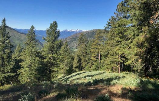 phone dies and I can’t text my wife to let her know that I am about 1 and 1/2 hours behind schedule, it will be a stressful ride back from Cashmere. I decide to switch to low power and airplane mode and hope that I have just enough juice to last until I am back in cell phone reception.
The ride down Nahahum Canyon is beautiful and open. The green hillsides are dotted with the familiar purples, reds and yellows that are characteristic of our Wenatchee Valley in the spring. Once I roll to a stop just outside of Cashmere, I pull out my phone and am relieved to discover that I have just enough battery to send a status text to my wife. Relieved that I am not the cause of unnecessary concern, I then swig the last of my water and trace along the familiar backroads from Cashmere to Wenatchee.
Although my list of international experience is extremely short (do a few days in Canada count?), I can now say that I have officially biked through Sweden. . . and it was every bit as beautiful as I thought it would be.
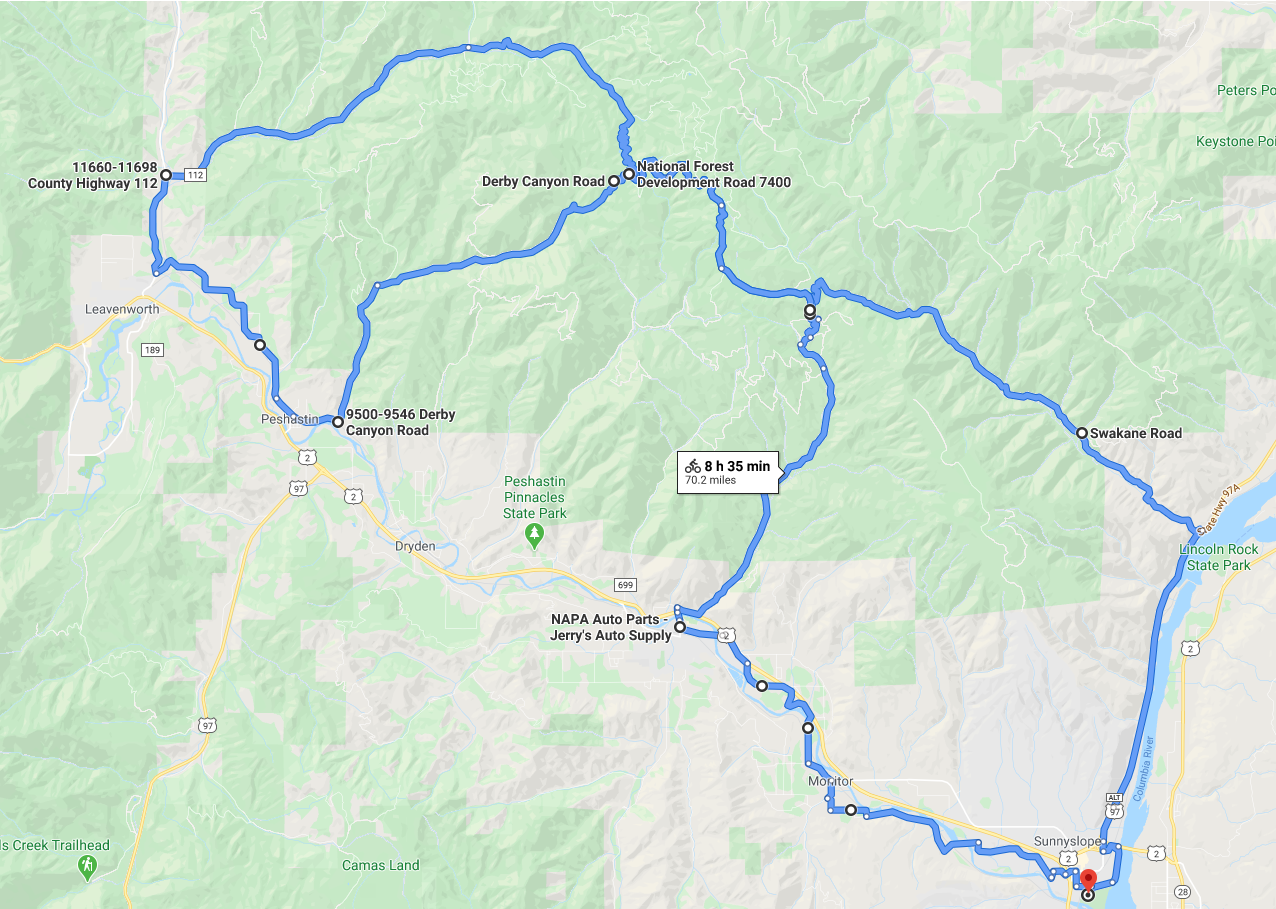
Trip Stats: Starting from Confluence Park in Wenatchee = 70.2 miles, 7,018 feet elevation gain.
Editor’s Note: This trip is mainly a gravel ride, so a gravel bike would work best. Although a mountain bike would work as well along with a road bike if you are feeling adventurous.
Leave It Better Than You found It. This should be every outdoor user’s goal. Pick up trash left by others, pull noxious weeds along your route, disperse old fire rings (they encourage more fires), throw branches over spur trails and spurs between switchbacks (make it harder to do the wrong thing than the right thing).
Disclaimer. Treat this information as recommendations, not gospel. Things change, conditions change, and those contributing these reports are volunteers–they may make mistakes, fail to give complete information, or may not know all the issues affecting a route. You are completely responsible for yourself, your actions, and your safety. If you won’t accept that responsibility, you are prohibited from using our information.