
Steamboat Rock: It’s Not A Rock
by Andy Dappen
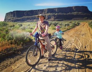
We had been wandering around the perimeter of Steamboat ‘Rock’ for over an hour when my wife commented, “You know, this is not a rock. Rocks have little summits. This is huge up here. This  should be called Steamboat Butte.”
I looked at the GPS unit to see how much distance we had already covered wandering around the perimeter of Steamboat ‘Rock’s’ summit plateau: 2 miles. Likely, we still had another 2 miles to go before we had made the complete circuit. “Might this even be Steamboat Mesa?” I asked. “At what scale does a butte become a mesa?”
“I don’t know. But I do know this is no ‘Rock.’”
Back home I did some research. Most definitions were hopelessly subjective, calling a butte a small flat-topped mountain, mesa a medium-sized flat-topped mountain, and a plateau large elevated area. The National Geographic website, thankfully, got specific, “The only difference between a mesa and a butte is its size. Most geographers say a butte is taller than it is wide, while a mesa is a much larger, slightly less elevated feature.”
The summit of Steamboat ‘Rock’ is about 800 feet above the Columbia River but the summit plateau is about 4,000 feet wide at its widest point, so a mesa Steamboat must be.
Regardless of what it’s called, the hike to the top and all the way around this geographic feature sculpted by the Ice Age Floods, is a beauty. As you wander the perimeter of this mesa, just about every step comes with a view over Banks Lake and the surrounding coulee country. And those views – characterized by the juxtaposition between the smooth blue waters of Banks Lake and the brown cliffs and pock-marked topography of the surrounding desert – are unusually photogenic.
Details, Details: Steamboat Rock State Park Outings
Activities. Hiking, trail running, paddling, fishing, swimming.
Seasons. The best seasons for hiking are spring and autumn. Summers are hot and afternoons are frequently breezy so paddlers should get out on the water early.
Access. From Grand Coulee, drive Highway 155 south about 10 miles. Or from Coulee City, drive Highway 2 and then High 155 north for about 17 miles. At milepost 15.6, turn west off Highway 155 into the park. Drive 2 miles to the entrance booth into the park and then another 1 mile to the day-use area with the boat launch. The trail starts on your left just before turning into the day-use area (2.9 miles from Highway 155). A Discover Pass is required for parking at the day-use area.
Maps. View our hiking topo map and our paddling map of the area.
Note: This PDF map, if downloaded into an app like Avenza PDF Map, is geo-referenced to work with the GPS functions of a smartphone.
–State Parks schematic map
Hiking
The hike to the summit of Steamboat Rock is 2.5 miles round trip if you just walk to the top and back, and 5.75 miles round trip if you also walk around the perimeter of the summit plateau. The  route gains 800 vertical feet to reach the top and then delivers many other short ups and downs as you walk around the perimeter, making the total gain about 1,200 vertical feet. We rate the difficulty of the hike as being a 2 (intermediate) for fitness and 3 (advanced) for skill (there is some scrambling and quite a lot of walking on rocky, uneven terrain. If you walk around the perimeter, you are often just feet way from cliffs with a few hundred foot drop, so we recommend against bringing young children and pets on the hike. Hiking Instruction:
Start across the road from the day-use parking area at Waypoint aa and follow the sandy trail uphill in a westerly direction toward Waypoint b.
At Waypoint b, the trail starts climbing steeply up the gully between the two prominent halves of the formation. Head up to Waypoint c (a little scrambling with hands and feet in may be necessary).
From Waypoint c take a right and follow the trail heading east up to the summit plateau at Waypoint d. Next follow the perimeter north to the highest point at Waypoint dd (elevation 2,312 feet). Total distance to here is 1.25 miles.
For a shorter walk, retrace your steps back down.
For a longer walk, keep going around the complete perimeter of the top by heading north to Waypoint e and then southwest to Waypoint F and then southeast to Waypoint g, located in the saddle between the two halves of the summit.
From Waypoint g, climb south to views at Waypoint h and then follow the perimeter of the cliffs to Waypoint j. Now walk to Waypoint k and lose a little elevation to reach a faint trail on the bench leading back to Waypoint g.
From Waypoint g it’s all downhill through Waypoints c, b, and aa to get back to the start.
Paddling
Kayakers and canoeists alike will find Steamboat Rock State Park an excellent flatwater paddling destination. There are easy places to launch boats from pullouts along Highway 155. There are also formal boat launching facilities for motor boats that paddlers can use at Steamboat Rock State Park and at Northrup Point on the opposite side of Highway 155 from Northrup Canyon at Milepost 18.9. This map shows some paddling possibilities, one using blue dashes, the other using purple dashes. Strong winds can be an unpredictable variable on Banks Lake and paddlers will generally do better if they paddle early in the day. In windy conditions, stay close to the shoreline so you can beach quickly if necessary.
Fishing
Banks Lake is a 27-mile long reservoir stretching between Coulee City down south and Electric City up north. Two popular boat launches for accessing the lake are at Steamboat Rock State Park and at Northrup Point a few miles farther north at Milepost 18.9. The reservoir is most popular for fishing smallmouth bass and walleye, but fishermen also come to catch lake whitefish, black  crappies, bluegills, perch, rainbow trout, Kokanees, and catfish. Lake whitefish are best caught in December, January, February and early March; smallmouth bass and Walleye are best fished from April through October; and trout fishing is best in April, May June, September, and October. During many winters, Banks Lake freezes over and becomes a popular ice fishery. In recent years a net pen rearing project between WDFW and the local communities has released several hundred thousand rainbow trout into the lake and this has significantly improved the trout fishing. For regulations, fishing season information, and information about licenses, visit the Washington Department of Fish and Wildlife website.
This post from Lip Rippers Fishing Adventures has useful written information about fishing various species on the lake. And this video has useful information for catching walleye on the lake.
Hours. The park is open year-round for day from 6:30 a.m. to dusk.
Camping
The park is also open year-round for camping, but in winter sections of the campground are closed. The park is a popular tent camping, boat camping, car camping, and RV destination in summer. Individual campsites can be reserved from May 15 to September 15. Campsites are available on a first-come first-served basis from September 16 to May 14. Utility sites have full hookups. Tents must be pitched within the designated tent pad. Two vehicles are allowed per campsite but campsites fees only cover one vehicle. Extra vehicle fees are due upon arrival. Reservations can be made online or by calling 888-CAMPOUT (888-226-7688). For fee information, check this camping rates page.
Geology
The visible geology seen on this hike makes it an interesting hike. First is all the granite seen down near the water level at Banks Lake when you look northeast from the summit toward the stone islands around Eagle Rock. The granites are from a magma batholith that cooled slowly inside the earth’s crust about 100 million years ago (late Mesozoic). Eventually this batholith was brought to surface through some combination of uplifting and erosion. Many layers of rock on top of these granites were eroded away. About 16 million years ago ( Cenozoic Era) great fissures spewed basalt over much of Central and Eastern Washington. The basalt seen around Steamboat Rock and the rock composing Steamboat Rock itself were the byproducts of these basalt flows. All the basalt that makes up Steamboat Rock probably erupted from these fissures in less than a million years.
 What happened between the Mesozoic granite and Cenozoic basalts — there are many millions of years of rock that are unaccounted for? Different forms of erosion (ice, water, wind) carried away this material to form the noncomformity in the time line between the much older granite and much newer basalt.
The next part of the story is very recent in respect to geologic time. During the Ice Age of the Pleistocene (two million years ago) a great ice sheet (The Cordilleran Ice Sheet) covered most of British Columbia and the ice advanced and retreated over northern Washington many times. About 15,000 years ago one lobe of this ice sheet (the Okanogan Lobe) reached down into Washington State and plugged the Columbia River just north of the present day town of Grand Coulee at a point where the Columbia happens to run north south. The ice dam backed up the Columbia River and created a huge lake that extended east in a somewhat similar fashion to Lake Roosevelt, the present-day lake backed up behind the Grand Coulee Dam.
With time, the water level rose enough that it spilled into a minor drainage that would be carved into the Grand Coulee. The Columbia River itself helped with this carving, but the catastrophic floods that spilled over parts of Washington State some 40 to 100 times between 15,300 and 12,700 years ago did most of the carving. During these catastrophic floods, Lake Missoula, a Great-Lake-sized body of water stored behind ice dams in Western Montana would inundate the Columbia River when the ice dam containing the lake would fail. Then, water flowing at a rate of 9.4 cubic miles of water per hour and at speeds of 50 to 60 miles per hour would ravage downstream landscapes as all that water rushed toward the Pacific Ocean. The Grand Coulee and Dry Falls farther downstream were both sculpted in fast motion as water, hundreds of feet deep flowing with terrifying speed and carrying car-sized boulders as sand paper, tore into the landscape and scoured it. Steamboat Rock was an island in the middle of this torrent, and the more erodible basalts around it were pressure washed away, leaving this more resistant plug facing into the flood waters like the prow of a ship.
Eventually the ice dam re-routing the Columbia River also failed and the Columbia was restored to its original course. This left the Grand Coulee, which was now a great canyon, high and dry. Today there is only water in much of the Grand Coulee because dams built at both ends of Banks Lake contain water pumped uphill from the Columbia River by electricity generated at the Grand Coulee Dam. Water from Banks Lake then feeds downstream lakes and reservoirs (e.g., Billy Clapp Lake and Potholes Reservoirs) and irrigation canals that distribute water to ranches and farms that are part of the Columbia Basin Irrigation Project.
Miscellaneous Info. Mosquitos can be a problem in summer. Grant County operates a mosquito-control program in the park.
Date: First posted 10/20/2015. Updated 10/25/2017
Leave It Better than You Found It. This should be every user’s goal. Do no damage and pick up trash left by others.
Disclaimer. Treat this information as recommendations, not gospel. Conditions change and those contributing these reports are volunteers–they may make mistakes or not know all the issues affecting a route. You are responsible for yourself, your actions, and your safety. If you won’t accept that responsibility, you are prohibited from using our information.
