by Andy Dappen
Article in partnership with The Wenatchee World. Forty for Forty: Recognizing the 40th Anniversary of the Chelan-Douglas Land Trust with 40 stories about lands the Land Trust has protected and kept open for public access.
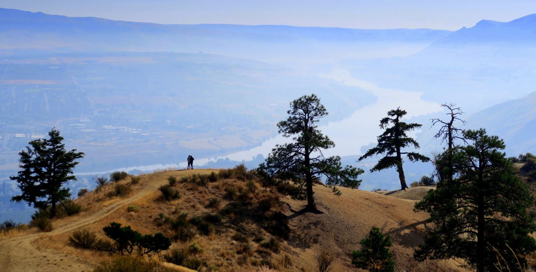
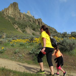
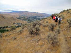
Most hikers and runners living near Wenatchee have visited the Saddle Rock area… a lot. Maybe enough to have grown a bit ho-hum about the prominent rhyolite towers overlooking the city. If you are among this crowd, here’s a suggestion to spice-up a future Saddle Rock exploration: Rather than the typical trip yo-yoing up and down, take a clock walk around the rock. How? Treat the Saddle Rock towers as the center of a watch and the lands north of this center as the 12 o’clock position. Next use the following route to explore the perimeter of these natural lands. If you find this notion something of a silly contrivance, consider that a measure of stupidity is often the best kind of fun. In this case “clocking around the rock” will expose you to new views, new places, and a new appreciation of an old haunt.
One O’clock, Two O’clock, Three O’clock Rock. Starting from the 12 o’clock position at the Jacobson Preserve Trailhead (off Skyline Drive), follow trails upward about a mile to Old Butte (1 o’clock). A quarter mile beyond Old Butte, take trails leading downhill for a half mile to connect with the Saddle Rock East Trail. Over the next third of a mile, the Saddle Rock East Trail traverses under the impressive east-facing walls of the rock massif (2 o’clock) and climbs gently upward to a low saddle (3 o’clock).
Four O’clock, Five O’clock, Six O’clock Rock. From the low saddle, turn left and follow the trail about a third of a mile over a small rise and along a descent (initially under power lines) to an intersection with the Saddle Rock Main Trail (4 o’clock). Turn right and follow the Main Trail (an old Jeep road) a quarter mile on flattish terrain (5 o’clock) until the trail makes a sharp switchback (6 o’clock) and begins climbing steeply uphill.
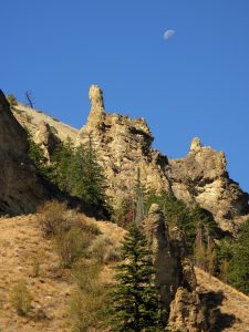
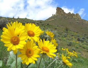
Seven O’clock, Eight O’clock, Nine O’clock Rock. A half mile past the sharp switchback (at an elevation of 1760 feet), a small trail branches off to the Main Trail. Turn left onto this smaller trail (7 o’clock) and contour for a third of a mile along a relatively flat path, cutting through gullies with rock formations locals call ‘Little Utah’ (a huge exaggeration). After one of these gullies, the contouring stops (8 o’clock) and the trail climbs consistently and quite steeply for the next half mile to a saddle on a broad ridge (9 o’clock).
Ten O’clock, Eleven O’clock, Twelve O’clock Rock. Turn right at the trail intersection atop this broad saddle and walk 200 yards looking for a cairn marking a trail branching off on the left. Turn left on this spur and follow it for a half mile until it reaches the main Saddle Rock Traverse Trail (11 o’clock). Turn left and follow the large Traverse Trail a mile down to the trailhead where you started (12 o’clock).
Details: Clocking Around the Rock
Access. Drive Skyline Drive to the Wenatchee Racquet and Athletic Club (WRAC). Park in designated slots along the NE boundary of the paved parking lot servicing the club’s main building. Note: Because this is a circular route, you can also intersect the described route walking in from South Hills Drive or the end of Circle Street.
Trip Instructions. The instructions, as described in the body of the story, start at the Jacobson Preserve Trailhead and use a combination of ‘authorized’ trails that are maintained and in good shape, as well as ‘social trails’ that are user-created, unmaintained, unsigned, and quite rough in places. The Chelan-Douglas Land Trust has developed a long-range Trails Plan for the area that, eventually, will incorporate the social trails used in this route description. At that time these particular trails will be built to a higher standard, maintained, and incorporated into the Trails Plan as authorized trails. Note: Because many social trails dissect the Saddle Rock Natural Area, you may wonder at times whether you’re on-route. Don’t get too hung-up about this – just keep using well-trodden trails headed in the right direction and know that you can’t get too lost when the city is almost always visible. DO get hung-up about staying on well-trodden trails and DON’T travel cross-country to course correct. Also, stay off newer paths that have trampled vegetation – there are already too many social trails fragmenting the area’s natural habitat. Think about leaving the area better than you found it, not worse.
Roundtrip Distance: 5.5 miles. Elevation Gain: 2,000 vertical feet.
Map. Signage and on-location maps in the Saddle Rock Natural Area are minimal so carry a copy of our map showing the route. You can also view the Saddle Rock Natural Area in CalTopo on your smartphone while walking the route.
Allowed. Hiking, trail running, dogs on leash (scoop their poop). Mountain bikes are allowed, but the steepness of many trails along this particular route does not facilitate good riding.
Not Allowed. No motorized use, camping, campfires, hunting, shooting, plant removal, off-trail travel, or littering.
Land Ownership. The Jacobson Preserve is owned and managed by the Chelan-Douglas Land Trust (CDLT). The City of Wenatchee owns the Saddle Rock Natural Area adjacent to the Jacobson Preserve, but the Land Trust raised much of the funding for this purchase and continues to help with stewardship of the area. Parking for hikers entering the area through the Jacobson Preserve is generously provided by the Wenatchee Racquet and Athletic Club.
