

On this ride, you’ll see topography shaped by ice that was once thousands of feet deep. You’ll see the many miniature depressions and basins (kettles) scoured into the softer ground of the highlands. You’ll also see places where the glaciers formed rounded hills because the hard bedrock close to the surface resisted the ice bulldozers.
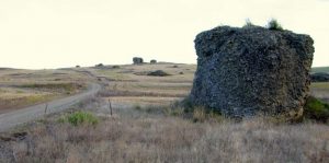
After the heyday of glaciation and periods of warming had the ice in retreat, massive amounts of glacial till (dust, sand, gravel, rocks, and boulders) transported by the glaciers were deposited in new areas. You’ll see huge boulders (erratics) that look out of place because… they are out of place! When all the ice melted, the boulders picked up in one place were strewn randomly and abundantly around new places.
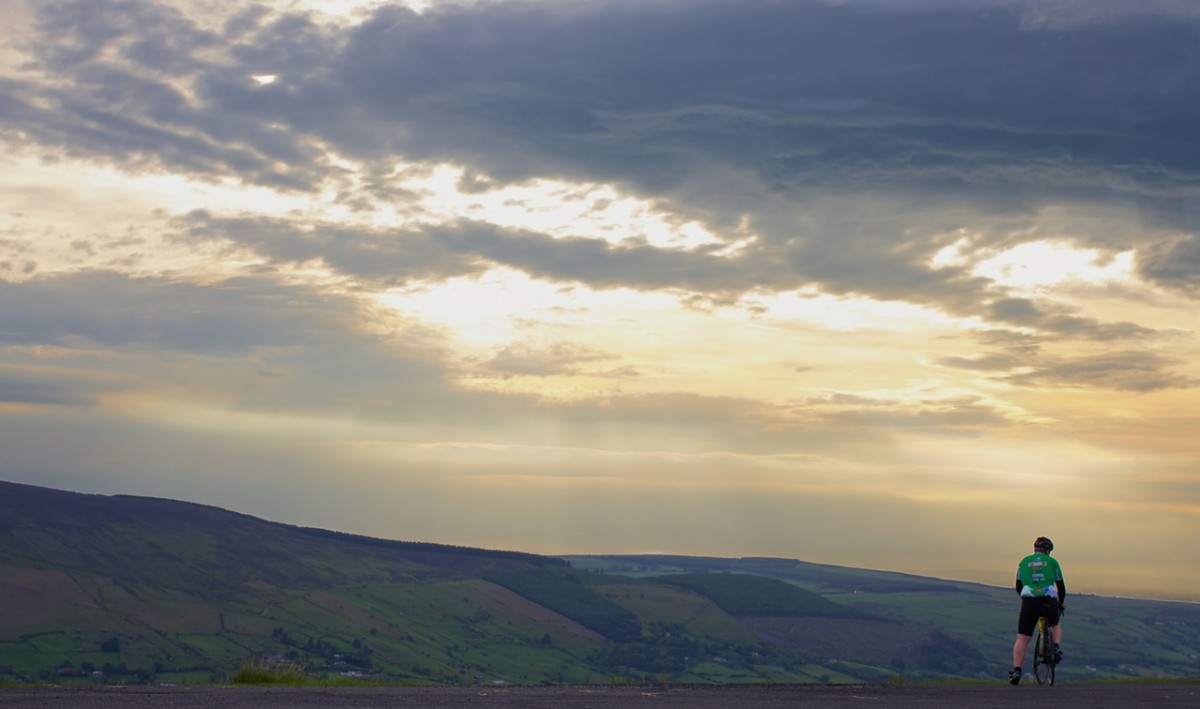
 This ride is also well-endowed with scenery. You’ll enjoy views over the Okanogan and Columbia river valleys at the start; Montana-like, Big-Sky Country in the middle; and the uniquely basaltic canyon country of the Pacific Northwest at the end of the ride.
Even though the technical nature of this route is not taxing, this is a ride worth taking.
Details, Details: Cameron–Delfeld Glaciation Loop
Activity: Mountain bike or cyclo-cross ride.
Note: The dirt roads traveled for this ride are wide and easy to ride, but in total there are several miles of roads with loose sand or thick gravel where cyclo-cross bikes will struggle. However, depending on the variations of the ride chosen, you may also have up to about 14 miles of pavement where mountain bikes will lag. Regardless of the bike chosen, you’ll wish for a different bike at times. Our recommendation is to err toward safety and use mountain bikes – better to take your lumps by going slower than by flying over the handle bars when thin tires burrow into soft sand.
Skill: 1+ (advanced beginner)
Fitness: 2+ (strong intermediate)
Distance: 24.5 miles.
Elevation gain: 2,250 vertical feet.
Access. From milepost 265.1 along Highway 97 (4.7 miles northeast of Brewster or 2.5 miles south of Monse), turn onto Highway 17 and follow this a half mile east to the Snyder Flats Cutoff Road. Park either at the bottom or the top of the Snyder Flats Cutoff. No permits needed.
Note: If you have weaker bikers along, park at the top of the road. When your group reaches the bottom of cutoff road, the stronger riders can climb back to the top of the cutoff road, retrieve the car, and return for the weaker riders.
Map. See our topo map of the route.
Trip Instructions (starting from the top of the Snyder Flats Cutoff Road).
- Ride the Cameron Lakes Road east (uphill) for 4 miles. The road is initially paved but quickly turns to gravel. There are beautiful long views along this leg. The wildflowers are also beautiful in spring
- Turn right onto Delfeld Road and head south. Enjoy the fantastical shapes of all the erratics and the Big-Sky country of this leg. Sections of this road have some frustrating miles of loose surface conditions. Sections of the road take some sharp turns and have some intersections that may have you scratching your head as to which fork you should follow… pay attention to the map.
- After about 5.4 rolling miles on the table top of the Okanogan Highlands, Delfeld Road starts dropping fast toward the Columbia River. Hang onto your brakes and enjoy the ride for 2.3 miles.
- At the intersection with Jack Wells Road (paved) turn right and keep heading downhill. In 1.8 miles you’ll see La Grange Road taking off on your right. A shorter (but hillier) route is to follow La Grange Road (a good gravel road) to where it intersects the Snyder Flats Cutoff Road and then return to the car at either the top or the bottom of this road. The La Grange Road will have almost no traffic.
- The slightly easier ride (because it’s paved) is to follow Jack Wells Road a total of 4.1 miles to Highway 17, turn right onto Highway 17 and follow this 6.75 miles back to the Snyder Cutoff Road. Highway 17 will expose you to some high-speed traffic, but this is not a terribly busy highway and it does have a good shoulder.
Road and Land Ownership. The route follows county roads and a state highway. The lands bordering this ride are part of the Colville Reservation.

 More Geology:
Various periods of glaciation occurred during the Pleistocene Epoch and the Cordilleran Ice Sheet covering most of British Columbia and Western Alaska at these times was thought to be 4,000 feet deep. Different lobes of ice extended south into Washington State and the Okanogan Lobe smothered much of Okanogan County east of the Cascade Mountains and west of the Kettle River in this portion of the Colville Reservation called the Okanogan Highlands.
Once the ice retreated, colossal amounts of sand, gravel, and rock bulldozed by the glacier were deposited by the melting ice. Some of this deposition formed big mounds of rubble (kames). Older drainages in the landscape before this period of glaciation were often plugged and filled with all this glacial debris while haystack-like boulders from afar (erratics) were scattered over the surface in unlikely places. Ice and meltwater were also left in the many depressions carved in the earth by the glaciers and this provided water for the hundreds of little lakes (kettle lakes) found in these highlands.
Most of these of these lakes are between 5 and 20 acres in size, and few have outlets. Consequently the salts and minerals washing into these lakes never leaves and the water becomes saltier with time. Most of the lakes have also receded over the past century so the exposed rocks rimming the shorelines are coated with a white crust composed of sodium carbonate, sodium bicarbonate, and sodium sulfate.
Reporter: Andy Dappen, September 2014
Leave It Better than You Found It. This should be every user’s goal. Do no damage and pick up trash left by others.
Disclaimer. Treat this information as recommendations, not gospel. Conditions change and those contributing these reports are volunteers–they may make mistakes or not know all the. If you won’t accept that responsibility, you are prohibited from using our information.
This guidebook post is sponsored by Andy Dappen, one of the founders of the WenatcheeOutdoors.org and OkanoganOutdoors.org websites. “It’s an easy ride but fascinating to think of this area being completely covered by a massive ice sheet long ago. Once that ice melted, the glacial erratics that now litter the landscape were left behind.”

