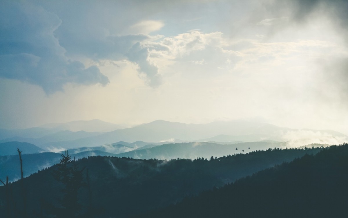

Scenic, beautiful vistas. Beautiful variety of landscapes–forests, mountains, sage hills, orchards.
Because of private property issues, this trip must be done as an out-and-back on Butler Ridge, so make sure to save energy for the return trip to Twin Peaks. Although riding it means crossing the same territory twice, the legal portion on Butler Ridge is beautiful, and is well worth the long views of the Enchantments on the trip out. On the return, your ridgeline vantage will finally allow you to satisfy your long-standing need to count the precise number of orchards in Monitor.
Maps: See maps below for more information. Map 1) TwinPeaks- South Map 2) Twin Peaks- North.
Note: use ‘Print Preview’ before printing to properly scale this map to a full sheet of paper.
Activity: Mountain Biking
Nearest Town: Wenatchee
Skill Level: 2
Fitness Level: 2. (To make this an advanced fitness ride, ride up Number 2 Canyon.)
Distance: 11 miles from the Twin Peaks parking lot to the Butler Ridge/Yaksum Canyon turnaround point.
Elevation Gain: Starting elevation 2,940 feet. High point 4,300. Gain about 1400 vertical.
Recommended Season: Spring, early summer, and fall.
Access:
Drive up Number 2 Canyon in Wenatchee. About .7 miles after the end of pavement, park at the gate blocking the road going straight ahead (FS Road 7101 hooks sharply left here). You’ll be going up past the gated road.
Trip Instructions:
- Zero out the odometer. Walk around the gate and ride up the road, staying on the larger, better-better traveled road whenever you encounter a spur.
- 2.85 miles (el: 4,280′) you’ll reach a Y in the road immediately beyond a shoulder with an expansive view over the surroundings. (The right fork reaches the top of the east peak of Twin Peaks after another .6 miles but that’s another ride.) Take the left fork and head west. The road climbs slightly, contours, and then drops steadily.
- 4 miles (el: 3,900′). Reach a saddle with an intersection. (Road 7107-350 deadends after .3 miles and road 7107-335 deadends after .5 miles.) Turn right and coast along a descending contour. A few spurs branch off this road but stay on the main road as it trends east and northeast. The road occasionally climbs a bit.
- 6.75 miles. A spur road/trail comes in on the right (el: 3620′) at a steep angle. This is where the more difficult descent off Twin Peaks merges with this easier route.
Note: Distances from this point on are not as exact due to flaws in the trip reporter’s character. The distances from this point on are approximated from map measurements. Each instruction below also gives the approximate distance traveled since the last instruction.
- From the point where the routes merge, follow the main road for about 1 mile to an intersection (el: 2,880′). A spur road or two will be passed. Stay on the main road as it drops and completes a few large switchbacks.
- At the intersection mentioned above, cut back hard to the left. This spur sometimes seems less traveled and less obvious but logging is taking place up in the area and changing the traffic on different roads yearly. Contour along this flat road for about .75 mile looking for a small road branching off to the right and dropping straight down onto the very prominent ridge known as Butler Ridge.
- Ride the scenic ridge and enjoy its views of the Cascades and the Wenatchee River Valley for about 1.5 miles to a saddle at 2,450 feet. The left trail was long used by the Wenatchee School District for its 8th grade Wenatchee-to-Cashmere Hike. It descends into Yaksum Canyon and reaches pavement after 2.75 miles. Most of this trail is on private property and is not to be riden without advance permission from Walter Hills (425-888-0412). However, with Walter’s permission you can take this trail to Yaksum Canyon Road, which will descend into Cashmere. From Cashmere you can either hop a bus to Wenatchee or ride home via orchard roads.
- If you do not have permission to ride to Yaksum Canyon Road, this saddle is a good spot to turn around. The saddle is on private property, but the owners have graciously agreed to allow respectful recreationalists to pass through. After the saddle, Butler Ridge is publicly accessible for another 2.7 miles, but you will have to turn around after the last parcel of DNR land. This ride can no longer be done as a full traverse of the ridge, as the north end of Butler Ridge has no legal public outlet. The ridge ends on private property, and is gated from the entrance via Butler Road. Due to recent issues with motor bikes damaging the road and with visitors dumping trash, the land owners at the end of the ridge respectfully request that recreationalists no longer access or exit the ridge through their property.
Misc/Other Issues:
-Stay on established trails and do not ride tracks that are obviously damaging to the terrain. Loose trails that skid straight down the fall line of steep slopes are fun to ride, but the ruts formed by such riding become channels for rainwater and quickly erode into unsightly scars. This kind of damage angers land owners / managers and creates a PR problem for the mountain-biking community.
-Riding up Number 2 Canyon to the starting point described above adds about 5 miles of riding and 2000 feet of elevation gain.
-After the out-and-back on Butler Ridge this ride can be connected to several other Twin Peaks routes, and may be linked to the Sage Hills trails.
Uses Allowed: Mountain biking, hiking, trail running.
Uses Not Allowed: Motorized vehicles are not allowed on the roads on the south side of Twin Peaks, but are allowed on the north-side roads and trails.
Land Ownership: Mixture of county and Forest Service roads, with a patchwork of BLM, DNR, and USFS, and private land.
Fees/Permits Needed: None.
Other Maps: USGS 7.5 Minute Quad: Monitor. Our map link shows the North side roads. For the South Side roads that are part of the start of this trip, see the Twin Peaks-Main Road route description.
Trip reporter: Andy Dappen. Original report filed 6/2005. Updated 7/2007 and 4/2013.
Leave It Better Than You Found It: This should be every outdoor user’s goal. Pick up trash left by others, pull noxious weeds along your route, disperse old fire rings (they encourage more fires), throw branches over spur trails and spurs between switchbacks (make it harder to do the wrong thing than the right thing).
Important Disclaimer: Treat this information as recommendations, not gospel. Things change, conditions change, and those contributing these reports are volunteers–they may make mistakes, fail to give complete information, or may not know all the issues affecting a route. So forget about finger pointing: If things go wrong, you are completely responsible for yourself and your actions. If you can’t live with that, you are prohibited from using our information.