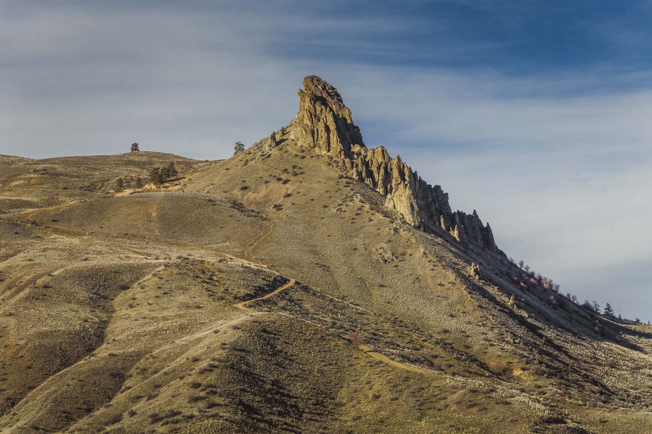

A Wenatchee landmark, Saddle Rock with its weathered rock towers and surrounding wild lands is both wonderfully scenic and ridiculously close to town. A high percentage of Wenatchee residents can easily walk or ride a bike to the trail heads.
Maps: View our topo map. Note: use ‘Print Preview’ before printing to properly scale this map to a full sheet of paper.
Activity: Hiking, Family Fun, Mtn Biking, Wildflowers, Trail Running. Look for native plants along the foothills.
Nearest Town: Wenatchee
Skill Level: 2
Fitness Level: HIKING: 2; TRAIL RUNNING: 2; MTN BIKING: 3
 Difficulty:
The trails and old jeep roads here all climb steadily (sometimes steeply). They gain about 1,000 vertical feel reaching the ridgeline and are not well suited for people who are in poor shape or unsteady on their feet.
Access:
- Southern access. Drive south on Miller Street. At its end, hook sharply to the right onto Circle Street. Drive about 0.3 miles and park at the large paved trailhead at the very end of Circle Street. This trailhead is maintained by the City of Wenatchee and has vault toilets.
- Northern access. Park in the Wenatchee Racquet and Athletic Club’s (WRAC) main parking lot off Skyline Drive. Park in the northernmost stalls (those farthest from the doors to the building) – the WRAC has signed those stalls that may be used for trail users. Please do not ask to use the WRAC’s indoor facilities unless you are a member. Find the trail by walking back to Skyline Drive and looking for the trail signage for Jacobson Preserve and kiosk on your right.
- Regardless of the access you use, bring all of the water you need and carry out any trash/waste your party generates (empty water bottles, tissue paper, food packaging, dog poop).
Trip Instructions:
- From the south. As of 2015, this trails have no signage. Go through the gate on the right side of parking area and follow the dirt jeep road upward. Stay on the main road/track, passing a number of smaller trails and roads. Use our map to get a general feel for the road’s route. When in doubt about which track/road to take, take the largest option. After about 1.5 miles, you’ll find yourself at the saddle on top which has a tremendous view of Wenatchee, the Columbia River, and the surrounding hills. This trip is especially enjoyable in spring when the flowers of the shrub-steppe are in bloom and in autumn when fall colors yellow the shrubbery. In summer, it’s best to avoid the scorching heat by visiting in early morning or after dinner.
- From the north. Walk through the parking area back toward Skyline Drive. The trail starts at the Jacobson Preserve (owned by the Chelan-Douglas Land Trust) where Skyline Drive makes a big bend and starts heading uphill. Take the trail signed for hiking. Part way up, the trail merges with an old jeep road. Keep following the road as it switchbacks upward — there is no more signage. When in doubt, stay on the road showing the most evidence of travel.
- The Ridgeline Trail adds considerable distance and elevation gain to any hike/ride at Saddle Rock. When you reach the saddle between the northern and southern trailheads, head west along the ridge, follow the single-track trail. Follow the trail for 1.5 miles until it intersects a cattle fence. Turn around and retrace your route.
NOTE FOR MOUNTAIN BIKERS: The trails and old jeep roads here all climb steadily (sometimes steeply). They gain about 1,000 vertical feel reaching the ridgeline and are not well suited for riders who can’t sustain a steady, steep climb.
Issues/Rules:
1) Saddle Rock is a mixture of public and private land. Wandering off the main routes marked on the map antagonizes private landowners and endangers everyone’s access to the area.
2) County regulations require that dogs be leashed.
3) This is a trail system with limited bathroom options, no water, and limited trash cans. The southern access (Circle Street) now has vault toilets but all other access points don’t. We recommend that you take care of your bathroom needs before arriving. Also bring whatever water you need and carry out any trash that you generate.
4) The Chelan Douglas Land Trust (CDLT) has been critical in maintaining public access to Saddle Rock and other trails in the foothills. If you use the Saddle Rock trails or trails around Castle Rock, the Sage Hills, or the Horselake Preserve), join the CDLT. The $25 yearly membership fee is a cheap way to protect your interests in keeping all of these areas open for public use. In 2012, the CDLT transferred 325 acres it had acquired around Saddle Rock as part of its Foothills Campaign (2011) to the City of Wenatchee. The City now maintains the trailhead and vault toilets that are part of the southern access.
Don’t Use Soft /Wet Trails. Please stay off trails when they are soft or wet enough that you’re leaving foot prints or wheel ruts deeper than 1/4 inch (or horse prints deeper than ½ inch). All of these prints hold and funnel water, and greatly accelerate erosion. When the trails are soft, ask whether a 100 people could use the trails in the same way you’re using them without messing up the surface? If the answer is ‘no’ please turn around. Be aware that not all use is equal–horses need the driest, firmest trails, then bikes, then walkers.
Trip Reporter. Andy Dappen 6/2007. Updates to this post were added 6/2012 and 9/2020.
Be More Than a User. These trails need frequent maintenance and most of the work is done by volunteers. If you use this trail, help maintain it. To join trail-maintenance parties, contact the Chelan-Douglas Land Trust (509-667-9708).
Leave It Better Than You Found It: This should be every outdoor user’s goal. Do not use small, user-made trails that are obviously not part of the large trails and dirt roads that are the official trails the land managers want used. Take out all of your own trash AND pick-up trash left by others. Pull some noxious weeds along your route (knapweed, white top, salsify). Throw branches and stones over spur trails that are not part of the formalized trail system (make it harder to do the wrong thing than the right thing).
Disclaimer: Treat this information as recommendations, not gospel. Conditions change, and those contributing these reports are volunteers–they may make mistakes or may not know all the issues affecting a route. You are still completely responsible for your decisions, your actions, and your safety. If you can’t live with that, you are prohibited from using our information.

