
Ruby Creek Outings – Playing the Bench
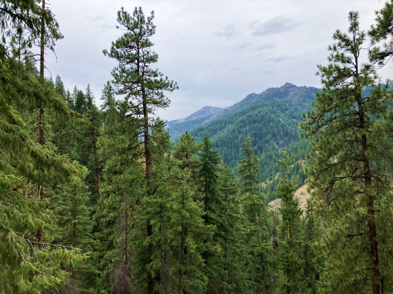
Look at the Forest Service maps of the Ruby Creek watershed, a watershed capped by Tronsen Ridge and draining into Peshastin Creek along the Highway 97 corridor, and you’ll wonder if you’re looking at a county road map. So many old logging roads contour and zigzag up the hillsides that the place might have been platted as a suburb of Leavenworth.
Most of those roads are now closed and are home to various thickets of second-growth forests. Some of the road, however, provide second-string outings for our local outdoor enthusiasts.
We say second string because these options wouldn’t be on anyone’s list of top hikes or top mountain bike rides in Central Washington. For those of us living here, however, the loop ride (or run) we mention uses a combination of well-maintained dirt roads and older roads that now feel like single-track trails to provide an entertaining outing not many people know about.
Meanwhile the trek up Windmill Point follows an old steep road that is now closed to all motorized use. The road bed is wide, mainly grassy and takes you through beautiful stands of stately ponderosa pines and delivers you to a peaklet with an impressive view of the surrounding hills..
While these may be second-string options, if you’re looking for something new to explore give the bench a little play time.
Details, Details: Ruby Creek Outings.JPG)
Access. From Big-Y Junction, drive Highway 97 south (toward Blewett Pass) and turn left (east) off the highway at milepost 176.2 onto Ruby Creek Road #7204. At the very bottom of this road there are some small, single-car pull outs and mountain bikers who want to maximize their time on a bike can park here. If you’ve come to walk up Windmill Point, drive Road 7204 for 0.55 mile; then park along the spur road (gated closed) on your right. The hike starts here. If you’ve come to ride (or run) the Ruby Loop, follow Road 7204 a total of 2.85 miles from Highway 97 to Waypoint RL1 (see map) and park in a small pullout here. No permits are needed to park.
Skill: 2 (intermediate) for the hike, run and ride.
Fitness: 2 (intermediate) for the hike, run and ride.
Trip Instructions.
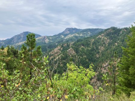
- Windmill Point: (5.25 miles round trip, 1,200 vertical feet of gain). Currently this is best done as a brushy hike for the last mile to the point but, with a solid amount of brush clearing, this could be a worthy bike ride testing your fitness on the ascent and your brakes on the descent. From the parking area, follow the spur road that is gated closed. Head gently downhill on this road and cross Ruby Creek at Waypoint W1. Now the road starts climbing steeply. Occasionally you’ll pass through small ravines where the brush is thick but these annoyances are short and easy to navigate (consider bringing a pruning saw and spending a few minutes here and there eliminating small trees and overhanging branches that impede easy progress). You’ll reach the saddle at W3 about 1.6 miles from the car and the summit at W4 in another mile (2.6 miles from the car). The last half of this route is particularly nice as you pass beautiful glades of pine grass and ponderosa pine and enjoy pleasant viewpoints overlooking the surroundings.
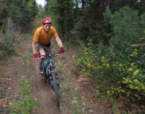
- Ruby Loop: (8.5 miles, 1450 vertical feet of gain). This is best suited as a mountain bike ride or a trail run and is most easily done in a counter-clockwise direction. The different waypoints on the map note different intersections you’ll pass: go left at RL2,straight
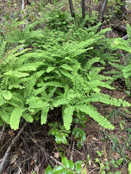
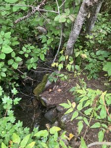
Ferns along the Ruby Creek Loop. Photo by Sarah Shaffer. (leftish) at RL3, and left at RL4. Between RL4 and RL5 the route is single track over a grown-in road bed. Go left at RL5 and then take a sharp, switchback turn at RL6 that takes you downhill. The road between R6 and R8 requires intermediate riding skills because the road has grown in quite a bit and is eroded in places. By R9, you’re back on larger roads and you’ll keep staying left at the intersections noted by R10 and R11. At R12 go straight and make a fast return to the car. Note: You can extend this ride quite a bit by parking back near Highway 97 and riding the main dirt road 2.85 miles (one-way) to Waypoint RL1.
Maps: View our topo map at this link or see map below for more information.
Note: This PDF map, if downloaded into an app like Avenza PDF Map, is geo-referenced to work with the GPS functions of a smartphone.
Land Ownership. The roads in Ruby Creek drainage traverse a combination of National Forest and private lands.
Reporter (and date): First posted 9/30/2015 by Andy Dappen. Updated on 9/4/2024 by Sarah Shaffer.
Leave It Better than You Found It. This should be every user’s goal. Do no damage and pick up trash left by others.
.JPG)

Disclaimer. Treat this information as recommendations, not gospel. Conditions change and those contributing these reports are volunteers–they may make mistakes or not know all the issues affecting a route. You are responsible for yourself, your actions, and your safety. If you won’t accept that responsibility, you are prohibited from using our information.
