

Methow River – Middle Section (Carlton to Burma Road)
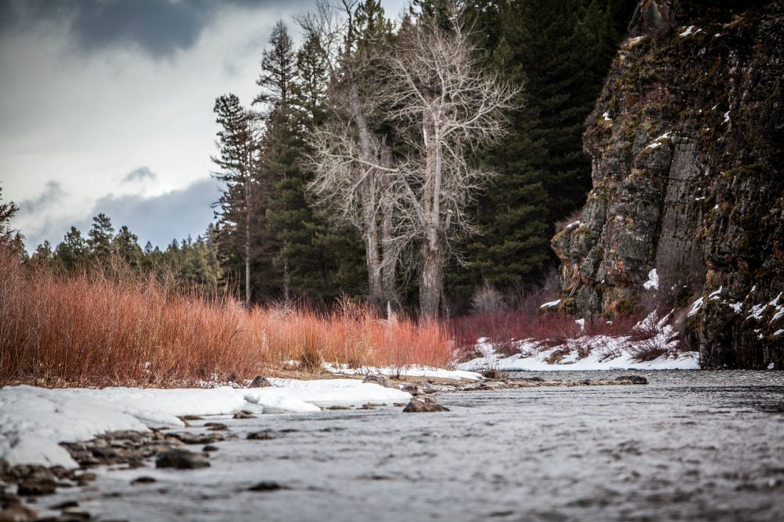
Attractions: The middle portion of the Methow River between Carlton and the Burma Road delivers a variety of class 2 and some easy class 3 rapids that are good fun for adventurous canoeists. These same waters are good ones for kayakers with some experience (advanced beginners to intermediates) to log more river time and boost their skills. The river offers Winthrop-styled scenery: dry ponderosa forests, big, dry hills whose north faces are wooded and whose southern exposures are grassed. In flood, the river, like most, turns muddy. For much of the spring and summer, however, the river transports you over gravels, rocks, and boulders of many different colors like a cellophane conveyor belt.
Activity: Canoeing, kayaking
Map: See maps below for more details. Note: These maps are formatted for legal size paper.
Use Print Preview to size properly before printing.
Distance: Depending on your put-in and take-out, trips between 5 and 18 miles long are possible.
Difficulty: Class 2 with possible touches of Class 3- (minus). At the water level of this trip report (4,000 cubic feet per second), the rapid under the Gold Creek bridge was rated a 3- and the rapid about half-mile downstream of the upper Burma take-out was also 3-. People paddling the river with us on this trip had done the river at several water levels and thought the paddling was slightly more demanding at both higher and lower flows.
Skill: 2 (intermediate). Fitness: 2 (intermediate)
Access, Put-Ins, Take-Outs. Drive Highway 97 North to the town of Pateros and then turn west onto Highway 153. Follow Highway 153 upstream, using the road’s proximity to the river to scout rapids as you go. For an easier trip (mainly class 2), drive 22.3 miles up Highway 153 to the town of Carlton. Put-in at the city’s riverr park, which has a nice sand beach and pit toilet. The park is on river left. Tturn into it by turning left very shortly after crossing the bridge leading into Carlton. Here are some other points of interest as you drive up Highway 153. Note: these mileages correspond with the highway’s mile markers:
- At milepost 1.7, pass Alta Lake Road on your left. There isn’t much camping around the river but there are camping spots a few miles up this road at the Alta Lake State Park.
- At milepost 6.7 or 6.8, you can look downstream at Black Canyon Rapids (class 3 to 4). This is the largest rapid on the Methow River and is below the stretch of river this report covers. See our guidebook entry for ‘Methow River – Lower’ for more about this rapid.
- At milepost 7.7, the Burma Road branches off to the right. Kayakers and canoeists can take-out immediately down stream of the bridge on either side of the river. Driving the Burma Road allows you to scout the next few miles of the river better than staying on the main highway—a nice benefit for canoeists who have a greater risk of swamping .
- At milepost 11.9, Highway 153 crosses a bridge and the upper end of the Burma Road reconnects with the highway. If you turn off the highway (right) and onto Burma Road and then drive a few hundred yards, there’s a good put-in/take-out spot maintained by the Washington Department of Fish and Wildlife (WDFW). Some use this as a put-in for the Black Canyon run, but for this trip description it serves as a possible take-out. A Discover Pass is needed to park here.
- At milepost 14.1, Highway 153 crosses a bridge and there is a put-in/take-out spot referred to as the McFarland Creek access (Discover Pass required here)
- At milepost 16.7, Highway 153 crosses a bridge near Gold Creek. This has a short rapid under the bridge with a big hole (river left) and big waves (river right). This rapid catches many canoeists off guard (it isn’t mentioned in some of the whitewater guidebooks) and has caused a fair number of spills. Experts can scout this hole and wave on the fly, but intermediate boaters are advised to pull over and scout the feature.
- At milepost 22.3 (at the town of Carlton), turn left and follow the road down into the park to launch.
Trip Description. River miles (RM) described below are taken from the mileages noted on the USGS maps and are different than the highway’s mile markers. For experienced paddlers, the rapids on this stretch of river are easily scouted on the fly. One exception is the rapid right under the Gold Creek Bridge which can sneak up on you. This rapid has a large hole spanning the left half of the river’s main channel and big waves in the middle. Canoeists might also want to drive the Burma Road – this gives you a better look at the many class 2 rapids found here.
- River mile (RM) 27.4: Put-in at Carleton (river left).
- RM 27.4 to RM 22: You’ll run about eight class 1 riffles.
- RM 21.7 and RM 21.5: Run two class 2 rapids.
- RM 21.2: Primitive river access with no amenities accessed from the Gold Creek Road on river right.
- RM 21: Gold Creek Bridge Rapid (scout from river left). At some water levels you can sneak the rapid to the right of the waves, although a bridge pillar creates a possible pinning hazard. It’s easy to line a canoe around all hazards along the right side of the main channel.
- RM 20 to RM 18.6: Run several class 1 riffles.
- RM 18.5 and 18.1: Run two or three closely spaced class 2 rapids.
- RM 17.8: McFarland Access. Possible take-out or put-in upstream of the bridge on river left. Discover Pass required.
- RM 17.5 to RM 15: About every half mile run a class 2 rapid.
- RM 14.7: River access for put-in or take-out on river left near the upper end (north end) of the Burma Road.
- RM 14.4 to RM 12.5: More class 2 rapids spaced about every half mile.
- RM 12.4: Kayakers should look for the play wave on river right slightly downstream of the town of Methow. The river pushes up against the highway here and there is a dilapidated footbridge almost overhead.
- RM 11.7: Engle’s Slide, a class 2+ to class 3 rapid, depending on water level.
- RM 11.2 and RM 10.5: Two more class 2+ or class 3 rapids.
- RM 9.8: Primitive river put-ins or take-outs at lower (southern) end of Burma Road. Pull out on downstream right. We think there is a pullout on the left, too, but our notes as to whether this is above or below the bridge are confusing. Note: Black Canyon Rapid is 1.5 miles downstream of the bridge.
- RM 9.2: Public fishing site on river right. WDFW site. Discover Pass required.

River Level Info. The Methow is most commonly run in May and June. Flow levels of 2,000 to 5,000 cfs (at the Pateros gauge) are good for canoeing. Other literature notes that recommended flows are between 1,000 to 10,000 cfs. No one in our party had run the river at flows above 5,000 cfs. For a USGS river gauge with real-time data at the town of Pateros (best gauge for this stretches of river), visit: USGS Waterdata.
More Info: See the books: A Guide to the Whitewater Rivers of Washington” by Jeff and Tonya Bennett and Washington Whitewater by Douglass North. Also see this listing at American Whitewater.org
Date and Updates. This trip information was originally posted in June of 2007 and updated in mid-June 2013.
Other Methow Trips. The lower portion of the Methow (McFarland Access to Pateros) is another enjoyable float trip and is suited to rafters, kayakers, and canoeists wanting a slightly wilder float.
Hazards: In May and June, this meltwater river is darn cold, even if you are floating in the warmer part of the state. Wetsuits or dry suits are recommended, taking an unplanned swim is not. Watch the debris, sweepers, and log jams, especially if the river is high.
Permits: No permits are needed to run the river but a Discover Pass is required for many of the river access points.
Leave It Better Than You Found It: This should be every outdoor user’s goal. Pick up trash left by others, pull some noxious weeds along your route, throw branches over unwanted spur trails, don’t ride or walk wet trails when you’re leaving ruts/footprints deeper than ¼ inch…
Disclaimer. Treat this information as recommendations, not gospel. Conditions change and those contributing these reports are volunteers–they may make mistakes or not know all the issues affecting a route. You are responsible for yourself, your actions, and your safety. If you won’t accept that responsibility, you are prohibited from using our information.


