Photo: The scenery looking west toward Mt. Stuart from this directissima route up to Tronsen Ridge.
Attractions. A direct route leading from the parking area at the Tronsen Road Non-Motorized Winter Recreation Area directly uphill to subsidiary ridge systems that feed into Tronsen Ridge. From the very start, the route leaves the road systems and climbs directly upward on (cross-country) on west- and southwest-facing slopes. Soon the route intersects what we call Bojangle Ridge (other routes in the guidebook use Bojangle Ridge) and follows this ridge system to Tronsen Ridge and, eventually, to a very scenic bump on Tronsen Ridge at an elevation of 5,910 feet. Once you’re up on the ridges, the route yields beautiful views out over the Blewett Pass environs and the high Cascades.
Note. The start of this route climbs through moderately treed slopes with western and southwestern exposures that get fairly wind and sun hammered and that don’t always hold a lot of snow. The route is almost always fine for snowshoeing (given that avalanche hazard is not high) but skiers may frequently find the snow cover is thin or simply of a bad consistency. We recommend that skiers arrive with a few different options (especially for the descent) should they find poor snow conditions or coverage on the ascent.
Skill: 2+ for snowshoeing; 2+ or 3- for backcountry skiing.
Fitness: 2 (intermediate)
Distance: 6 to 7 miles roundtrip.
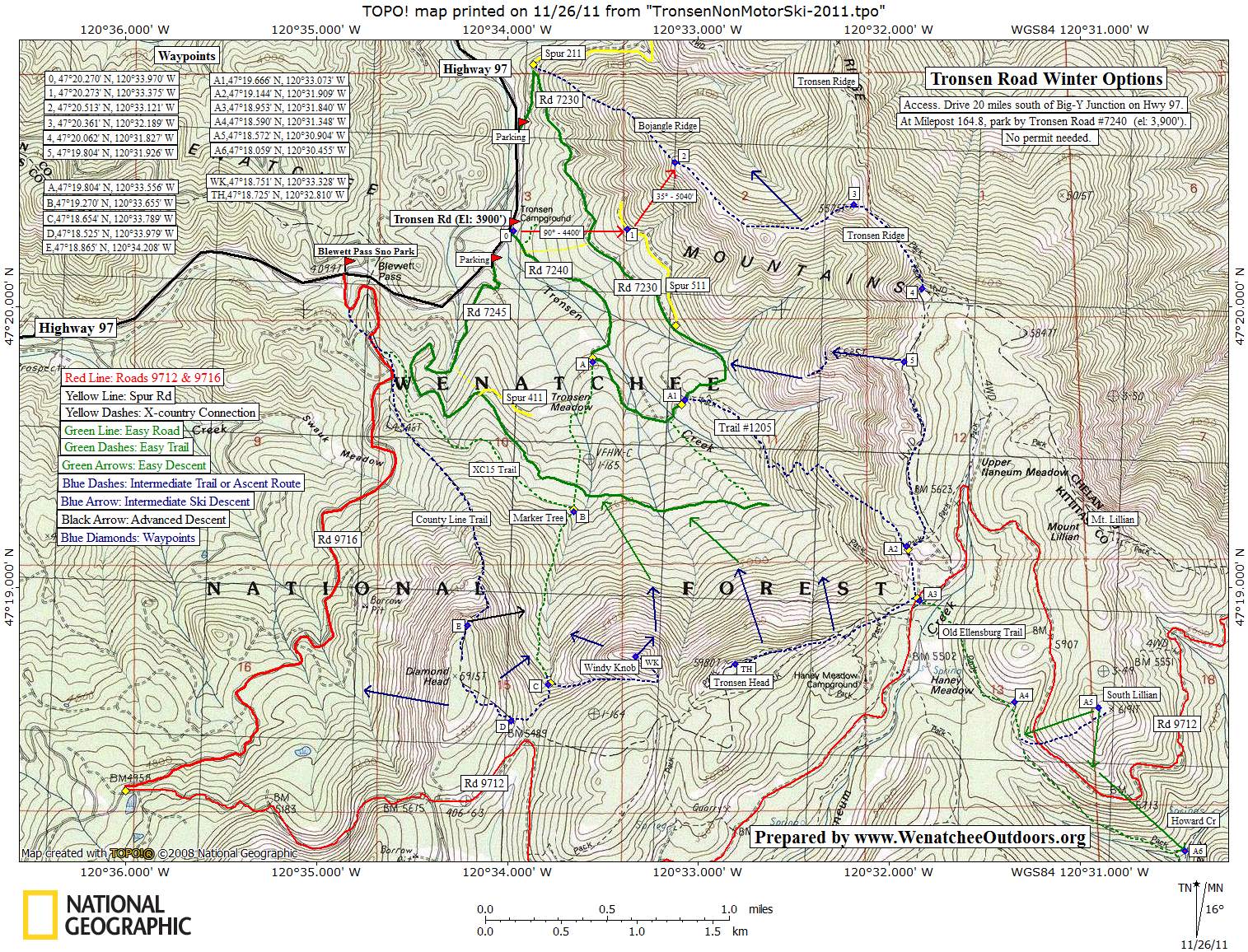
Maps. See our topo map of this route below.
Elevation Gain: 2,000 vertical feet
Activity. Snowshoeing or backcountry skiing.
Access. From the Big-Y Junction at the intersection of Highway 2 and Highway 97, east of Leavenworth, drive south on Highway 97. Pay attention to the milepost signs and, about 0.8 mile before Blewett Pass at Milepost 164.8), park on the east side of the highway along the plowed shoulder. Forest Road 7240 (Tronsen Road) intersects the highway here. A parking pass is not required.

Photo by Allison Dappen. Snowshoeing ridges leading to Tronsen Ridge.
Trip Instruction.
- From the parking area follow a true bearing of 90 degrees to 4,400 feet (Waypoint 1).
- Follow a true bearing of 35 degrees to an elevation of 5,040 feet and intersect Bojangle Ridge (Waypoint 2).
- Turn right and follow the ridgecrest in an easterly direction to Tronsen Ridge at Waypoint 3 (5,575 feet).
- At Waypoint 3 it’s easy to veer left and keep heading north on Tronsen Ridge. Instead, turn right and head in a southeasterly direction. Drop 80 vertical feet and then follow Tronsen Ridge to your highpoint (elevation 5,910 feet) about a third of a mile away (Waypoint 4).
 Return. Backtracking is the fastest option. You can also keep heading south on Tronsen Ridge for about a mile (Waypoint A2) and then follow the Tronsen Meadows Trail (Trail #1205) back to the Tronsen Road (Waypoint A1). Here, follow the Tronsen Road downhill for 1.75 miles to return to the car
Permits. None needed for parking of for snowshoeing.
Leave It Better Than You Found It: This should be every outdoor user’s goal. Pick up trash left by others, and do no damage yourself.
Disclaimer: Treat this information as recommendations, not gospel. Conditions change, and those contributing these reports are volunteers–they may make mistakes or may not know all the issues affecting a route.You are still completely responsible for your decisions, your actions, and your safety. If you can’t live with that, you are prohibited from using our information.