
The view from camp at Buck Creek Pass included Liberty Cap to the south
By Brad Brisbine
This trip on the Buck Creek Pass Loop was a repeat of a place I had been to in 1978. I’m happy to say that it was better than I remember!Several of us headed out in late August on a Thursday after work, drove to Fish Lake near Lake Wenatchee, and drove 24 miles up the Chiwawa River valley to Trinity.We hiked in 3 miles, set up camp by headlamp, and enjoyed a clear night of stargazing. Heading out the next morning, we completed the hike to Buck Creek Pass.There we made base camp for the next 3 nights, filling days with day hikes between rain showers.

Buck Creek, the way we came, is to the east in the photo left.
 And this photo (right) is looking west, toward Glacier Peak, Washington’s last wilderness volcano. The other four volcanoes have roads leading part way up their flank.
Mission Ridge skiers are familiar with the 10,541-foot hulk of Glacier Peak . Indians called the mountain DaKobed, or “Great Parent”. Professor W.D. Lyman described it this way:
“It can be seen in all its snowy vastness, ten thousand feet high, and bearing upon its broad shoulders miles and miles of rivers of ice, the most beautiful and significant of all the poems of nature”.

Saturday’s day hike was to Pass No Pass, involving hiking back down trail a mile, and turning up a lonesome side canyon.
Fortress Mountain (8674′) is beyond, its meadows were used heavily by sheep herders in the past. When I day hike, my pack drops from 52 pounds to a comfortable 12. The canyon was surprisingly lush at the end of a hot summer. I can only imagine what it looked like a month earlier, half pink with heather.

David’s Penstemon however, were in full bloom.

Sunday’s day hike toward High Pass catapulted us to the high ridges. The Sound of Music theme resonated in my mind.

The trail swung from the Suiattle River side to the Buck Creek side several times. Around the corner from here the trail was very narrow on a cliff band. Buck Creek’s “U”-shaped glacial valley at left.

Looking down at Buck Creek Pass at left of center, and Pass No Pass right of center, separated by Helmut Butte, right on the Cascade Crest.

An other-worldly telephoto shot of a pumice and ash gully on Glacier Peak. This gully was eroded by the Chocolate Glacier, and left exposed by major glacial retreat about 13,500 years ago, then ash laden by the massive eruption about 12,000 years ago.

Monday we finally had a morning cloud break, revealing Glacier Peak’s Dusty Glacier, looking like cake frosting.
What’s left of the Chocolate Glacier extends to the summit. It showed an advance in the 1950’s, but stabilized for several decades since.The cindercone is about 700,000 years old, much younger than the surrounding mountains.

Ten Peak Mountain, also on the Cascade Crest, with back side draining to Lake Wenatchee.

The blister will heal in two weeks, but I have memories for a lifetime.
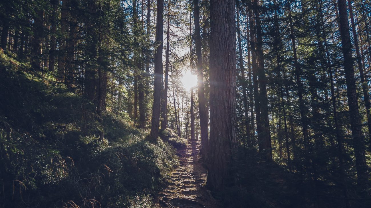
The last few miles is a former mining road, used in the 1950’s to access Red Mountain Mine.
Details, Details: Buck Creek Pass Loop
Access. Follow Highway 2 to Coles Corner, then drive 4.4 miles on Highway 207 past Lake Wenatchee State Park to a bridge crossing the Wenatchee River. Shortly past the bridge, leave Highway 207 by staying right at a fork and then veering right again at the next fork onto the Chiwawa Loop Road. About 5.75 miles from Coles Corner, the Chiwawa Valley Road branches left. Turn left and follow the road 2.7 miles to a bridge across the Chiwawa River. Cross the river and, about 0.3 miles later, curve left (remain on the paved road). The paved road becomes State Highway 3, which is also called the Chiwawa River Road. Follow this in a northwesterly. In eight miles the road turns to gravel, then in another 10.75 miles (at a prominent fork). Go straight to Trinity (0.75 miles farther), veering right takes you up to the Phelps Creek Road 2.4 miles to the Phelps Creek Trailhead (this is the road you’ll walk down at the end of the trip). Northwest Forest Passes are needed for parking at the trailhead.
Maps:


GPS
Download a GPX file with the waypoints noted on our maps.
Trip Instructions.
We did the loop in a clockwise direction but many do it counterclockwise as well. To go clockwise, start at Trinity and head up the Chiwawa River. About 2.75 miles up the trail veer left, and head another 6.5 miles up to Buck Creek Pass. From the pass, head north and intersect the Pacific Crest Trail after 4.4 miles. Now follow the PCT in a norteast direction about 3 miles to Suiattle Pass. At Suiattle Pass, contour northeast and then climb to reach Cloudy Pass. From Cloudy Pass, drop in a southerly direction to Lyman Lake. Go around the north end of Lyman Lake and then head south (uphill) toward the Lyman Glacier, following the small trail leading to Spider Gap. From Spider Gap, keep heading south and descend snow for almost a mile. At the end of the snow, find the trail dropping to Spider Meadows. Here, parallel Phelps Creek down to the southern end of the meadows and then keep following the Phelps Creek Trail five miles back to the trailhead. Finally walk the road about 2.4 miles downhill toward the Chiwawa River. Near the Chiwawa River, turn right and follow the road 0.75 miles back to Trinity.
Equipment Needs: Normal backpacking kit. In late summer, Vibram soles and ski poles are usually adequate for contending with the snow. MicroSpikes allow for more safety and more flexibility – they let you climb the snow in all conditions and in all temperatures.
Skill Level: 2
Fitness Level: 2 if done as a backpacking trip.
Permits: Northwest Forest Pass required at the trailhead.
Not allowed: Motorized vehicles and mountain bikes.verboten. Horses are allowed on most parts of this routes but NOT on the section over Spider Gap.
Allowed. Dogs and horses are OK for the walk into Spider Meadows. Horses are not allowed on the last two miles of the hike leading to Spider Gap. The ability for dogs to climb the last mile of snow to Spider Gap depends largely on how frozen the snow is (the harder the snow, the harder the route is for dogs).
Updated Trip Reports: Recent condition updates about this trail (from WTA.org)
Leave It Better Than You Found It. This should be every outdoor user’s goal. Pick up trash left by others, pull some noxious weeds along your route, throw branches over unwanted spur trails, don’t ride or walk wet trails when you’re leaving ruts/footprints deeper than ¼ inch…
Disclaimer. Treat this information as recommendations, not gospel. Conditions change, and those contributing these reports are volunteers–they may make mistakes or not know all the issues affecting a route. You are still completely responsible for your decisions, your actions, and your safety. If you can’t live with that, you are prohibited from using our information.
