Pictures and text courtesy of Shane Wilder.
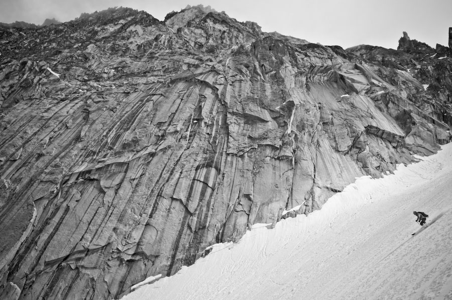
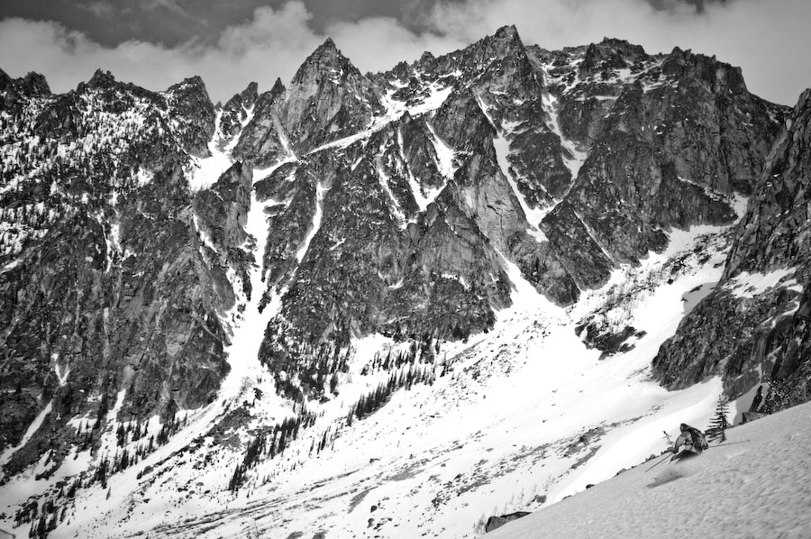
Colchuck glacier rises to an elevation of 8000 ft and separates Dragontail from Colchuck Peak. The glacier is located in the heart of the Stuart Range and offers some spectacular skiing. The slope itself is relatively gentle with a maximum angle of around 35 degrees but the terrain you are surrounded by is extreme. The cliffs of Dragontail rise over 2000 ft and drop directly into the glacier.
When conditions are good an ascent and descent can be relatively simple. When conditions are icy or avalanche prone, this slope can take on a different character and one where crampons, ice axe and or avoidance may be most advisable.
Once one reaches Colchuck Lake you find yourself at an elevation of 5570 ft. Route finding is strait forward but I always find myself slightly climbers right to avoid any potential rock fall coming off of Dragontail. Colchuck Glacier offers 2500 ft of excellent skiing in a remote and wild setting.
 Details, Details: Colchuck Glacier
Skill: 2+ to 3- (advanced intermediate).
Fitness: 2+ to 3- (strong intermediate).
Access: Follow Highway 2 to Leavenworth and at west end of town turn south onto the Icicle Road, following signs to the Leavenworth National Fish Hatchery. Stay on the Icicle Road for 8.6 miles. Near the Bridge Creek Campground, turn left onto Forest Service Road 7601 (The Eighmile Road). Follow Road 7601 for four miles (and until it ends) to the Mountaineer Creek Trailhead. This is the starting point for the trails leading to Colchuck Lake and Stuart Lake. A Northwest Forest Pass is needed to park here. Note: In winter and through part of the spring, the Eightmile Road is gated closed down by the Bridge Creek Campground and you’ll need to ski the road as well as the trail. Skiing the road adds 1.5 to 2 hours to your ascent times and about half an hour to the return time. Most years, the road opens to vehicular use in early to mid-May.

Approach: Follow the 5-mile long hiking trail to Colchuck Lake. Our hiking guidebook entry has the details and a map for approaching Colchuck Lake.
Trip Instructions: Once at Colchuck Lake, either ski across the lake or walk counterclockwise around the lake to reach the south end of the lake. Next, climb in a southerly direction to reach the col between Dragontail and Colchuck peaks. From the col, climb in a westerly direction to reach the summit of Colchuck Peak (parts of this final climb to the top are usually more easily done booting your way up).
Map: See map below for more information. Print our topographic map of Colchuck and Enchantments on 8.5″ x 14″ paper in landscape mode.
Gear: The snow and ice conditions up the glacier and to the summit of Colchuck can vary tremendously in spring. Crampons for the skis and boot are recommended. An ice axe will also be appreciated in some conditions.
Permits: are not needed to camp at Colchuck Lake until after June 15 but a Northwest Forest Pass will be needed to park at the trailhead.

Leave It Better Than You Found It: This should be every outdoor user’s goal. Pick up trash left by others, pull some noxious weeds along your route, throw branches over unwanted spur trails, don’t ride or walk wet trails when you’re leaving ruts/footprints deeper than ¼ inch…
Disclaimer. Treat this information as recommendations, not gospel. Conditions change and those contributing these reports are volunteers–they may make mistakes or not know all the issues affecting a route. You are responsible for yourself, your actions, and your safety. If you won’t accept that responsibility, you are prohibited from using our information.

