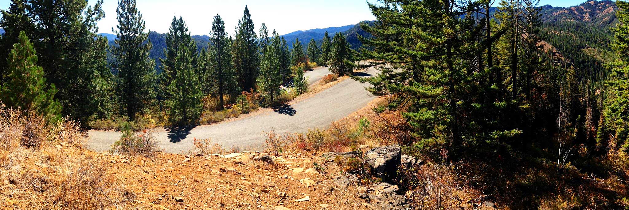

The iconic “hair pin turn” along Old Blewett Pass Highway. Photo by Mark Shaffer.
ATTRACTIONS: This ride offers beautiful views, and riding Old Blewett Pass Highway is kind of like mountain biking on your road bike–on pavement, but on a “bike path through the forest.” It can also be ridden on a mountain bike. This adventure offers historical content at the information kiosk located on the West side of the pass, along with remnants of stone fireplaces from a structure long gone. Did you know Blewett Pass used to have a ski lodge?
DISTANCE:
–Retracing the Old Blewett Pass route: About 45 miles roundtrip
–Completing the loop on Highway 97: About 48 miles roundtrip
ANOTHER RIDE OPTION:–Park at mile marker 172.5 (if coming from Leavenworth or Cashmere) where the old Blewett Pass Highway starts on the right side of the road next to a creek. Continue along the Old Blewett Pass Highway for 5.3 miles to the summit. Once at the summit continue down the West side of the summit for 4.5 miles until you reach modern Highway 97. You will also see an information kiosk (see picture below) on the left side of the road just prior to reaching modern Highway 97. Once here, retrace your path back to your vehicle on the East side of the summit (this ride was completed on 10/3/16 by Sarah and Mark Shaffer).
ELEVATION:
–Peshastin: 1,010 feet
–High point along Old Blewett Pass: about 4,100 feet
 SKILL. 2 (intermediate)
FITNESS. 2+ (strong intermediate)
ACCESS:
–Drive Highway 2/97 to the Y Junction just east of Peshastin and park at the Park and Ride on the north side of the highway.
–If you want a short ride and/or don’t want to ride along Highway 97 (good shoulder but fast traffic), drive south on Highway 97 (toward Blewett Pass) and at milepost 172.5 exit to the right on the Old Blewett Pass Road (there are many pullouts along this road where you can park) and follow the trip description below from mile 13.
TRIP INSTRUCTIONS:
–Starting from the Park & Ride at the “Y”, intersection of Highways 2 & 97 near Peshastin (elevation 1000′), go south on 97 (Blewett Pass Highway).
–After about 2 miles, turn right on Campbell Rd., which parallels the highway for about 2 miles.
–Back on Hwy 97, continue south for about 2 more miles and turn left onto Old Blewett Pass Rd, paralleling the Highway for about 1.5 miles, turning left back onto the Highway at that point. 
–At your mile 13 (about 1/2 mile past mile post 173), bear to the right onto Old Blewett Pass Road (elev. 2400′). From here on, about the only “traffic” you’ll encounter will be other bicycles.
–In about a mile, the pavement crosses Scotty Creek, the road narrows, and the grade increases to 5%. The climb is basically a series of curves along the side of the mountain for another 5+ miles to the 4071′ summit.
–The pavement here as of October 2016 was in great condition!
–From the summit, the road continues to curve downward, another 4 miles until it finally intersects with the modern Highway 97 (your mile 23, elev. about 3100′). The surface of the south face is typically in much better condition than the north — with few steep road cuts, there tends to be much less debris on this section. As of October 2016 the road was in fantastic shape.
–From the intersection, riders can opt to climb over the “new” Blewett Pass (elev. 4102), making this into a loop tour, but having to deal with the trucks and other high-speed traffic. My preference is to simply turn around and back-track, taking in the climb and descent, as well as the view, 180 degrees from the outward leg.
RECOMMENDED SEASON:
Spring, Summer, Fall.
OTHER INFORMATION:
Although about 8 miles of Highway riding in each direction is required near the start and finish of the ride, shoulders are generally wide and traffic isn’t nearly as heavy as it is on Highway 2. There is also the distraction of Peshastin Creek alongside on the upward leg, and the exhilaration of the slight downhill on the return — although it’s not uncommon to have a headwind over the final few miles of the ride.
LAND DESIGNATION: U.S. Highway, Forest Service
FEES / PERMITS: None required.
TRIP REPORTER: Original trip reporter was Larry Glickfeld (August, 2006). This post was updated on 10/3/16 by Sarah Shaffer. Main update: Old Blewett Pass Highway was in excellent condition both on the East side and the West side of the pass. Smooth riding, hardly any debris on the road, in great shape.
LEAVE IT BETTER THAN YOU FOUND IT. This should be every user’s goal. Pick up trash left by others, pull some noxious weeds along your route…
DISCLAIMER. Treat this information as recommendations, not gospel. Conditions change and those contributing these reports are volunteers–they may make mistakes or not know all the issues affecting a route. You are responsible for yourself, your actions, and your safety. If you won’t accept that responsibility, you are prohibited from using our information.

