
We’ve set up a GPS course and quiz along a 4.5- mile loop using the Homestead Trail (Horselake Reserve in the Sage Hills). We’re confident hikers, families, and naturalists will find it fun and instructional. Some reasons to follow the course and take the quiz:
- It will help you learn to use a GPS unit (even if you act like a caveman, this is the 21stcentury).
- It will engage kids in the hunt for waypoints and have them walking longer distances without whining (this is the 21st century and gadgets are pacifiers).
- You will learn more about the Horse Lake Reserve and its natural history (this is the 21stcentury and gadgets help us learn).
To participate:
1. Download/import the waypointsto your GPS unit or smartphone (grab the Horselake-Homestead GPX file).
2. Find the waypoints in numeric order and answer the quiz question associated with each waypoint. View the questions below (also click below to print questions and answers).
3. Read the answers either in this document and tabulate your score.
Horselake – Homestead GPS Course & Quiz

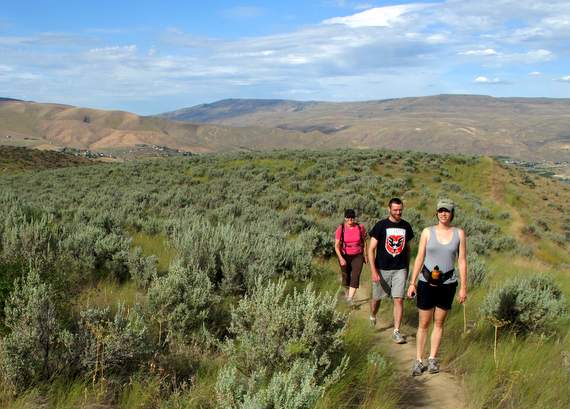
Directions: Find the waypoints in numeric order and then answer the questions. Note: Stay on the trails — all of waypoints can be found from the trails, so pease do not travel cross-country. The next four pictures were all taken at waypoints, see if you can identify which ones.
Waypoints
- What structure do you find next to here? Do you need to use it?
- What would you call this place? What are three peaks and two rivers seen from here?
- It ain’t just heavy, it’s really heavy: What is it?
- The trail makes a turn and heads toward the hills here. What direction are you heading after making the turn?
- What trail feature do you find here? Take 20 to 25 paces to the west – what manmade item do you find?
- What manmade structure is overhead?
- What trail feature do you find here?
- Walk uphill on a zig-zagging trail from the last feature. This waypoint is near another manmade structure. What is it?
- What is the metal item just uphill of the trail here (this could be removed in the future)?
- The trail curves through some big brush here. What types of plants are these?
- From here look north to see a volcano that is over 10,000 feet high. What peak is it?
- There is a taller, prominent grass here with a broad blade. What kind is it?
- What’s different about the land to your right here?
- Some shrub-like trees are to your left and right here. What are they?
- What does the trail do here? To your left and almost at the same elevation what land feature do you see? What kind of trees are on that land feature? Look uphill a quarter of a mile away and see if you can identify what kind of trees you’re seeing.
- The big trees you could see at the last waypoint are now 25 yards off the trail here. What kind of trees are they?
- What kind of land feature are you at? What elevation are you at now? What peak do you see to your west? Some of the mountains that were visible from Waypoint 2 are visible – name two.
 What river is out to your east?
 - What trail feature have you reached? There are a number of plants that have you’ve seen at other waypoints – name a few.
- Walk downhill from the last waypoint. How would you describe this land feature?
- What’s the prominent manmade structure about 150 yards away? What kind of trees are straight ahead about 75 yards away?
- What is the trail feature here? Check out the many types of trees to the left and slightly behind you. Can you identify a few?
- What manmade structure are you at?
Note: The two waypoints below (4b and 4a) can be worked into a shorter loop that uses Waypoints 1,2,3,4,5,4b,4a4a) What’s distinctive about the trail here (what would you call this trail feature)?4b) What is the prominent shrubs are you seeing both in burned and in living form? How Did You Do? How many correct answers did you get?
- 22-20:Wily Coyote
- 19-17: Clever Crow
- 16-14: Thinking Squirrel
- 13-11: Dim Doe
- 10-9: Stupified Quail
- 8-0: Befuddled Beetle.

Driving Access. From the intersection of Wenatchee Avenue and Horselake Road at the north end of Wenatchee, drive west (uphill) on Horselake Road. In one mile, the pavement ends. Drive another 2.3 miles up Horselake Road and park on the right side of the road at a formal trailhead that was built by the Land Trust in 2009. Note: Neither the city, the county, nor the Land Trust has a formal budget to pay for trailhead maintenance. All of us who use the trails can help by picking up trash found at the trailhead (and on the trails) and disposing that trash at home. Also please don’t dispose of trash in the vault toilet and clean up after yourself after using that same toilet.
Map: Homestead Trail Topo Map.
Trail Info. Additional Homestead and Horselake Trail Information found here.
Seasonal Closure. All Sage Hills trails (including the Lone Fir Spur and Homestead Trail) are closed December 1 to March 31.


