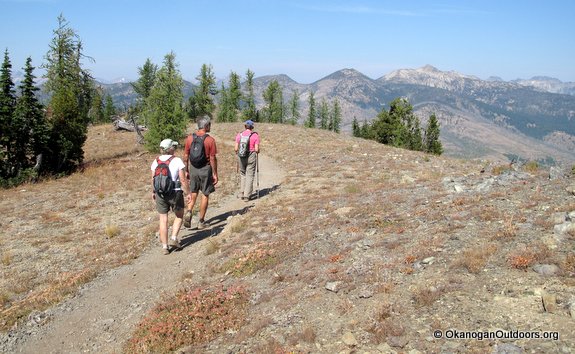
Attractions. The car does most of the work – which makes short, sweet work of this hike to a 7,000-foot viewpoint with a commanding view of the Methow Valley below and the North Cascades on the horizon. On top of the stellar scenery, the lookout itself is an added attraction of this outing. If anyone is manning the structure when you arrive, try to wangle a look at the protractor inside

used to locate fires – it’s a great tool for identifying all those, lumps, bumps, pillars and breasts on the skyline.
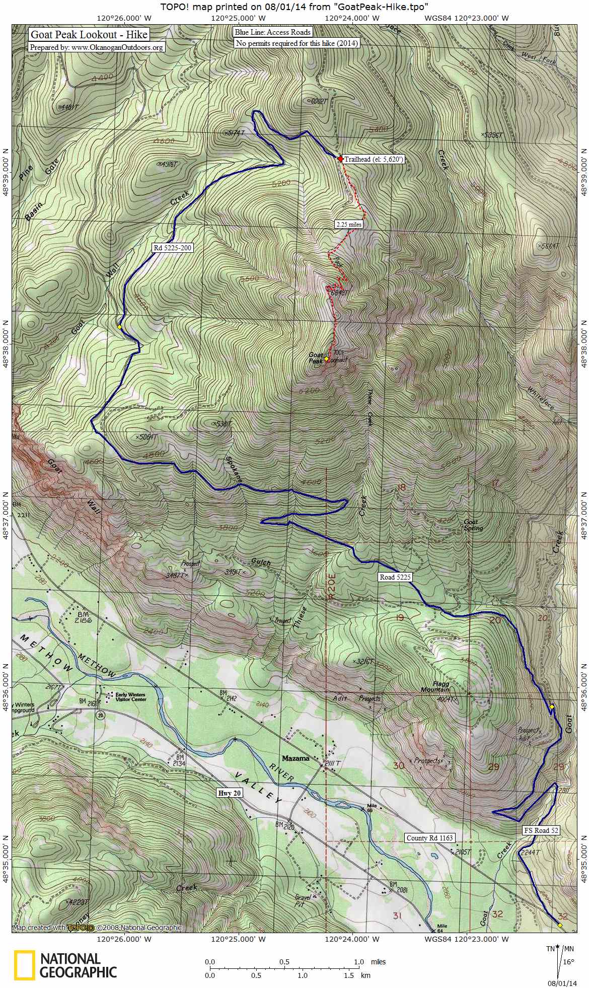
Distance. About 4.5 to 5 miles (round trip)
Elevation Gain: 1,400 vertical feet.
Skill: 1+ (advance beginner). Fitness: 2- (easy intermediate).
Recommended Activities: hiking and trail running. Dogs are allowed but because this is a popular hike, please consider leashing your dog at busy times.
 Access. From the Mazama, drive east on County Road 1163 (Goat Creek Road) for 1.8 miles to its intersection with FS-52. Turn left (north) and follow FS-52 for about 2.6 miles to a junction with FS-5225. Turn left and follow FS-5225 for 6.2 miles. Now turn right on Spur 200 and follow this for a little under 3 miles until it ends at the trailhead. No permits are needed for the hike.
Trip Directions. Not much to this one – follow the one and only trail upward (and in a generally southerly direction) to the top of Goat Peak. Retrace your route on the return.
Map. See our topo map of the route.

Other: Bring plenty of water — there are no streams along the way.
Lookout History. Most lookout towers around the state have been rendered obsolete by new technologies and have been dismantled. This particular lookout tower has refused to die, however. During fire season it was manned until 2013 and for the last 19 years of the lookout’s tenure ‘Lightning Bill’ (Bill Austin) manned the fort. In 2014, Bill was moved to the Leecher Lookout outside of Twisp and the Goat Peak Lookout started being staff sporadically when approaching storms justified having more eyes looking out over the ground for possible fires caused by lightning.
Reporter and Date: Andy Dappen, August 2012.
Leave It Better Than You Found It: This should be every outdoor user’s goal. Pick up trash left by others, pull some noxious weeds along your route, throw branches over unwanted spur trails, don’t ride or walk wet trails when you’re leaving ruts/footprints deeper than ¼ inch…Disclaimer. Treat this information as recommendations, not gospel. Conditions change and those contributing these reports are volunteers–they may make mistakes or not know all the issues affecting a route. You are responsible for yourself, your actions, and your safety. If you won’t accept that responsibility, you are prohibited from using our information.
This post was originally published on 8/2/14.