
by Ray Birks and Andy Dappen
Attractions: Open shrub steppe riding on good trails that drain well, make this a good place to ride in spring (flowers and greenery), fall (blonde grasses and golden light), and, surprisingly, for much of the winter too. Throughout this network of trails there are typically easy dirt roads to climb and single-track trails to descend. This is part of the larger Beezley Hills Preserve that extends to Moses Coulee and includes over 30,000 acres.
Activities: Mountain biking, hiking, trail running.
Nearest Town: Ephrata.

Skill Level: 1 – 2
Fitness Level: 1 -2
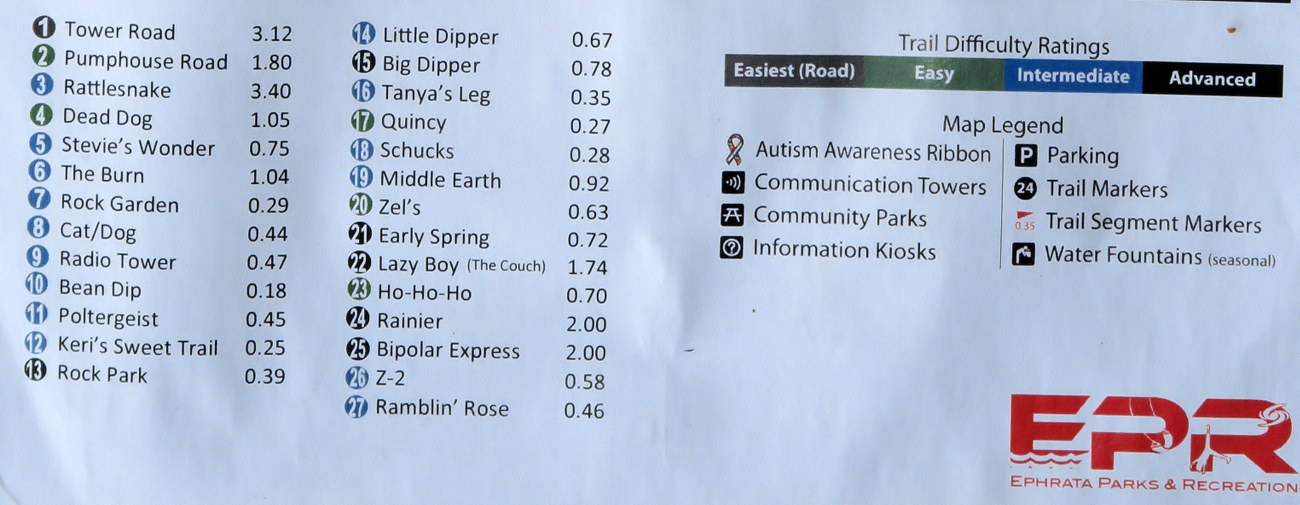
Distances:Easy trails: 4 miles. Intermediate trails: 9.5 miles. Advanced trails: 11 miles.
Recommended Season: Any season although summer can be hot. This is a great place to ride in winter when other trails around Central Washington are too snowy, too muddy, or closed to riding.
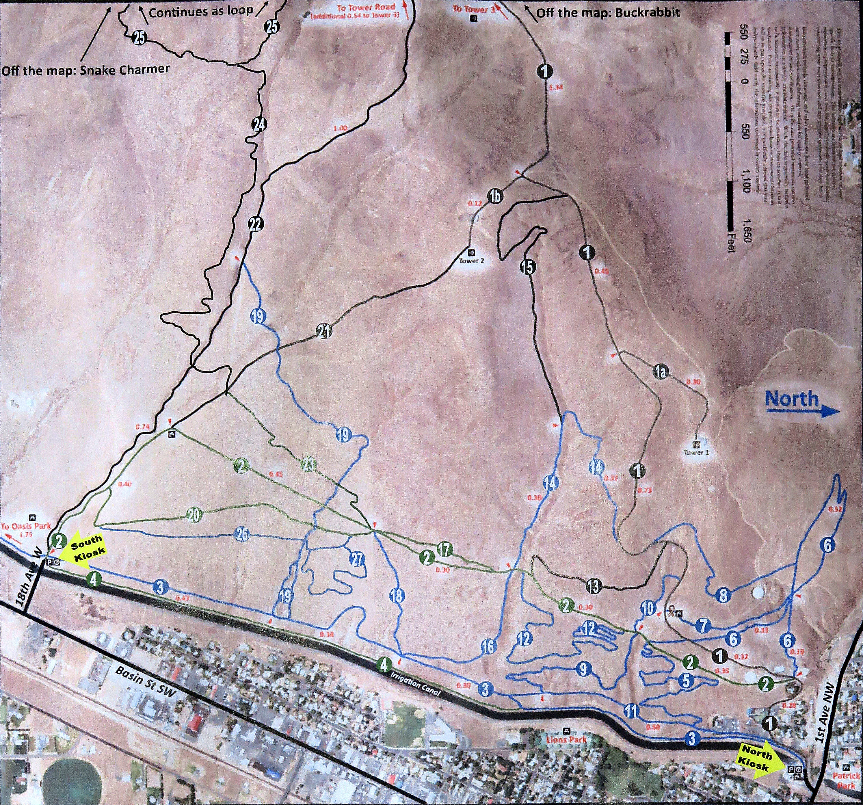
Access: From downtown Quincy, drive State Highway 28 about 16 miles east and then northeast to the town of Ephrata. South Kiosk access: From the south end of Ephrata, turn west on 18th Ave W, drive about 0.1 miles, cross the irrigation canal, and park off the road on your right hand side. North Kiosk access: From the middle of Ephrata, turn west off of Highway 28 (aka Basin St SW) onto First Ave NW drive about 0.35 miles, immediately before the irrigation canal turn left on Cyrus Road and you’ll see the kiosk. The roads are a bit confusing around this access point so use the schematic map (link above) to help navigate around the warehouses and homes. No permits needed for parking or trail use.
 Trip Information: There are many trails and loop possibilities. Use the schematic map to craft a ride of the length and difficulty you want. Roads tend to provide good ascent routes.
Photo: Fence Crossing on Little Dipper
Fees/Permits: None needed.
More Rides: Maps and details of over 120 regional rides in our mountain biking guidebook.
Leave It Better Than You Found It: This should be every outdoor user’s goal. Pick up trash left by others, pull noxious weeds along your route, disperse old fire rings (they encourage more fires), throw branches over spur trails and spurs between switchbacks (make it harder to do the wrong thing than the right thing).
Important Disclaimer: Treat this information as recommendations, not gospel. Things change, conditions change, and those contributing these reports are volunteers–they may make mistakes, fail to give complete information, or may not know all the issues affecting a route. So forget about finger pointing: If things go wrong, you are completely responsible for yourself and your actions. If you can’t live with that, you are prohibited from using our information.
Story Originally Published: December 2014.
Map: Print the schematic map of trail system below. Trailforks also has a good Google map of the complete trail system here.