
 The Ptarmigan Traverse Extended Trek (Part 1)
by Bill Wicheta
“We were wanderers from the beginning.” Thus Carl Sagan begins his book Pale Blue Dot. How true for many of my friends and I, thus the lure of long wilderness treks in beautiful high country is hard to resist. Nature wanderers moving to NCW soon hear of the Ptarmigan Traverse, a route first done over the course of 13 days in 1938 by four members of the self- named Ptarmigan Climbing Club. They traveled from Dome Peak to Cascade Pass and climbed numerous peaks along the way. No data was published on this first trek. In 1953, five others reversed the route and recorded their experience. The history is well documented in a story by Lowell Skoog.
As this trek became known to mountaineers, it was more commonly done from north to south exiting via Cub Creek to the Suiattle River Road. It is not a route for casual cross-country hikers, as travelers must have ice axe, crampons and rope and also have glacier travel and off-trail mountain navigation experience.

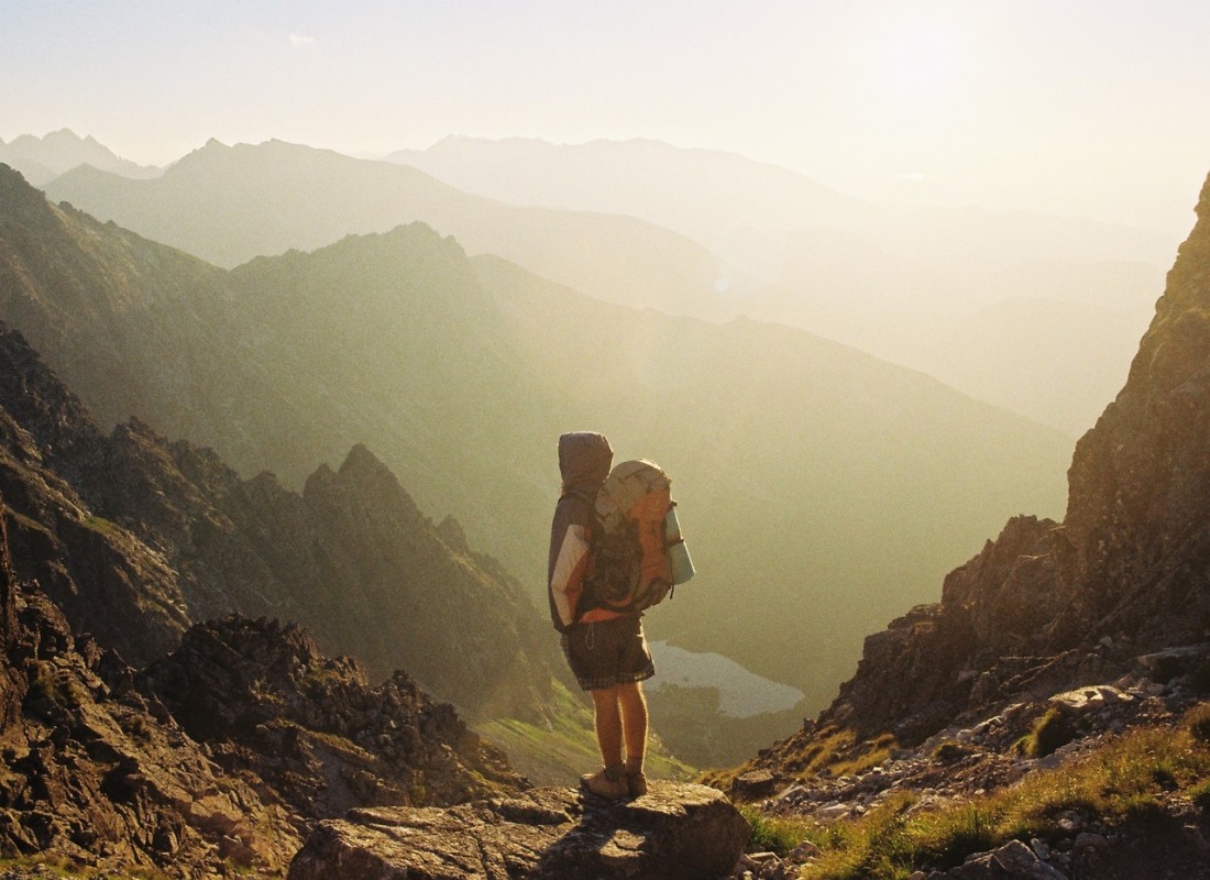
 My longtime desire to do this route came to fruition in August of 2014. I had a week and a half off (ample time for the route and maybe some peaks along the way), my strong son Will, was available to carry a disproportionate amount of group gear and Mark Shipman was happy to accept my invitation.
It is always risky to invite Shipman along on an adventure. In this case he wasn’t content with the standard route but concocted the “Ptarmigan Extended Trek.’ Rather than exiting via Cub Creek, Mark suggested we wander an additional 30 miles through the mountains and exit at the Phelps Creek Trailhead. A total distance of 70 miles, half of which would be off-trail.
We could do this by continuing from Dome Peak and traveling via Kaiwhat Pass, Ross Pass and maybe Totem Pass or the Bannock Lakes. From there drop to Canyon Lake, picking up a little used official trail (797 on Green Trails Map) to Image Lake. From that point our route would use the regular trails of Miner’s Ridge, Suiattle Pass, Cloudy Pass, Lyman Lake, Spider Gap and the Spider Meadows-Phelps Creek Trail.
Too many times Shipman has gotten me into difficult situations and, remembering all these jams, I immediately said Yes!
We started out on August 17th. I’m still amazed that I can awaken in my cozy home in Wenatchee and, with a few hour’s drive, enter jaw-dropping gorgeous mountain terrain. Our first day was beautiful and sunny. The monotony of the numerous switchbacks leading to Cascade Pass was less annoying than usual because I knew we wouldn’t be repeating them. Once at the pass we left the official trail and crowds behind as we headed up to the Cache Glacier.
As we dropped to Kool-aid Lake on the other side of Cache Col, Jeff Paton, having gone in a couple of days ahead of us with several friends doing part of the trip with us, met us with offerings of chicken soup and/or Fireball! After setting up camp we spent the evening visiting, taking glorious sunset photos and watching a bear speed across the slopes of the basin above us at a pace that could complete our entire planned trek in a day!

 On our second day, we climbed two peaks directly above our camp, Hurry Up and Mix-up which were pleasant scrambles with spectacular views. Followed by a refreshingly chilly dip in the lake and drying in the sun before breaking camp. We said goodbye to two of our party, Jeff Paton and Kyle Flick, the latter who had kindly agreed to help with our car shuttle.
We crossed over the Red Ledge and set our next camp amongst lovely mini-meadows reminiscent of a mini-Enchantments. After supper we made a late hike to the top of Art’s Knoll, directly above our tents. From here we could exchange headlight flashes with our friends back at Kool-aid Lake.


Laziness made me happy about the rain, which forced a late start on our third day. The poor weather did cost us our hoped-for ascent of Mt. Formidable but it didn’t keep up long enough to keep us from moving camp. Through swirling clouds we ascended the Middle Cascade Glacier to the Spider-Formidable Col and found a picture perfect campsite about a half hour short of Yang Yang Lake, the traditional second camp for the Ptarmigan Traverse. Our views were better and we thought, weather permitting that perhaps we could still tag Formidable the next day.

 It was not to be. The next morning swirling clouds still engulfed Formidable so we dropped to Yang Yang Lake to meet with other friends doing the standard Ptarmigan Traverse who had jumped past us the previous day. The clouds complicated the route finding as we made a scrambling ascent up a rock gully with loose debris to gain a ridge on the north side of Le Conte Peak.We contoured SE on the slopes of the Le Conte Glacier, in the direction of Le Conte Lake, a gorgeous mountain lake with turquoise waters fed from above by tongues of glacial ice. We passed many places I would love to camp on this trek, and Le Conte Lake was certainly one.

 Heading up the slope of the Le Conte Glacier was ‘sporty’ – my son Will, might use the word harrowing because the low snow year meant we had to negotiate a section of bare glacial ice. No one brought ice screws and we had all decided to bring our lightweight aluminum crampons and our lightweight non-technical aluminum ice axes. Keeping our load light seemed smart when we were planning our trip but these weight savers were definitely less secure on bare glacial ice.
We crossed between Sentinel Peak and Old Guard Peak. The tops of these peaks were hiding in clouds so we abandoned the idea of climbing Sentinel Peak. Instead we walked onto the south end of South Cascade Glacier and then dropped to the lovely and well-named White Rock Lakes and established the fourth night’s camp.
Morning was bright and beautiful affording an icy view of Dome Peak, our next goal. Passing bears, and imitating them by grazing on the abundant blueberries, we made our way to the Dana Glacier and Spire Point. Once more the clouds moved in and we passed by Spire, giving up yet another summit we had hoped to attain.
At the pass above Cub Lake we exchanged goodbyes with our friends doing the standard Ptarmigan. They dropped to the lake while Shipman, Will and I stayed high, losing altitude slowly as we navigated around buttresses and cliffs working east-southeast along the slopes. We found an airy fin off the east toe of the Dome Glacier that called out for our tents. Several of our campsites were awesome, but this was my favorite!

 The sixth day dawned clear. We moved up to the Dome Glacier and did a little head scratching looking for the correct col to gain the summit of Dome Peak. A mountain that dominates this section of the Cascades, Dome was one of our main goals. From the summit we also hoped to scout out glacier conditions on the Chickamin for the next day’s travel. But mountains don’t always accommodate our desires and, once again, clear skies gave way to thick clouds and limited our views to about 50 feet.
The last 30 meters to the true summit required navigating across a knife-edged ridge in our bulky mountaineering boots. Hundreds of feet of air occupied the space below the ridge and a little bouldering move made for ‘sporty’ (i.e., scary) move to the summit.


The swirling mist was yielding occasional but tantalizing views and yet I spent the least amount of time on Dome’s summit than on any peak in my life. I touched the top and turned around immediately. The sky was throwing out serious rain, and I did not relish the idea of repeating the bouldering moves or scrambling the ridge with wet rock.
Unable to see the Chickamin, once back on the glacier and under the cloud layer we scouted around the southeast toe of the glacier to see if it seemed feasible to head towards Kaiwhats Pass from Dome Glacier, and it did. Though still early, we elected not to move camp but to enjoy another evening at our particularly spectacular site.
Our seventh day began clear and remained so. Breaking camp, we traversed across Dome Glacier and following our previously scouted route, rounded the buttress leading down from the summit, heading SE, hoping to stay high and curl around the south base of Sinister Peak to gain the ridge line leading down to Kaiwhat Pass.
This was not possible. Cliffs forced us down a ridge south of the Dome Peak summit and forced us to descend all the way to the valley floor of Dome Creek. This was no easy task. However, the valley was beautifully remote and ringed on the northeast by soaring rock walls with many unclimbed routes.
Painfully, we regained the altitude we had been forced to lose. We slogged steeply up the opposite side of the valley through loose soil. We crossed steep streams and bashed through thick brush to finally reach the pass. Will had not done much off-trail travel in the Cascades and now he was getting a full-dose experience.
It had taken considerable time to work our way to the valley floor and regain lost altitude.Fatigue had us making camp after traveling only a short distance south of Kaiwhat Pass, a bit shy of the famed Hanging Gardens where we had hoped to camp. This proved to be our only sub-optimal site and the only place we were pestered by mosquitoes.
Coming up……the Hanging Gardens, Ross Pass, Totem Pass, Image Lake and more fantastic locations will be explored. To read part 2 of the Ptarmigan Traverse Extended Trek click here.
