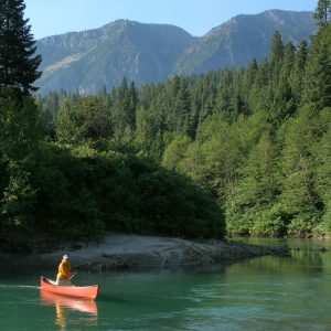
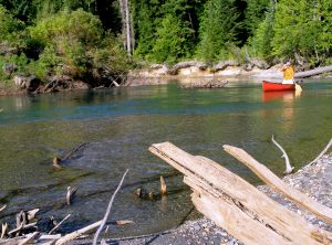
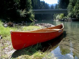
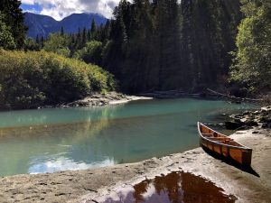
Chelan County has no waterways qualifying for the federal designation of being a “Wild and Scenic” river. Our closest contestant may be the White River, flowing 33 miles from the eastern boundary of the Glacier Peak Wilderness into Lake Wenatchee. In summer, the name of this river would seem a misnomer. Instead of being white, the glacial till saturating the water reflects both forest and sky and takes on a beautiful blue hue. Couple that with dramatic cliffs and peaks confining the blue water and you’ll be hard pressed to find a prettier river.
Even though a dirt road follows the river valley upstream for 10 miles on the lower stretches of the White, the thick riparian vegetation and tall timbered forest essentially erases awareness of the road’s existence. Add to this the hundreds of birds you will see and the dozens of salmon you might see and the setting actually feels more like the type of river you’d encounter in northern British Columbia or Southeast Alaska.
So while ‘Wild and Scenic’ the White may not be, wild and scenic the river surely is.
Details: Paddling the Lower White River
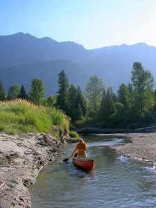
A superb introduction to the natural beauty and teeming wildlife of the White River is to paddle the final six miles of the river before it enters Lake Wenatchee. For canoeists and kayakers with intermediate paddling skills, this meandering stretch of water offers a surprising sense of wildness. Stop on some of the sandbars found along the way and study the tracks – you’ll find the prints of deer, bear, raccoons, coyotes, geese, ducks, shore birds, and songbirds. Views beyond the aqua-colored river vary from sheer, gray-walled peaks to silver-snagged marshlands. Meanwhile, the constant presence of sweepers, logjams and submerged makes the river an obstacle course to navigate. This adds very real danger, but also excitement to Chelan County’s version of a wild and scenic river.
Trip Distance: Roughly seven miles (6 river miles, 1 lake mile).
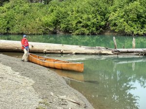
Difficulty: Intermediate paddling skills are important for the White River. Even though there’s no true whitewater, this is NOT a river for novices or beginners. The current is swift and many hazardous sweepers, submerged logs, and logjams (both natural and man-made) are passed along the way. In many places, you need precise maneuvering skills to thread narrow gaps flanked by logs or branches. In other places, you may need to pull over quickly to walk around a blockage spanning the entire river. Paddlers should be adept with forward and backward ferries to position their boats as well as with draws, braces, and rudders to turn quickly.
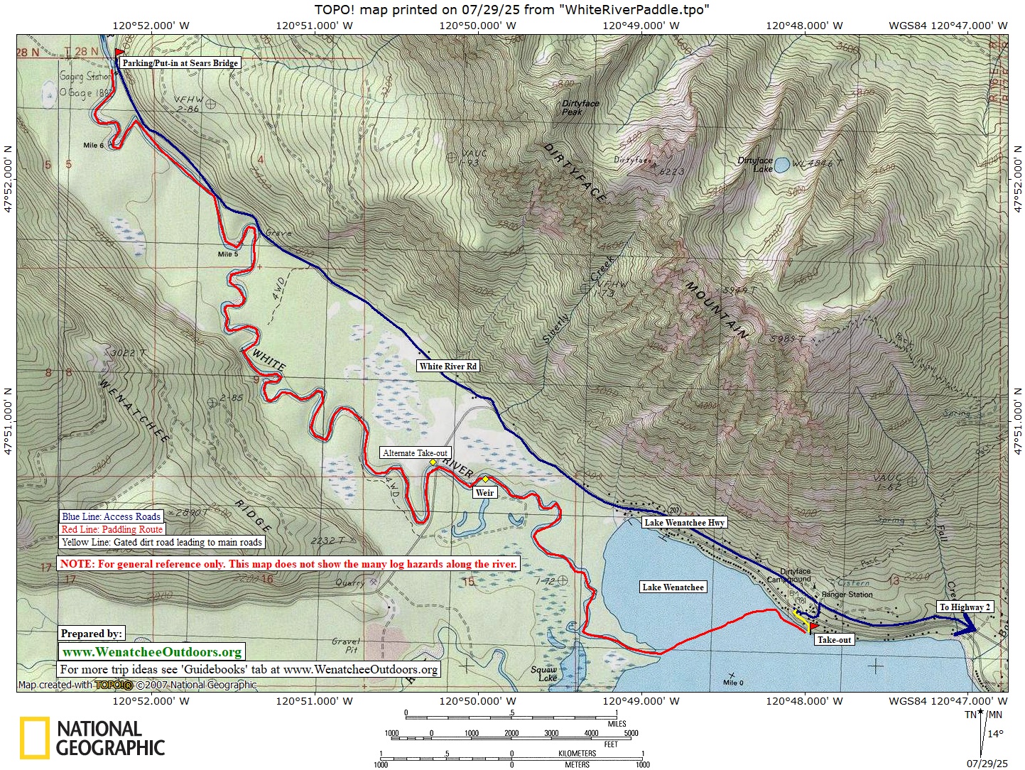
Map: Use the map printed with this article.
Recommended Season: mid-July through mid-September. With its flat grade, this section of the river holds enough water to accommodate paddlers throughout the summer. On September trips, you may scrape bottom occasionally or need to walk your boat over a shallow riffle. On the plus side, lower water allows for prime salmon viewing. If salmon are in the river, please don’t walk on the gravel beds where they are spawning – float over them or walk on the beaches beside the gravel beds.
Access to Take-out: Drive 14 miles west of Leavenworth on Highway 2 to Cole’s Corner (Milepost 84.7) and turn right (north) on Highway 207. Zero out the odometer and follow Highway 207 (the Lake Wenatchee Highway). At Milepost 4.4 the highway forks–go left, staying on the highway which runs along the north side of Lake Wenatchee. At Milepost 8.8 (across the street from the turn into the Dirty Face Trailhead), turn left on an unnamed road and drive 100 yards toward the lake. At the intersection with North Shore Drive, turn right and drive 100 to 150 yards to an inconspicuous wide spot on the left side (lake side) of the road beside a rusted metal gate and beneath a large Douglas fir. This spot is between house numbers 17499 and 17515. Beyond the rusted gate, a 200-yard-long, unmaintained dirt road heads down to a cobblestone beach providing the take-out for this trip. If using a bike for your shuttle (recommended), leave the bike chained to a tree in the woods somewhere along this dirt road. Also, go down to the water and study the beach so you’ll recognize it at the end of your paddle. The wide spot in the road mentioned above is not a legal place to leave a vehicle if you’re planning a car shuttle. If you’re car shuttling, leave that vehicle along the unnamed road as you return to the Lake Wenatchee Highway.
Access to Put-in: After returning to the Lake Wenatchee Highway, drive to Milepost 10.5 and turn right onto the White River Road. Reset the odometer and drive to Milepost 2.5. Here, the road to Sears Creek branches off on the left and immediately crosses the river. Park on the left side of the White River Road in a pullout just upstream of the bridge. Carry boats 30 or 40 yards upstream of the bridge and follow a short, steep (and bushy) path to the river.
Trip Instructions
- Put in and paddle the river. In July, it’s likely to take 3 hours of easy but steady paddling to reach the takeout. In September, count on 4 hours of easy but steady paddling to complete the trip.
- Expect to find many dangerous sunken logs, sweepers, and logjams in the river. Skilled paddlers will be able to maneuver around most of these obstacles, but any given year there will probably be a few log jams requiring a short portage. The river changes yearly so even if you’ve paddled this stretch of water before, expect the unexpected.
- Roughly 5 miles beyond the put-in, you’ll reach the bridge for the Lake Wenatchee Highway crossing the river. This bridge can serve as an alternate take-out if you want a shorter trip or the wind has picked up and you wish to avoid the mile-long crossing of Lake Wenatchee to reach the take-out.
- About a third of a mile downstream of the bridge, the river flows over a small weir. Depending on the water level, the water flowing over the weir may be too shallow to float, so scout from the beach on river right. If you decide the water is too shallow, line boats around the weir on river right.
- At the mouth of the river, follow a northeasterly bearing to cross over to the north shore of the lake (roughly a mile of open water). Then, follow the shore in an easterly direction to the take-out.
Tips: 1) A bike shuttle (or jog) back to the car at the put-in is relatively easy, 4.8 miles long, and paved the entire distance. 2) The first few miles of the trip have several places where the river gravels and current are perfect for spawning salmon to build their redds in late summer. A salmon redd is a depression in the gravels of the river bottom created by a female. Each female excavates a few of these depressions and, during the one or two days when she actually spawns, she will deposit a few hundred eggs in each of her redds.
Bugs: From early July through the middle of August, mosquitoes can be an annoyance when you go ashore. Bring repellent. Also, take comfort in knowing that even if the bugs are bad ashore, they won’t be a problem once you’re paddling.
Land Designation. The riverbanks are a combination of lands owned by the Chelan-Douglas Land Trust (CDLT), Washington Department of Fish and Wildlife, U.S. Forest Service, and private citizens. From a fish and wildlife standpoint, the White is the most productive river in the county, which is why the CDLT has put considerable effort, resources, and funds into protecting 8.6 miles of the river’s shoreline. Some of these holdings are along this stretch of the river, some are farther upstream.
Andy Dappen is the founder of WenatcheeOutdoors.org and a former board member of the Chelan-Douglas Land Trust. Join him in supporting CDLT’s many projects that enhance our quality of life in Central Washington. (https://www.cdlandtrust.org/support-us/membership)