Icicle Ridge Traverse…and the Lonesome Hok Club
by Andy Dappen

 Early December and the snowpack is high and thin. Checking the regional snow and telemetry sites, the places to ski are few. The Stevens Pass environs are the obvious attraction so the few skiing options there will be crowded with addicts getting their first fix of the season.
During a chance encounter with Wenatchee lawyer, Kyle Flick, he comments, “You have a pair of Hok skis don’t you?”
I do and ask what he has in mind.
“A traverse of Icicle Ridge. With all the undulations, the Hoks would be perfect.”
Kyle thinks the Hoks (pronounced hawks), a permanently skinned ski, will keep us from constantly skinning and de-skinning while we span the many knolls along the ridge. I like the idea for other reasons. First these short skis are light and when used with lightweight leather telemark boots, the entire Hok kit is lighter than my normal ski-touring kit — a good thing considering we’ll be carrying skis a long way up to and down from skiable snow. I’m  also a big fan of the Hoks for early-season skiing because, used with a Tiak, a long pole you lean back on while descending, you can keep your weight in the back seat. If your skis plow into a rock or a stump you’re unlikely to take an over-the-tips digger onto some dagger hidden in shallow snow.
As we make plans, Kyle wonders who else can join us. That evening I learn the others I know who are so equipped are unavailable.

On Saturday morning at 6:30 a.m., we two members of the Lonesome Hok Club start up the Fourth of July Trail with skis on our back and microspikes on our feet. After a few hours, we hit snow but it’s so firm it’s easier to walk than ski. Around 11:00 a.m. we reach the broad, swoops of Icicle Ridge and turn south. The 15-inch snowpack is firm in places, breakable elsewhere so we don the skis. We cover the next five miles along the ridge and the initial descent of the Icicle Ridge Trail efficiently. As Kyle suspected, the rolling terrain is perfect for the Hoks – we save time on all those time-consuming skin transitions. Meanwhile for me, there’s comfort leaning back on my Tiak as we descend among the many rocks, stumps, and logs littering the shallow snowpack.
About four miles from the Icicle Ridge Trailhead, the snow becomes too bony to ski safely. Skis go back on the pack. Happily I tramp downward wearing my lightweight leather boots rather than adding the crushing load of plastic boots to my shoulders. Ahhh, the pleasure of walking with a light pack – especially when you’re tired. Membership in the Lonesome Hok Club has its privileges.
Details, Details: Icicle Ridge Traverse
 While the description above focuses on doing this ski traverse with Hok skis, it is easily done with regular Alpine touring or telemark ski gear. Metal-edged skis with no-wax bases — like the Altai Kom, Voile Ultra Vector BC or Karhu XCD Guide (no longer made) and mounted with Alpine touring or telemark bindings also make this undulating traverse simpler.
Nearest Town: Leavenworth.

Skill Level: 2 for the ridge, 3 for descending the Icicle Ridge Trail.
Fitness Level: 3+ as a day trip.
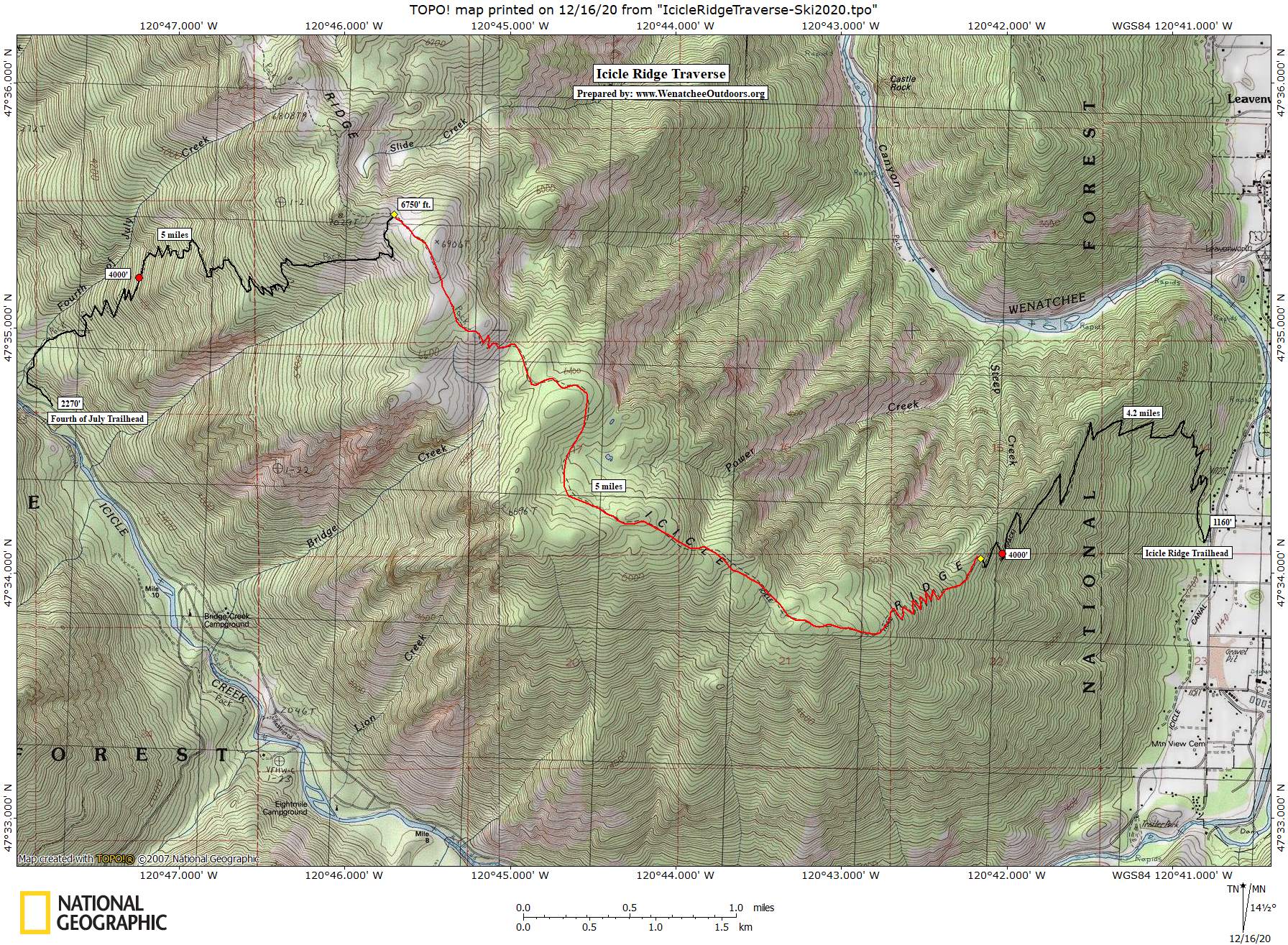
Distance: A total of 14 miles. It’s five miles from the Fourth of July trailhead to the ridge proper, five miles along the ridge until the skiing got too sketchy for us, and four more trail miles down to the Icicle Ridge Trailhead and the shuttle car.
Elevation: The route gains 5,000 vertical feet and loses 6,100 vertical feet.
Access: For this traverse you’ll want a car at each end. To reach the Icicle Ridge Trailhead, leave Highway 2 at the Icicle Junction in Leavenworth and follow the Icicle Road 1.4 miles. The parking lot is to the right and marked with a small sign saying “Icicle Ridge.” Leave a 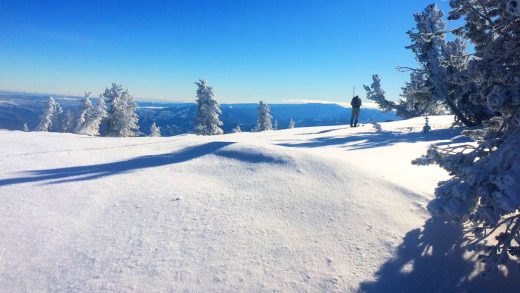 shuttle car here; then continue driving up the Icicle Road an additional 8.2 miles to the Fourth of July Trailhead (also on your right). Once the heavier snows of winter arrive, you’ll only be able to drive 7.1 miles up the Icicle Road to Bridge Creek where the plowing ends. This adds another 1.1 mile of fairly flat road skiing to reach the Fourth of July Trail.
Maps: View our map of the route.
Additional Information. Chester Marler also has a post in the guidebook about skiing this route much later in the season (March). Read that report.
Fees/Permits: Northwest Forest Pass required to park.
Trip Reporter: Andy Dappen, December 15, 2020.
Leave It Better Than You Found It. This should be every outdoor user’s goal. Pick up trash left by others, pull some noxious weeds along your route, throw branches over unwanted spur trails, don’t ride or walk wet trails when you’re leaving ruts/footprints deeper than ¼ inch…
Disclaimer. Treat this information as recommendations, not gospel. Conditions change, and those contributing these reports are volunteers–they may make mistakes or may not know all the issues affecting a route. You are still completely responsible for your decisions, your actions, and your safety. If you can’t live with that, you are prohibited from using our information.