
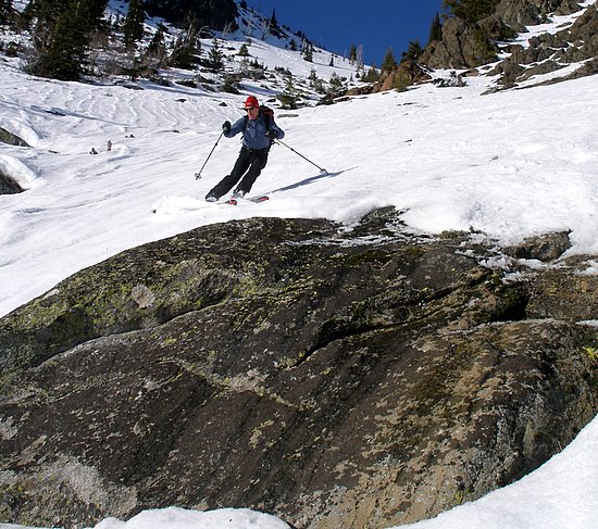
For backcountry skiers, much about a safe and enjoyable day of touring is wrapped up in the decision of where you ski. Knowing something about the general avalanche hazard in the surrounding mountains, the amount of new snow, the wind conditions, and the oncoming weather for the day ahead are all important in deciding upon the best place to ski.

In fact before you even leave home, matching the conditions of the day to an appropriate trip can make all the difference in whether the avalanche risk before you can be easily managed or whether you’re playing Russian Roulette with loaded slopes. It can also make all the difference in whether you’re slogging through storms with almost no visibility versus skiing sunshine, or whether you’re skiing slopes coated with a few inches of powder versus busting through breakable crust.

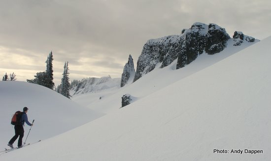
More than almost any place in the country, Central Washington has a choice of extremes and in-betweens. For extremes, we have the two very different snow and climatic conditions of Stevens Pass to the west on the Cascade Crest and Blewett Pass/Mission Ridge over 40 air miles east of the crest. Stevens Pass averages over 470 inches of snow per year. This area is characterized by more snowy weather than sunny weather, relatively warm winter temperatures (most winter days range between 25 and 35 degrees Fahrenheit, and a classic maritime snowpack where winter avalanches are most likely to occur on the day following a storm.
The BlewettPass/Mission Ridge environs, meanwhile, log around 160 inches of snow per year, receive copious amounts of sun, and have colder temperatures (often 10 degrees colder). With the thin snowcover and the colder temperatures, the snowpack sometimes mirror continental conditions and can form temperature-gradient snows that can be unstable for longer periods of time.
Finally the Icicle and Entiat canyons are ‘tweener snowpacks. Expect snow depth here to be closer to be 50 to 60 percent of the snowpack at Stevens Pass.
What Does This Mean?
On almost any given winter or spring day, the diversity of ski countries found here in Central Washington allow you to 1) lower your avalanche exposure and 2) find enjoyable snow conditions.
Some examples:
1) 18 inches of new snow just blanketed Stevens Pass. This probably translates into very slow travel conditions and significant avalanche hazard around the Cascade Crest. At Blewett Pass, however, the new snow may measure-in at 6 inches, making the new snow far more manageable for covering distance and moderating the avalanche hazard.
2) No new snow has fallen for a week. If daytime temperatures have remained below freezing, the Stevens Pass backcountry could be stellar – especially on north-facing slopes. However, if daytime temperatures have been warm, the slopes around Stevens may be gloppy or even crusty. The significantly colder north-facing slopes around Blewett Pass or Mission Ridge, will probably offer much better powder skiing conditions.
3) There’s been a foot of snow at Stevens Pass and only 2 inches of new snow at Mission Ridge (not unusual). Avalanche hazard may be high at the crest while the skiff of new snow at Mission may be disappointing. This might be a good ‘tweener day up Icicle Canyon where the 6 to 7 inches of new snow on Eightmile Peak or Cannon Mountain may be the right mix of lower slide hazard but higher snow quality.
How Can You Monitor All This?
WenatcheeOutdoors has several tools to help you quickly monitor weather and snow conditions around the region. Under the ‘Condition Reports’ heading see the ‘Weather & Road’ link. In the matrix that displays, the right-hand column (Ski Area Weather) let’s you access a weeklong forecast for backcountry destinations around the region. Click on the different links for Stevens Pass, Blewett Pass, and Mission Ridge. While looking at these forecasts, you may also double click on the Google map inside these forecast and get a forecast that’s tailored to a more specialized region, like Mt. Stuart.
After getting a sense of the expected weather, open up the ‘Winter Reports’ matrix (also in the Condition Reports area). The right-hand column (Avalanche Info and Telemetry) is particularly important for monitoring snow conditions. The upper links to Avalanche-Eastside and Avalalanche-Stevens give you the generalized avalanche report for the East Slopes of the Cascades and for the Cascade Crest around Stevens Pass. Spend a fair amount of time learning how to read and interpret these reports.
 As a very general rule when the hazard is rated 2 (moderate) or 3 (considerable), smart tour selection and terrain usage (sticking to forests and ridges, choosing aspects registering lower hazard, choosing elevation levels with lower hazard, etc.) can allow you to get out and enjoy a tour with good turns without exposing yourself to undue risks. Until you really know your stuff, when the hazard hits 4 (high) or 5(extreme), opt to downhill ski or Nordic ski on a groomed trail system.
To further understand what’s going on around the region and where to spend the day touring, use the telemetry sites at Stevens Pass, Mission Ridge, and Tumwater Mountain, and compare what’s going on at the same general elevation (around 4,000 feet) with temperatures, wind strengths, wind directions, total snow accumulation, and new snow. Some of these sites give data for multiple elevations, so also study what’s going on at higher elevations. The telemetry site at the bottom of our column ‘WA State-All Mtn Weather Sites‘ is especially valuable for letting you monitor the region–it gives you links to graphs for each weather site that is much easier to analyze. From this one site you can see weeklong graphs of what’s taken place at Stevens (On the Pacific Crest) , at Tumwater Mountain (20 miles west of the crest) and at Mission Ridge (40 miles west of the crest). Note: one problem with this link is that after clicking the telemetry site you want to see, you’ll need to scroll down to find the actual graphs.
When looking at these graphs, the safest region to ski is often obvious. And while safety should be the overriding factor in where you decide to ski, on those days when the entire region has rather uniform hazards (not unusual) the telemetry data can help you see where the skiing will be best, what aspects you might want to ski (or avoid), and the elevation you might want to ski (or avoid).
Once you’ve decided on a general destination (Stevens Pass, Icicle Canyon, Blewett Pass, Mission Ridge area), open up our online Skiing-Backcountry guidebook and use the geographic locators and the tour difficulty numbers to identify possible tours.** Study the topographic maps associated with those tours and make sure the aspects and general terrain match up with what you know about avalanche hazards and/or snow conditions. When you find a tour meeting all these qualities, print the route info and the topographic map. You’re good to go.
**Note: At the side of the the online guidebooks, a search box helps users narrow down the selections. For example, if you want to see all the Blewett Pass area ski tours, click the Blewett Pass check box and the total number of ski tours will be filtered down to that area.
This post by Andy Dappen was originally published on 11/22/09.
