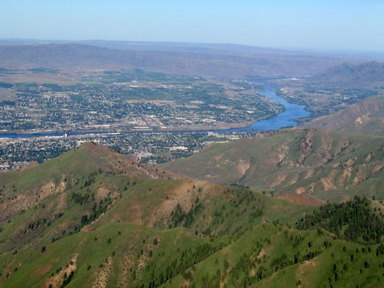
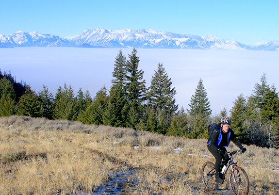
Scenic, forested, and very close to Wenatchee. Cool in summer. Wonderful wildflowers in the forests and meadows and on the summit’s rock terrain.
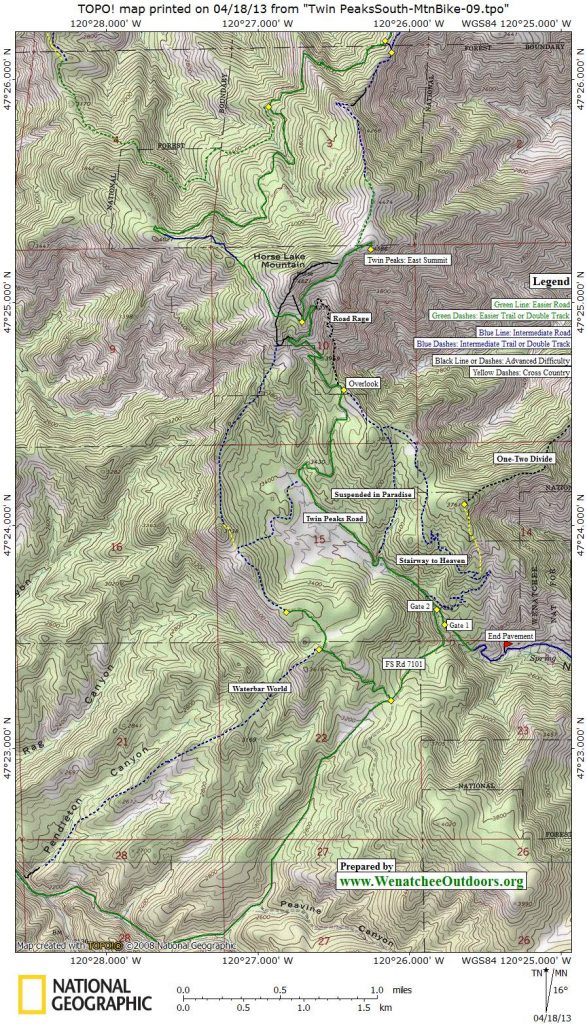
Maps: View our topo map below. 7.5-minute quad for Monitor.
Note: use ‘Print Preview’ before printing to properly scale this map to a full sheet of paper.
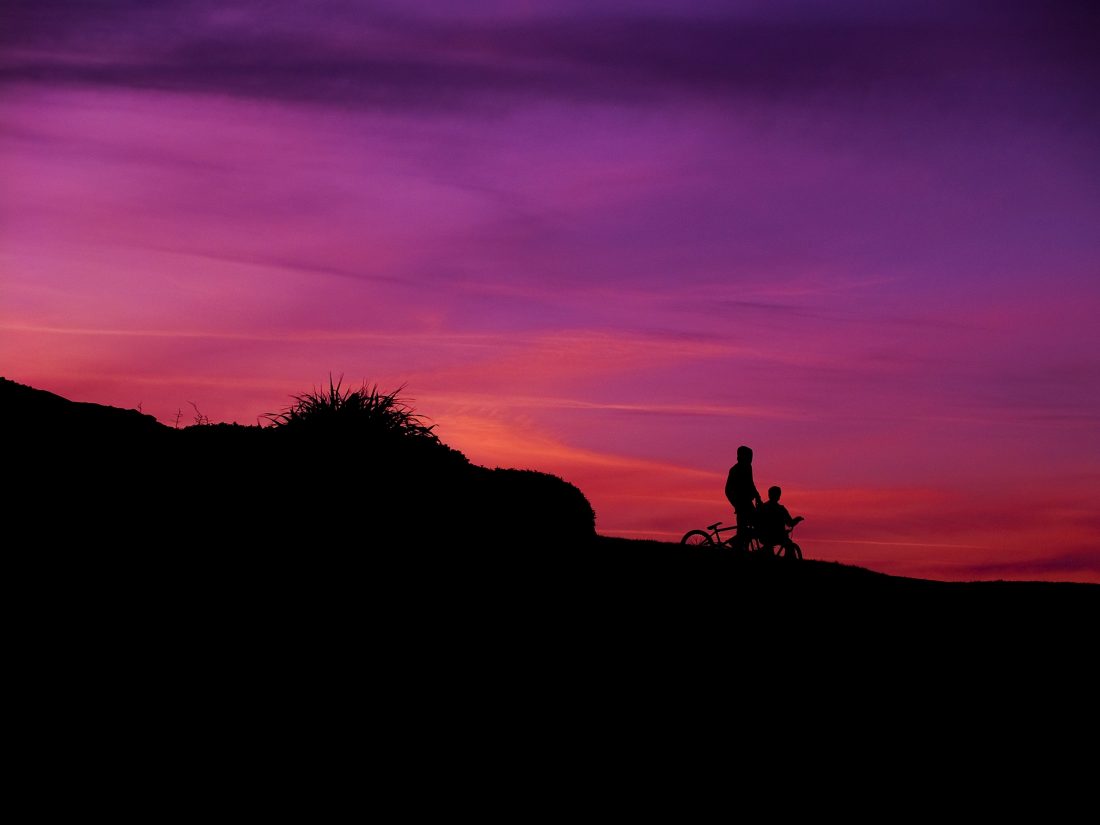
Activity: Hiking, Mountain Biking, Wildflowers, Trail Running, Family Fun
Nearest Town: Wenatchee
Skill Level: HIKING: 1, TRAIL RUNNING/MTN BIKING: 2
Fitness Level: 2
Distance: 7 miles
Elevation: 1,600 feet
Recommended Season: Most of the spring, summer or fall. This is a particularly nice escape during the heat of summer—it’s usually surprisingly cooler up here than expected.
Access. From the southern end of Western Avenue in Wenatchee, hook right and drive up Number 2 Canyon. About 4 miles up the road the pavement ends. Low clearance vehicles should park here (turn around and, facing downhill, park in the small paved pullout on the right side of the road). High clearance vehicles can drive another 0.7 miles up the dirt road and park at the gate blocking a road going straight ahead (FS Road 7101 hooks sharply left here). You’ll be walking past the gated road. Elevation here is 2,940 feet.
 Trip Instructions:
(If you parked at the end of pavement, walk the dirt road 0.7 miles to the gate that high-clearance vehicles can drive to — see the access info above. If you’re biking zero out your odometer here so it corresponds with the mileage figures below).
— Walk around the gate and follow the road. As a general rule you’ll be staying on the larger, better-better traveled road whenever you encounter a spur.
–0.5 mile: The road hooks left by an old foundation (on the left of the road). Notice the trail taking off on the right. This trail is called Suspended in Paradise and is a more advanced trail you can explore another day. Stay on the main road as it hooks, climbs, and comes into the bottom of Big Meadow.
–1.85 miles: The road passes the Canyon Number One Overlook. The overlook is just to the right of the road and is a nice place for a rest and a view. It is also where the Suspended In Paradise route reconnects with the main road (to connect with the trail, follow the ridge in a SW direction). After your stop, get back on the main road and climb on.
–2.85 miles (4,280 feet) you’ll reach a Y immediately beyond a shoulder with an expansive view over the surroundings. The left road contours and can be used for a tour to Cashmere—see the Cashmere via Twin Peaks and Butler Ridge ride. Take the right road for this trip.
–3.3 miles a single-track spur branches right and goes directly to the East Summit (another 0.15 mile). This is easy to miss—worry not if you don’t see it.
–3.35 If you miss the single-track, you’ll come to a Y. The left road goes to the north side of the mountain and can also be used to ride to Cashmere via a more difficult route. Stay right and ride the road to the East Summit (4,585 feet).
–RETURN TRIP: Follow the road back down or, when you get back to the Canyon Number One Overlook, use our map to ride Suspended in Paradise. This trail requires more skill (For mountain bikers it is an intermediate trail).
Cons/Hazards:
You’re following a dirt road, which is never as scenic or intimate as a path.
Misc:
This area can be the launch point for quite a few different trips. Get to know the general area by using this main road first.
Issues:
Stay on established trails. Do not take routes that are obviously damaging to the terrain. Some mountain bikers are blazing unsustainable trails as they ride straight down ridgelines and hillsides. These trails become rutted water courses that erode badly when it rains (and during winter runoff). This creates a PR problem for mountain biking groups that are trying to work responsibly with the Forest Service.
Uses Allowed: Hiking, trail running, horseback riding, mountain biking. In winter: snowshoeing and cross-country skiing.
Uses Not Allowed: Wheeled motorized vehicles are not allowed on the road when the gate is closed. In winter the road is closed to wheeled machines but open to snowmobiles.
Land Designation: Forest Service
Fees/Permits: None
More Info/Links: See our other Twin Peaks entries
Trip Reporter: Andy Dappen 6/05

Leave It Better Than You Found It: This should be every outdoor user’s goal. Pick up trash left by others, pull noxious weeds along your route, disperse old fire rings (they encourage more fires), throw branches over spur trails and spurs between switchbacks (make it harder to do the wrong thing than the right thing).
Important Disclaimer: Treat this information as recommendations, not gospel. Things change, conditions change, and those contributing these reports are volunteers–they may make mistakes, fail to give complete information, or may not know all the issues affecting a route. So forget about finger pointing: If things go wrong, you are completely responsible for yourself and your actions. If you can’t live with that, you are prohibited from using our information.