
Report and and photos by John Plotz
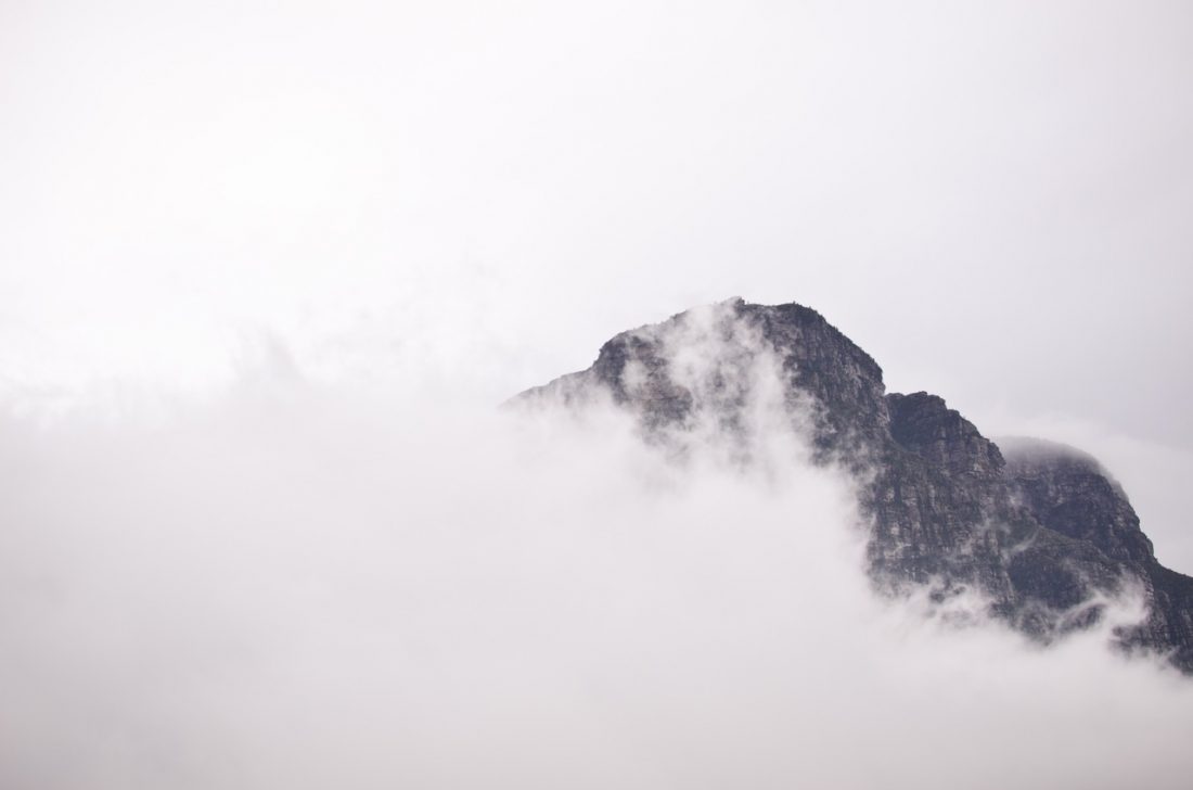
From Colchuck Lake, the girth of Dragontail Peak is enough to make anyone feel small and insignificant. Studying the massive walls of this peak, a climber’s eye is immediately drawn to the twin black buttresses of the Serpentine Arete and its harder cousin to the north, Backbone Ridge.
Climbers usually allot 12 hours to climbing the Backbone Ridge, but this will be my fifth time climbing it (second this year) and Kyle Flick’s fourth time, so the two of us expect to ascend it much faster this time around.
We leave the car around 4:30 a.m. and, just as we’ve done a dozen times this year, reach Colchuck Lake exactly 2.5 hours later. Some people spend hours on a treadmill each week — Kyle and I hike up Colchuck Lake.
We walk around the lake, hike up the moraine deposited below the Colchuck Glacier, and cross 100 feet of rock-hard snow with boulders littering the run-out zone below us. With no crampons, we gingerly hop between the rocks imbedded in the snow until we reach safety. Next, we solo up the scrambling section of the lower part of Backbone Ridge, which is about 600-feet long, passing two parties along the way. Soon we’re at the base of the first business pitch: A 70-foot-long, 6-inch-wide, off-width crack rated 5.9.
Usually this pitch is protected with a 6-inch Camalot or Friend. The downside to bringing a monster camming device is that there is no use for the cam after this first pitch, so climbers end up hauling this deadweight the remaining 1,400 vertical feet up the peak. I have been telling Kyle recently that the crack feels solid enough to leave the big dog behind–it’s time to show some backbone and lead the pitch without the pacifier. That means I’ll be faced with about a 40-foot runout.
I get into a rhythm at the start of the off-width. In this case I’m stuffing my left leg and arm as far into the crack as possible, and smearing my right foot out against the opposing wall. I pass the last feature I can protect, a small chockstone, and commit to the next 40 feet. At times, I feel the exposure and it plays games with my mind and confidence. I concentrate on staying relaxed–tensing up will only lead to fatigue, failure, and a LONG fall!
I find I make better progress if I don’t keep looking up at where I want to be. By simply focusing on the moves before me, I move steadily skyward and, suddenly, I’m high enough to sink several beautiful pieces of protection near my left shoulder. Then, I scurry upward another 15 feet and establish a belay. I haul up our packs, belay Kyle up to the stance, and then we’re really off to the races.
Over the years, we’ve managed to find variations that are clean yet challenging. The key is to stay just left of the crest. The third pitch features a fun, thin crack that turns into an ugly off-width after 60 feet. We’ve found you can avoid the off-width by stepping some 10 feet left into a clean, perfect layback crack that’s just north of the ridge.
After our fourth pitch, we unrope and solo up to the Fin. The Fin is a very distinguishable landmark on Dragontail, is easily seen from Colchuck Lake, and offers what may be the finest, most spectacular climbing on this mountain. The exposure up here is fearsome: You look straight down thousands of feet on the trail winding up to Asgard Pass and out upon a ragged skyline dominated by Cashmere Mountain, Eightmile Mountain and Mt. Stuart. For some sick reason, Kyle and I have made it our tradition to solo across the Fin before we rope up. This is not hard climbing, but the consequences of a mistake here demands that we test every hold. With this kind of exposure, you still never entirely trust the tested holds.
We reach the traditional spot where we rope-up and Kyle takes off up cracks and an easy corner. The second pitch takes me up perfect twin cracks to the left side of a solid pillar. I jam and lieback this feature to a lovely belay ledge. Kyle then sprints off on the third pitch, which also has nice double cracks ending at a pillar that requires steep face-climbing to surmount. Finally, we reach the crux of the Fin, a 5.9 undercling.
I’ve led the undercling before and have usually been rattled by exposure and fatigue. This time, each move feels measured and controlled. This allows me to get good rests and place solid protection around the hardest moves. Then, I make the final scramble to the top of the Fin and bring Kyle up on belay. We unrope and breeze up the last 500 feet to the summit where we check the watch: We’ve climbed the backbone of this monster wall in seven hours.
We enjoy the precipitous setting of the summit and agree amongst ourselves that we’ve finally got this route and the best variations wired. Between the route’s length, spectacular setting, and rock quality, we’re also in agreement that Backbone Ridge deserves its status as a Northwestern classic.
Details, Details: Backbone Ridge
Difficulty: Grade IV, 5.9. The route ascends 2,000 vertical feet of rock, dishes out a fair bit of 5.8 and 5.9 climbing, and is broken up by a lot of 4th-class climbing. Climbers need to be proficient, efficient, good route finders, in good shape, and able to travel light if they don’t want to get sandbagged by this route.
Descent: Scramble off the back side of Dragontail Peak, first on bare ground heading southeast and then on moderately steep (and sometimes very firm) snow descending east toward Asgard Pass. From Asgard Pass, follow the hiker’s trail down to Colchuck Lake.
Climbing Equipment. A standard rack covering placements up to 3 inches. Also include a few large pieces (5 to 6 inches) for the off-width pitch(es). Unless you’ve got good beta about the snow conditions, aluminum crampons and/or a lightweight ice axe are also recommended for the approach and the descent.
Recommended Season. June through September.
Hazards. The normal stuff—death by stupidity, storm, bad luck, and/or bad karma. Also, this is a relatively popular route and there is very real rockfall hazard if climbers are above you. Be ready to climb another route (or even another peak) if there’s too much company out ahead of you.
Access: Hike to Colchuck Lake, skirt the west side of the lake following a confusing maze of rougher trails, hop across the boulders on the south side of the lake, and then climb up the talus and scree leading toward the top of the moraine deposited by the Colchuck Glacier. Access the toe of the route at about the 6,800-foot level.
Trail and camping information. The details of hiking to Colchuck Lake, the trailhead passes needed, the camping permits required, etc., are covered in our hiking guidebook description of Colchuck Lake.
Map. View our topographic map of the area below.
Strategy. Because permits are required to camp at Colchuck Lake and these permits are hard to come by (call the Wenatchee National Forest at 509-548-6997 for permit details), many climbers tackle the route as a day climb. Get going early by headlamp, be in good shape, and expect to exit in the dark. If you’re worried about completing all this in a day, you might consider hiding a summer-weight sleeping bag and a bivy sack at the lake as you pass through in the morning. This will give you options if you return to the lake after dark and you’re physically spent.
Additional Info. More detailed climbing information and topos of the route can be found in Selected Climbs in the Cascades: 1 (Nelson and Potterfield) and the Cascade Alpine Guide: 1 (Fred Beckey).
Leave It Better Than You Found It: This should be every outdoor user’s goal. Pick up trash left by others, pull some noxious weeds along your route, throw branches over unwanted spur trails, don’t ride or walk wet trails when you’re leaving ruts/footprints deeper than ¼ inch…
Disclaimer. Treat this information as recommendations, not gospel. Conditions change and those contributing these reports are volunteers–they may make mistakes or not know all the issues affecting a route. You are responsible for yourself, your actions, and your safety. If you won’t accept that responsibility, you are prohibited from using our information.

