
Lower Icicle Creek: Snow Creek Trailhead to Leavenworth Hatchery
Attractions: The Lower Icicle Creek is a great short run that can be paddled as a warm up for those thinking about running the middle Icicle Creek section or as a supplement to a day on the Wenatchee. You’re always close to the road on this run so in a real emergency exiting the river on the left is possible, but most of the land is private so use discretion if you need this option.
Distance: 2.2 miles
Difficulty: Class IV+
Skill: 4 (expert).
Fitness: 3 (advanced)
Average Gradient: 91 fpm
Gauge Information:
Min Sug. Level: 700 cfs
Max Sug. Level: 2000 cfs
From April through early July when the Icicle is usually paddled, local paddlers estimate the Icicle’s flow to be about 20 percent of the Wenatchee River at the Peshastin Gauge. That means you should be looking for flows on the Wenatchee at Peshastin to be running between 3,500 to 10,000 cfs.
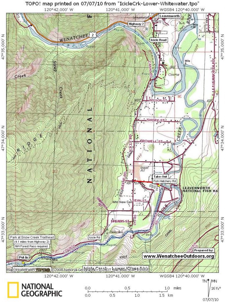
Maps: See map below for more information.
Access:
- From Highway 2 mile 99.1 (the west end of Leavenworth) turn on to Icicle Creek Road.
- Follow the road up 2.1 miles and take the turn-off for Hatchery Road (just across from this turnoff you’ll find the Homefires Bakery which is a traditional paddlers stop).
- Follow Hatchery Road 0.2 miles to its end and park at the fish hatchery.
- To reach the put-in, head back out to Icicle Creek Road and continue up the canyon to mile 4.1 and the Snow Creek trailhead (you’ll need a Northwest Forest Pass to park here, otherwise find a spot along the road).
Trip Description: This description of the river come from this link at American Whitewater:
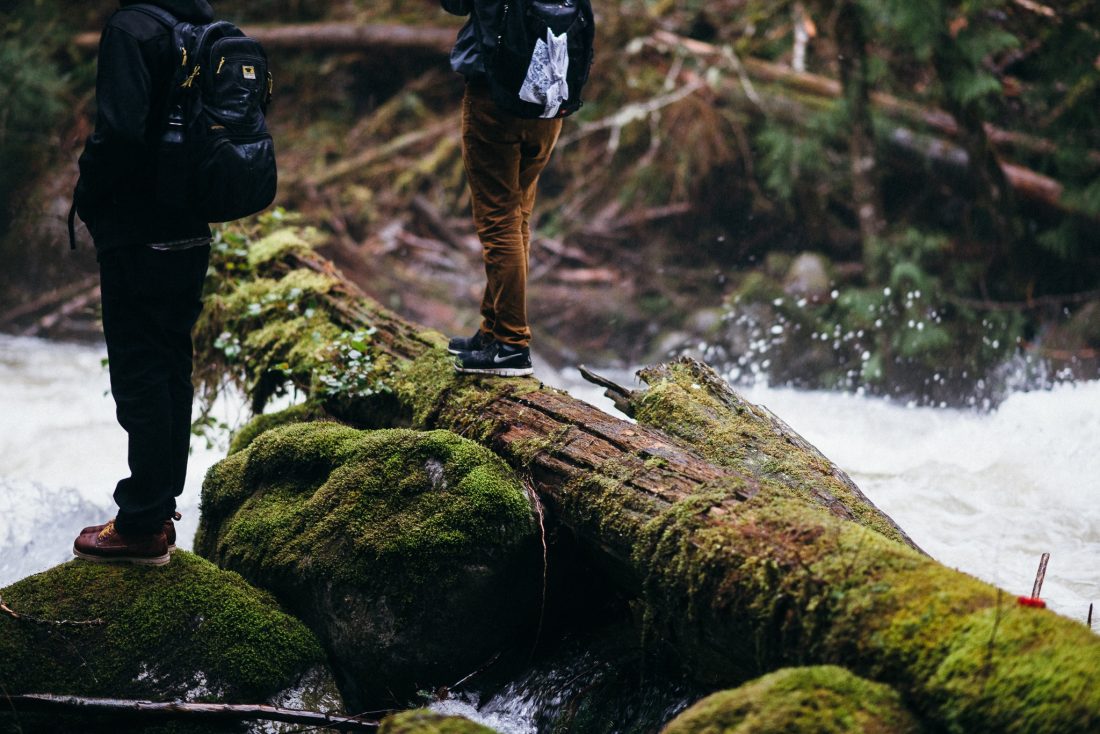
“ The run starts at the Snow Creek trailhead. Looking upstream the river crashes through an impressive jumble of very large boulders. It’s good fun to pick your imaginary lines through the maelstrom, and then scramble down the rocks to a put in as close to the base as you want.
The river kicks off right away with a great rapid that ends just under the trail bridge (you can scout it out beforehand by walking down the first hundred yards of the trail from the parking lot). If you enjoy this first rapid be prepared for plenty more, but if you’re already feeling a little shakey it’s an easy exit back to the parking lot.
As you continue past the bridge head left to scout the next challenging sequence. You’ll see a horizon line indicating it’s time to scout. The sequence of ledges and boulders can form a couple of good-sized holes so pick your line and hang on or make the quick portage around.
After this drop the river continues for another mile and a half of constant class IV+ action. Most of it can be boat scouted although there may be a couple spots where you want to have someone take a peak for wood or check out the hole that sits at the bottom of many of the chutes and ledges.
One potential hazard to be aware of is the first of the dams on this run (you can scout it out beforehand by walking down the first hundred yards of the trail from the parking lot). It comes about 2/3 of the way through the run and is a couple feet high. It can be portaged on the right. Alternatively you can run it, but check out the hydraulic at the base and pick your line carefully. A rock near center right breaks up the backwash and a boof right up against this rock makes a nice line.
The river continues with more fun rapids before slowly tapering off as you reach the fish hatchery dam. The dam backs up the river into a long pool about 1/4 mile in length. Paddle past the intake structure on your right and continue down the pool to the dam. Use caution as you approach the takeout above this second dam. This dam is considerably larger (about a 30′ drop) than the first with a very nasty hydaulic at the base. You do not want to run this thing so give yourself plenty of space to get out safely (either right or left). The take-out options up the steep muddy bank don’t get any easier as you get close the dam.
Hazards. All the usual suspects for advanced whitewater: holes, boulders, spillovers, sweepers, strainers…
Current Conditions. River conditions are subject to change, especially after storms or floods. For more the most up-to-date and detailed information or to view photos and user comments, check this river’s information at American Whitewater or call Leavenworth Mountain Sports to find out what locals are reporting ((509) 548-7864).
Help us out! If you have a detailed account of running this section of river, please submit it to the editor at WenatcheeOutdoors.org
Leave It Better Than You Found It: This should be every outdoor user’s goal. Pick up trash left by others, pull some noxious weeds along your route, throw branches over unwanted spur trails, don’t ride or walk wet trails when you’re leaving ruts/footprints deeper than ¼ inch…
Disclaimer. Treat this information as recommendations, not gospel. Conditions change and those contributing these reports are volunteers–they may make mistakes or not know all the issues affecting a route. You are responsible for yourself, your actions, and your safety. If you won’t accept that responsibility, you are prohibited from using our information.