
Lower Nason Creek (Merritt to the Wenatchee River)
Attraction. A lush, green stream with cellophane-clear water, abundant birdlife, and piles of driftwood that make this waterway feel more like a West Side creek than an East slope river. Lower Nason Creek offers a few trip options of different length — one of these options will appeal most to whitewater kayakers, another should interest canoeists who enjoy downriver boating and want to extend a trip down the Upper Wenatchee.
 Description. Lower Nason Creek is primarily a class II run along the Highway 2 corridor east of Stevens Pass between Merritt and Lake Wenatchee. This section of river, as we describe it, breaks into thirds. The highest third is narrow and intimate, has abundant wildlife, and is mainly fast-flowing water sprinkled with a few I+ or II- drops. The middle third contains the most whitewater and is not terribly fierce but is demanding in the manuevering required to avoid the many rocks and logs in or alonside the river. The lower third is rarely done but is very pleasant in its quiet ambience and its bird life — despite several mandatory portages around logjams, experienced canoeists floating the Upper Wenatchee River should use this portion of the creek for a more adventurous put-in and add some extra miles to their day.
Distance: 4 to 10 miles depending on the put-in and take-out.
Difficulty: Class II+ or III-
Average Gradient: 60 feet per mile.
Gauge Information. Look for flows of 700-1500 cfs on the DOE Nason Creek gauge when the Wenatchee is between 8,000 and 13,000 cfs (based on Bennett). USGS gauge Wenatchee at Peshastin (also available through the NOAA hotline 206-526-8530). At the higher limit of flows this run becomes fast and continuous.
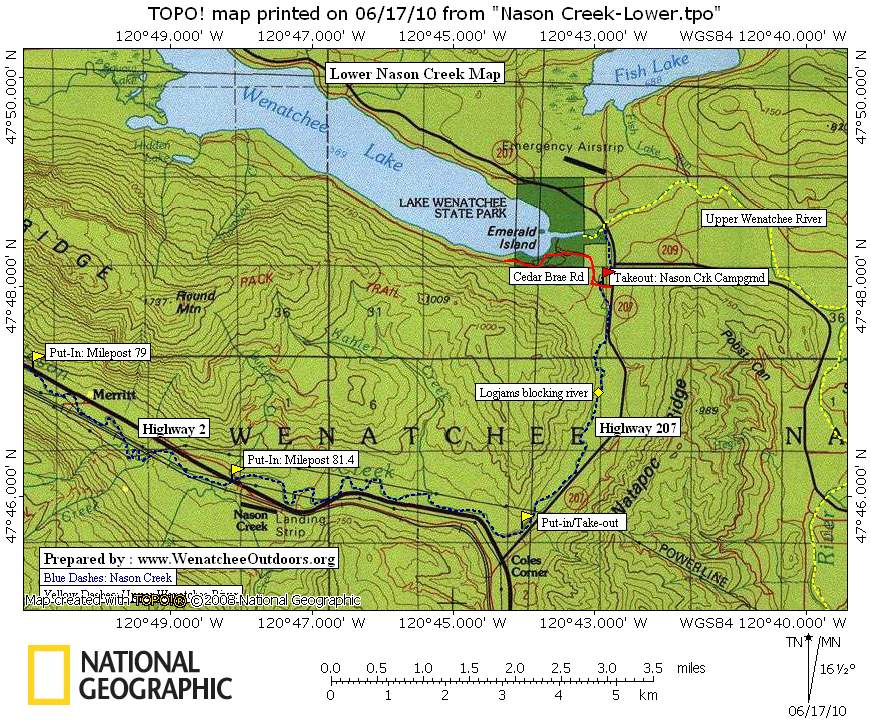
Put-in(s) and Take-Out(s)
- Milepost 78.6 along Highway 2. This is the highest put-in.
- Milepost 79 along Highway 2. There is a large pullout on south side of Highway 2 and easy river access. This is the recommended put-in if you want to float the upper portion of this stretch of creek.
- Milepost 81.4. Put-in at the small bridge where Highway 2 crosses Nason Creek. This is the preferred put-in by those mainly interested in a more concentrated dose of whitewater. The whitewater stretch is short, but there are many small holes, waves, and eddies where Class II and Class III boaters can play and develop their skills.
- Milepost 84.4 and milepost 84.8 (Cole’s Corner) along Highway 2 . There are places here where the river comes along the highway where boaters take-out. Canoeists can also put-in here if they want to paddle down to the confluence and then float the upper Wenatchee.
After Cole’s Corner (the junction of Highway 2 and Highway 207), Nason Creek borders Highway 207 (the road leading to Lake Wenatchee). Mileages below refer to the driving distance from Cole’s Corner.
- Mile 0.35. A short dirt road leads to a gravel parking lot on the west side of the highway. Park here and put-in or take-out in a very small eddy that can be found 70 yards farther down the highway.
- Mile 0.45. There’s a good pullout on the west side of the highway and with some imagination you can figure out how to get on or off the river here (a bit tricky).
- Mile 2.25. Although you’re away from the road here, in 2010 there were several logjams in quick succession that required portaging. These are large longjam that will probably stick around for some time and will require some major flooding to flush away.
- Mile 3.7. Turn west onto Cedar Brae Road and in about a 100 yards there’s a bridge across Nason Creek. There’s an excellent take-out immediately downstream of the bridge on river right. Driving access is via the Nason Creek Campground (a Forest Service Campground) along sites 39 to 47. As of 2010 the cost was $17/night to camp here.
Map. See map below for more information.
Recommended Season: Late spring during the snow melt. In general terms there’s roughly a month between mid May and mid June when the creek is in shape.
Hazards. Woody hazards (log jams, sweepers, strainers) are always a worry on this stretch of river. Normally the upper two-thirds of the run we’ve written about is clear or has ways around partial blockages. This, however, can change yearly. In fact, one wind event can cause a blowdown that immediately changes the wood hazard so, even if you’ve heard the run is clear, keep your eyes downstream and be ready to move to shore. The final third of the river run we’ve written about has several mandatory portages around log jams that completely block the river (three portages in 2010). To get updated river information check our ‘River and Lake Levels’ Condition Reports (scroll down this page until you reach the User Report area) or call Leavenworth Mountain Sports (509-548-7864) and ask what they’ve heard.
Additional Information. See the American Whitewater website. River conditions are subject to change, especially after storms or floods. For more the most up-to-date and detailed information or to view photos and user comments, check this river’s information at American Whitewater.
Got Updates? If you have updated information about the river, please submit comments to the editor so we can update this information and/or our condition reports.
Trip Reporter and Date. Prepared by Andy Dappen, June 2010.

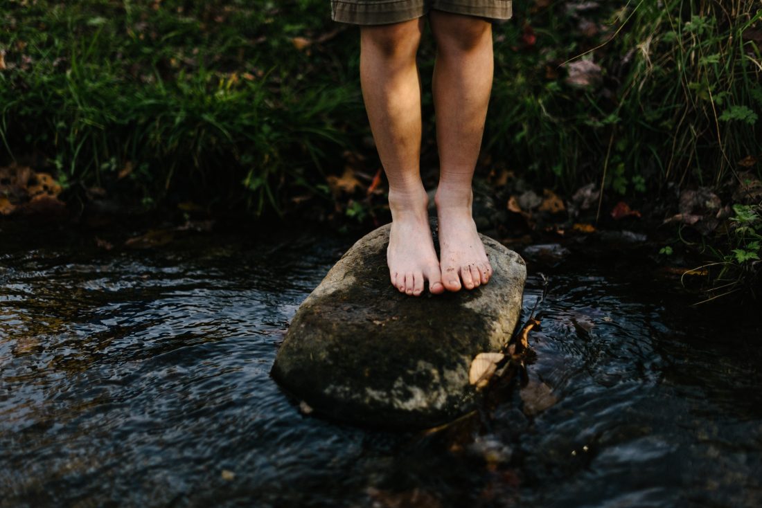
Photo Left: Clear, shallow, green, woody — adjectives that typify Nason Creek.
Leave It Better Than You Found It: This should be every outdoor user’s goal. Pick up trash left by others, pull some noxious weeds along your route, throw branches over unwanted spur trails, don’t ride or walk wet trails when you’re leaving ruts/footprints deeper than ¼ inch…
Disclaimer. Treat this information as recommendations, not gospel. Conditions change and those contributing these reports are volunteers–they may make mistakes or not know all the issues affecting a route. You are responsible for yourself, your actions, and your safety. If you won’t accept that responsibility, you are prohibited from using our information.