Attractions: Big Chiwaukum is the highest peak in the Chiwaukum Range, but sees only a few visitors each year. Peaks to the south that are closer to the Frosty Pass/Ladies Pass trail (Snowgrass Mountain, Ladies Peak, and Cape Horn) receive much more attention. This scramble offers great views of the surrounding mountains and alpine lakes and can be done as either a long day-hike or an overnight trip. There are two ways of ascending this peak, from the east or the west.

Skill: 3+ for hikers, 1+ to 2- for climbers/mountaineers.
Fitness: 3 (advanced) if done in a day, 2 (intermediate) as an overnight trip.
*East Route*
Distance (roundtrip): Roughly 15 to 17 miles to complete the loop described
Elevation Gain: Whitepine Creek Trailhead: 2800 feet; Summit of Big Chiwaukum: 8081 feet; Gain: 5281 feet
Access:
- Follow U.S. Highway 2 to about 6.3 miles west of Coles Corner or a little over 13 miles east of Stevens Pass
- Turn west onto Whitepine Creek Road. Find the Whitepine Creek Trailhead at the road’s end.
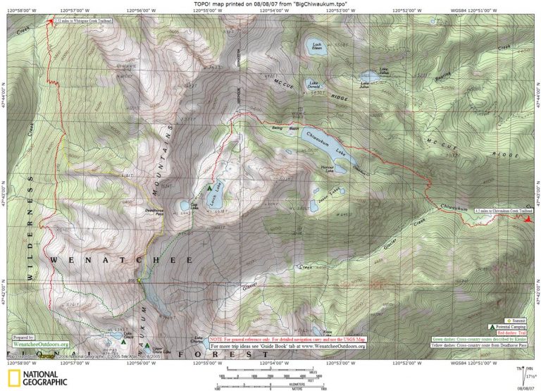
Map: See map below for more information.
Trip Instructions. According to the Beckey guidebook, a route from Deadhorse Pass to the summit is feasible, but no other details are given. With that in mind, I planned to ascend to the summit from Deadhorse Pass and descend the west slopes towards Grace Lakes and the Wildhorse Creek Trail. I knew this would be a full day with perhaps 17 miles and 5500′ of elevation gain. I completed the trip in about 11 hours. In retrospect, I got little help from the Beckey guidebook and should have done more homework, such as reading the excellent report from Paul Klenke at Summitpost.org
- Follow the Whitepine Creek Trail for 2.5 miles. There has been some recent trail work and most of this section is in excellent shape.
- At the junction, turn south (left) on the Wildhorse Creek Trail and climb to about 4500′ on the trail, where the second creek marked on the quad crosses the trail.
- Shortly after that, leave the trail and head southeast, then east up the ridgeline that includes Point 6181′. Where this ridge blends into the slope below Point 7534′, continue traversing and ascending to eventually reach scenic Deadhorse Pass.
- From the pass, easy class 2-3 scrambling on the ridge crest or on its east side leads to a flat shoulder at about 7700′. Here I dropped onto the east slopes, grudgingly giving up elevation and continuing south on easy talus and snow slopes until almost directly east of the summit block. Some pretty steep rock remained above and no easy scramble route was apparent. This was the point of the day where I was questioning Beckey’s “feasible” route via Deadhorse Pass.
- After searching out a series of scrambling options, I eventually crossed the range to the west side via a Class 4 notch, perhaps only 100 feet north from the actual summit, but separated by an overhanging knife edge of Class 5 rock. Reaching the notch meant that I would be able to complete my intended loop route by descending down the west slopes, but I still was hoping to find a route to the top.
- I descended about 100 feet down the cliffy west slope, then made a turn south to enter a different gully system that appeared to lead back towards the top. Klenke rates the top portion class 3+. A small sitting spot next to the summit register calmed my nerves a bit before I continued the descent.
- Given a second opportunity to climb this peak, I would opt for ascending via Klenke’s documented route rather than coming up from Deadhorse Pass. I wanted to reach the first water that was available, so I descended in a southerly direction on the west face as I gave up elevation on loose Class 3 slopes. By scrambling in and out of numerous shallow gullies, I was able to reach the flats of Upper Grace Lake. Had I known of the advice in Klenke’s report, I would have stayed higher, closer to the south ridge in order to travel on easier slopes.
- To reach Lake Grace I followed a western trending ridge located just north of Lake Grace. This lead to easy slopes for descending south into the lake basin. From here, I headed northwest following open slopes, then west down steeper terrain to the Wildhorse Trail at a spot (est. 5200′) almost directly south from Point 5761′. After hours of scrambling and cross-country travel, the trail always seems so wide and welcome. I still had 7-8 miles to go and lots of elevation to descend. It was a relief to reach the Wildhorse/Whitepine junction, with the best and easiest of the trail conditions coinciding with the portion closest to the trailhead.
**For an alternate route that approaches the summit from the east, see the Paul Klenke’s trip description.
Fees / Permits: Northwest Forest Passes are required at the Whitepine Creek Trailhead and the Chiwaukum Creek Trailhead (the access point mentioned in Klenke’s description).
Trip Reporter: Charlie Hickenbottom, Wenatchee, 8/2/07
*West Route*
Distance: 7.5 miles one way
Elevation: 5,400 feet elevation gain
Access:
- Follow U.S. Highway 2 to about 6.3 miles west of Coles Corner or a little over 13 miles east of Stevens Pass.
- Turn west onto Whitepine Creek Road. Find the Whitepine Creek Trailhead at the road’s end.
Trip Instructions: For details on this route, read Paul Klenke’s entry at Summitpost.org
Alternate Map. Here’s another map from the NW Hikers Forum showing the approach to Big Chiwaukum from the Grace Lakes area.
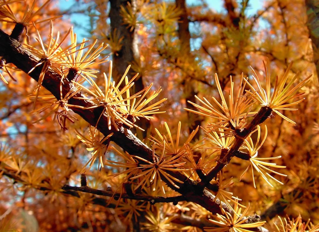
Recommended Season: For hiking, the best times would be in July when the wildflowers are in bloom, or late August and early September when the fall colors appear. The peak is accessible year-round and has been described as a skiable summit, though it may not be possible to ski from the summit tower.
Fees / Permits: Northwest Forest Pass is required at the trailhead MAPS: USGS 7.5 minute series Chiwaukum Mountains
Update 2012. Charlie updated some of the info about reaching the peak and some of the other links available at this link on the WenatcheeOutdoors Forum.

Leave It Better than You Found It. This should be every user’s goal. Pick up trash left by others, pull noxious weeds along your route, throw branches over unwanted spur trails, etc.
Disclaimer. Treat this information as recommendations, not gospel. Conditions change and those contributing these reports are volunteers–they may make mistakes or not know all the issues affecting a route. You are responsible for yourself, your actions, and your safety. If you won’t accept that responsibility, you are prohibited from using our information.