by Andy Dappen

This walk following a ridge high above the Little Wenatchee River about 12 miles west of Lake Wenatchee starts high thanks to Forest Service Roads. A short climb, mainly through old-growth forests of the Henry M. Jackson Wilderness, delivers you to Poets Ridge, which maps identify as Wenatchee Ridge. At first the ridge is also wooded with conifers of impressive girth, but soon the trees thin and views thicken. Enough so that you might be tempted to unsheathe the plume to scribe a verse … or a haiku.
Flowers, mountains, sky
Why so sad and glum Batman?
Walking poetry
Some verses (see above) are unfit for sharing. This matters little – it’s the physical and mental state that has you trying that matters. Poets Ridge helps you find that state.

Details, Details: Poets Ridge to Poe Mountain
Activity: hiking, peak bagging.
Nearest Town: Leavenworth/Plain.
Skill: 2+ (strong intermediate). Note: The ridge has one short segment of exposed scrambling where an inopportune slip could cause injury. On other parts of the ridge, the trail is good but narrow and the side hill drops away precipitously. This is good for neither folks who are clumsy nor those who suffer from acrophobia.
Fitness: 2 (intermediate).
Distance: 7 miles (round-trip) to Poe Mountain, 10.75 miles (round-trip) to Longfellow.
Elevation Gain: 2000 vertical feet
Best Seasons: mid- to late summer and autumn.
Access. From the northwest end of Lake Wenatchee, drive 12 miles past the White River Road on Road 65, always staying on the main paved road. Immediately before the paved road turns to gravel, turn right and zig zag 4.4 miles up Road 6504 (unsigned and brushy) to the trailhead. No permit required.
 Trip Instructions.
- From the parking area (waypoint po3), climb the Irving Trail #1547 about 1 mile to a saddle (waypoint po4).
- Turn left and follow the ridge another 2.5 miles to the summit of Poe. The ridge has some exposure and a little scrambling.
- A few hundred yards before reaching the summit of Poe Mountain (po5), the Irving Trail intersects the Poe Mountain Trails that climbs nearly 3,000 vertical feet up from the Little Wenatchee Ford Campground to the summit of Poe Mountain. Stay right at the trail junction and climb a short distance farther to reach the summit.
- Return the way you came.
Other Trip Options. At or very near the trail junction with the Poe Mountain Trail mentioned above, a smaller trail leads downhill and north along Poets Ridge toward the 6,577-foot summit of Longfellow Mountain. To extend your outing, keep walking this trail north along as long as time, energy, and ability allow. This trail actually cuts across the western slopes of Longfellow (below the summit) past waypoint po6 and keeps heading north to Bryant Peak. If you want to summit Longfellow, leave the trail near po6 and scramble (class 2) following the path of least resistance up the western slopes of Longfellow.
Maps. See map below for more information.
GPS Info. Download this GPX file for the waypoints noted on our map (po1 – po7).
Related Background. The different peaks along Poets Ridge and the one subsidiary ridge extending toward Mount Bryant are: Washington Irving, Edgar Allan Poe, Henry Wadsworth Longfellow, John Greenleaf Whittier, Jonathan Swift, Henry David Thoreau, and Cullen Bryant.
Hazards. The trail has a small bit of scrambling and some exposed traversing. There are some definite fall hazards if you slip in places. This is not a good option for young children, the clumsy of foot, and those freaked out by exposure.
More info. If you’re interested in climbing more of the Poets see this entry at SummitPost.org
Allowed (or not). Most of this route is in wilderness area, and is closed to all mechanical (bike) or motorized use.
Land Ownership. Forest Service.
Fees/Permits. No permits or passes needed for entry via this trailhead.
Reporter (and date). First posted 9/1/2015.
Leave It Better than You Found It. This should be every user’s goal. Do no damage and pick up trash left by others.
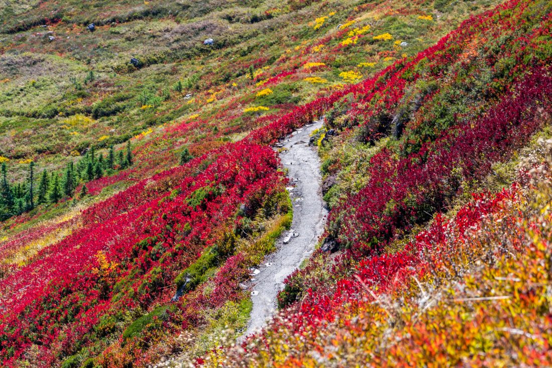
Airy views along Poets Ridge not far from the summit of Poe Mountain.
Disclaimer. Treat this information as recommendations, not gospel. Conditions change and those contributing these reports are volunteers–they may make mistakes or not know all the issues affecting a route. You are responsible for yourself, your actions, and your safety. If you won’t accept that responsibility, you are prohibited from using our information.

