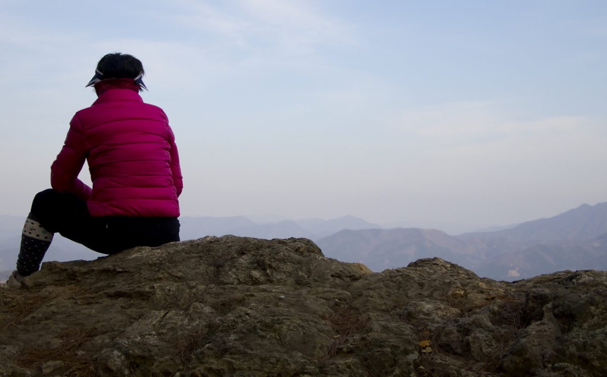

This short, but steep hike is a quick way to get high enough to enjoy a 360 degree view: Mt. Rainier, Glacier Peak, Cashmere Mountain and Grindstone Mountain, to name a few. On a clear day it’s a glorious view.
Maps: Wenatchee National Forest map (see topo below). While the trail is not marked on the Greentrails Map #177 (Chiwaukum Mts.), this is a handy map to have along to orient yourself to the views. Note: use ‘Print Preview’ before printing to properly scale this map to a full sheet of paper.
Activity: Hiking
Nearest Town: Leavenworth
Skill Level: 2
Fitness Level: 3
Distance: Three miles one way to Black Jack Ridge. An additional mile to the top of Boot Jack Mountain. Total roundtrip distance: 8 miles.
Elevation: 3,250 to Black Jack Ridge. Another 689 feet to the top of Boot Jack Mountain. Total elevation: 3,939.
Recommended Season: Spring, summer, and fall. The upper ridge is probably pretty spectacular in the early summer with wildflowers. The trail stays in the trees the entire time until you hit the ridge, so it would be a great hike to take on a hot day when you don’t want to be sun-exposed.
Access: Drive up the Icicle Creek Road (Road 76) to the Chatter Creek Guard Station. At this point the road has evolved into 7600. In 1.5 miles take a left at the intersection signed “Black Pine Horse Campground” (you are still on road 7600). Cross the bridge. DO NOT GO LEFT AT THE “JACK/TROUT” sign that is immediately past the bridge. This will take you to the “Jack Creek Trail”. (There are WAY TOO MANY trails with “Jack” in them around here, so don’t let yourself get confused.) Continue road 7600 another 1.5 miles to the parking lot on the right hand side of the road with a trailhead sign.
Trip Instructions: You have two ways to start the hike: one trailhead is across the road from the parking lot. Taking this route will start you on a well-maintained, but quite brushy section of trail. On a wet day, or a day with a lot of dew, avoid drenching your pants on the beginning of the hike by avoiding this section of the trail. Instead, walk farther up the road to the “Black Pine Horse Campground”. There is another trailhead in the campground which will start you on a less brushy section of the trail. Both trailheads start on the “Jack Pine Trail” (number 1597). In less than a quarter mile, the “Black Jack Ridge” trail heads up the hill to the right. Take this trail.
The hike is pretty straight forward: one trail that continues up, up, up to the ridge. No real decisions to be made until you reach the ridge in 3 miles.
At the ridge, the main trail heads down into the next valley. We started down this trail, but quickly decided it was not going in the right direction to get up Boot Jack Mountain. We’re not exactly sure where this trail goes, as it doesn’t appear on any of our maps. Instead, we climbed the ridge line. While there is no discernable trail at the beginning, the father you climb the ridge, the more evident the trail becomes. There are several flat campsites along the ridge (no water, but magnificent views). Overall, from the ridge to Boot Jack Mountain is very easy—it is only the last short stretch that requires a bit of scrambling up some large boulders (easy enough for our dog to do).
Additional Information: While this trail gains a lot of elevation in a short distance, it is also an easy trail to hike because the trail surface is soft and forgiving. No real obstacles to negotiate, just a steady hike uphill. This trail appears to be well used by horses, with an established horse campsite at the base of the trailhead. The two times we have done this hike we have been the only ones on the trail.
Someone has started a hiker’s log at the top of Boot Jack Mountain. It’s a small spiral notebook and pencil in a plastic bag stuffed near the cairn at the top. The bag was “critter chewed”, so we replaced it with another plastic bag. It would be fun to get a more weather-proof container up there–I always enjoy reading who’s been there before.
Uses Allowed: Hiking, horses.
Land Designation: Alpine Lakes Wilderness Area.
Fees/Permits: Northwest Forest Pass required to park at the trailhead.
Reporter: Carolyn Griffin-Bugert, September 2006.
Condition Updates:
–From Frank Peryea 8/3/2007:
The tread of the trail with its many switchbacks is in good shape. It has not been logged out; however, the trees lying across the trail are small to medium size and therefore easy to step or clamber over. The lower part of the trail is over-grown by shrubs but is easy to follow underneath the vegetation. The burnt-out meadow near the ridge, reached after about 2 hours of steady uphill hiking, is green with revegetative growth and, in the post-fire absence of intervening trees, offers great views of surrounding ridges and mountains. The trail to the summit of Bootjack is sketchy. I recommend veering off to the right and bushwacking straight up the hill when the existing trail heads east after about a quarter-mile into the meadow. One will pick up a faint trail that remains intermittant but becomes better defined with elevation, eventually reaching the summit with its spectacular 360-degree views. Ninety percent of the Bootjack trail is a grunt, gaining almost 4,000 feet in 7.5 miles. It, like Dirtface, is a good training hike.
–From Peter Valaas: 8/12/2007:
Went up Blackjack Ridge (Bootjack Mtn)but went on to traverse the ridge to Cradle Lake Trail and down Jack Creek. Beautiful alpine basins along that route.
May 2008 Update: The Icicle River Road was washed out by a massive land/snow slide in mid May near Doctor Creek. Motorized access to this trail will not be possible throughout all of June and probably well into the summer. Check with the Forest Service (509-548-6977,then 0, for front desk) to learn the status of the road. You can drive to the washout area, park nearby, and walk around the slide (not real easy but doable) and then walk or ride a mountain bike along the road–which actually provides a rather unique opportunity to have the trails leaving from the upper Icicle to yourself.
Leave It Better Than You Found It. This should be every outdoor user’s goal. Pick up trash left by others, pull some noxious weeds along your route, throw branches over unwanted spur trails, don’t ride or walk wet trails when you’re leaving ruts/footprints deeper than ¼ inch…
Disclaimer. Treat this information as recommendations, not gospel. Conditions change, and those contributing these reports are volunteers–they may make mistakes or may not know all the issues affecting a route.You are still completely responsible for your decisions, your actions, and your safety. If you can’t live with that, you are prohibited from using our information.

