![Tiptop-lg[1]](http://wenatcheeoutdoors.org/wp-content/uploads/2016/07/Tiptop-lg1.jpg)
Excellent views of the Brothers and the Enchantments await the explorer that ventures to this nondescript summit. You’ll have to roam around the summit area to get your 360 degree view, however. Trees and a communications building are taking over the open views of this former lookout site.
Activity: Hiking
Nearest Town: Leavenworth
Skill Level: 2
Fitness Level: 2
Distance: About 4 miles roundtrip.
Elevation: About 1400 ft elevation gain.
Recommended Season: Summer and fall
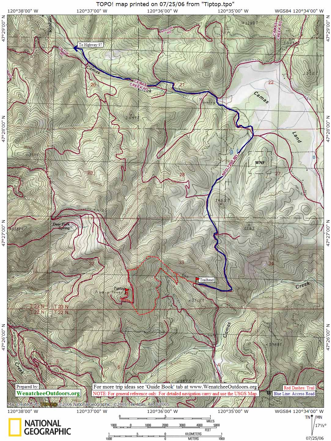
Access:
–Heading south on Highway 97, turn left on Camas Creek Rd.
–There are numerous approach options; one is to head south on Hwy 97 and turn left on Camas Creek Rd.
–After about 3 miles, take a right on NFD 7200. This road follows the edge of Camas Land before branching right.
–Park at about 3400′ elevation, where the USGS quad shows a 4WD road leaving NFD 7200, just north of Point 3715′.
— Other options for this hike are approaches such as FS7201 and Ruby Creek (FS7204).
Maps: USGS Tiptop quad or Green Trails maps. View our topo map below. Note: use ‘Print Preview’ before printing to properly scale this map to a full sheet of paper.
Trip Instructions:
— From the parking area past Camas Land, follow some old logging tracks towards the south ridge of Tiptop. Follow some game trails up and across the southeast slopes and up the south ridge eventually reached the intersection of the summit road.
–On the return, one can descended the summit road in a northerly direction and then followed the northeast ridge over two small humps. From here, a south-southeast descent through open forest returns to the starting point.
Fees/Permits: None
Trip Reporter: Charlie Hickenbottom, Wenatchee
Leave It Better Than You Found It. This should be every outdoor user’s goal. Pick up trash left by others, pull some noxious weeds along your route, throw branches over unwanted spur trails, don’t ride or walk wet trails when you’re leaving ruts/footprints deeper than ¼ inch…
Disclaimer. Treat this information as recommendations, not gospel. Conditions change, and those contributing these reports are volunteers–they may make mistakes or may not know all the issues affecting a route. You are still completely responsible for your decisions, your actions, and your safety. If you can’t live with that, you are prohibited from using our information.