First light on the far shore, waking us up with a rich orange that warms the soul. Day hikers usually miss this. We bear the 45-pound packs in order to experience daybreak in
Water is the lifeblood of nature. To me, the mountains seem most alive around the lakes.
An hour later the colors have changed. An impressionistic painting appears on the lake, displaying both rich and subdued colors.
Rainier. Climbing above Circle Lake, we cleared the ridge and had an impressive view of Mt Rainier.
Hiking over 6,850’ Citadel Pass gave us my first-ever view of Spade Lake. It was everything I had built it up to be. Perfect! The peninsula camp awaited, with its double beach.
All are peaks that hold alpine lakes in their clutches, and I’m living the good life because I’ve been to many of them.
Getting down to Spade Lake was not as simple as we might have imagined. This is definitely a back door route, and there was no trail. In the rocks close to the pass I saw only one cairn, and it was only two-rocks high.
After being stymied by one cliff band after the other, we finally found a place where we could lower our packs with a rope, and down-climb, at times sliding with one foot dragging in a rock crack so we wouldn’t pick up too much speed.
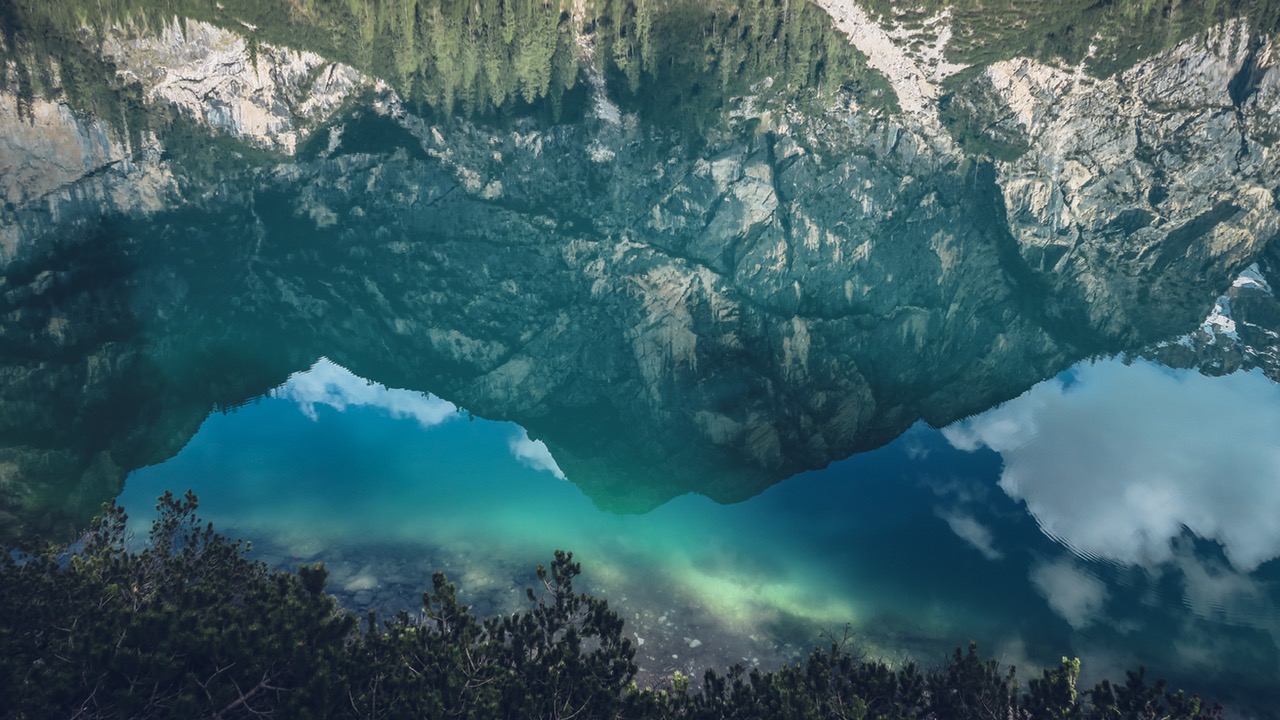
Spade Lake. In the distance, from left are Mt Rainier, Three-Queens, Hibox, Four Brothers, Chickamon, Lemah Mountain, Chimney Rock, Summit Chief and Little Big Chief, with Bears Breast at the far right. We enjoyed shallow inlets on each side of camp for superb color displays. The featured attraction were blue and green, of every possible combination. I was ecstatic.
A fantastic 7 lakes, all that I had imagined and an array of colors for the eyes to feast on. It was worth the 45 pound packs and steep terrain, those jewels of the mountains.
Maps. See a topo map of the route.
Nearest Town. Cle Elum.
Fitness Level. 3
Access. From Cle Elum, follow Highway 903 west to Roslyn, Ronald, and Lakedale. Higway 903 eventually merges with the Salmon la Sac Road. Stay on the Salmon la Sac Road and, just before the Salmon La Sac Campground, veer right on the Cle Elum Valley Road (aka Road 4330). Follow this for 12 to 13 bumpy miles. About 100 yards before the road ends, park on the left side of the road at the Cathedral Rock Trailhead. Some years a high-clearance vehicle is recommended. A loop can be done starting and ending from this trailhead. The author did this using a second vehicle at Salmon la Sac and hiking from Waptus Lake down the Waptus River to the car parked at Salmon la Sac. A Northwest Forest Pass is required at these trailheads
Lakes Visited. Squaw Lake, Peggy’s Pond, Circle Lake, Venus Lake, Spade Lake and Waptus Lake, including looking down on Deep Lake.
Leave It Better than You Found It. This should be every user’s goal. Pick up trash left by others, pull noxious weeds along your route, throw branches over unwanted spur trails, etc.
Disclaimer. Treat this information as recommendations, not gospel. Conditions change and those contributing these reports are volunteers–they may make mistakes or not know all the issues affecting a route. You are responsible for yourself, your actions, and your safety. If you won’t accept that responsibility, you are prohibited from using our information.