This enjoyable training ride leaves from the southern edge of Wenatchee and climbs up to the orchards of Wenatchee Heights and to that area’s long views over the Columbia River Valley.
SKILL: 2 intermediate
FITNESS: 2- (low intermediate)
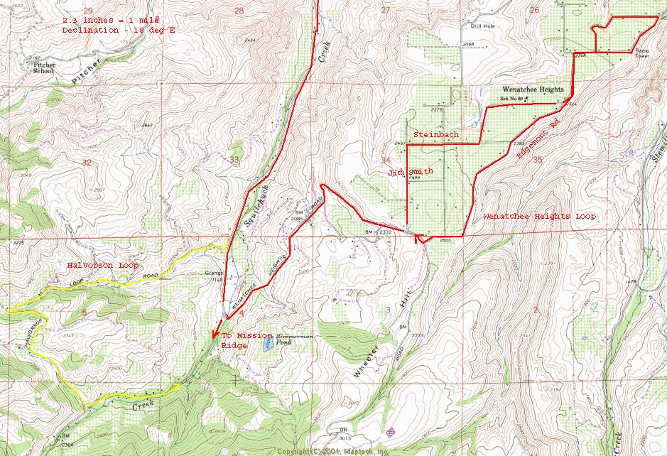
DISTANCE: 19.5 miles round trip.
ELEVATION: 1,740’ gain.
RECOMMENDED SEASON:. Spring when the fruit trees up on the heights are in bloom. Also fall when the air is cool and ripe with the scent of fruit.
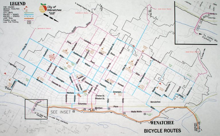
ACCESS: Drive to Lincoln Park in south Wenatchee and park in the parking lot off Methow Street near the intersection of Crawford and Methow.
TRIP INSTRUCTIONS:
- Follow Methow Street south for about 2 miles.
- At the stop sign turn right on Squilchuck Creek Road and bike uphill.
- In roughly 2.75 miles, turn left on the Wenatchee Heights Road and start climbing more steeply.
- In another 2.3 miles near the top of the grade, turn left on Jim Smith.
- In 0.7 miles turn right on Steinbach, then ride another 0.7 miles to Edgemont Road.
- Turn left and follow Edgemont 1.5 miles to the intersection with Gunderson?? (Edgemont goes into a private orchard shortly beyond here).
- Retrace Edgemont by either going straight back to Steinbach or by taking Gunderson which does a small loop.–Back at the intersection of Steinbach and Edgemont, remain on Edgemont heading SW.
- In 0.8 miles turn right on Wenatchee Heights Road and drop 2.4 miles to the Squilchuck Creek Road. Turn right and retrace your route back to Lincoln Park.
- Note: For a longer ride, combine this ride with the Halvorson Loop or do the Wenatchee Heights Long Loop Option.
MAPS. See our maps of the route below. Also use the Wenatchee Bike Map to drive or bike to Lincoln Park where the directions of this route begin.
FEES/PERMITS: None.
REPORTER: Andy Dappen 11/2005
LEAVE IT BETTER THAN YOU FOUND IT. This should be every user’s goal. Pick up trash left by others and pull a few noxious weeds along your route.
DISCLAIMER. Treat this information as recommendations, not gospel. Conditions change and those contributing these reports are volunteers–they may make mistakes or not know all the issues affecting a route. You are responsible for yourself, your actions, and your safety. If you won’t accept that responsibility, you are prohibited from using our information.